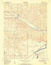
1950 Map of Keats
USGS Topo · Published 1950About this map
Fort Riley Military Reservation dominates the landscape west of the Kansas River, showing an area defined by tactical military use and rural agricultural life. The reservation contains a Vehicle Firing Range and numerous structures marked as ruins, indicating a displacement of earlier farmsteads. Near the Wild Cat Creek valley, the small settlement of Keats sits along the Chicago Rock Island and Pacific railroad, serving as a focal point for the surrounding township of Wildcat. To the southeast, the terrain transitions into the broader river valley where the Manhattan Airport and Government Agriculture Farms are situated. Institutional history is noted at the Rebekah IOOF Home and a nearby Cemetery, while the northern hills feature Washington Marlatt Memorial Park and a local Rock quarry.
Find a feature on this map
31 named features on this map. Tap any name to fly to it.
Don’t see what you’re looking for? This feature index may not catch every label — zoom into the map to look around manually.
Map Details
Editions of this 1950 Keats Map
2 editions found
Other maps of this area

1886 · Junction City
USGS Topo · 1:125,000

1889 · Junction City
USGS Topo · 1:125,000

1894 · Junction City
USGS Topo · 1:125,000

1947 · Manhattan
USGS Topo · 1:62,500

1947 · Fort Riley
USGS Topo · 1:62,500

1950 · Keats
USGS Topo · 1:24,000

1950 · Manhattan
USGS Topo · 1:24,000

1950 · Junction City
USGS Topo · 1:24,000

1951 · Swede Creek
USGS Topo · 1:24,000

1951 · Ogden
USGS Topo · 1:24,000