1900s (20th Century) Maps of Republic County, Kansas
Explore 32 historic maps of Republic County from the 1900s (20th Century). These maps offer a rare glimpse into what life looked like during the 1900s — showing old roads, neighborhoods, homes, and landmarks that have changed or disappeared over time.
Whether you're researching your family's past, planning a metal detecting trip, or studying how Republic County's landscape evolved across the 1900s, these high-resolution maps are a powerful tool for exploring the history of this region.
- Focus on a specific era: All maps on this page are from the 1900s, giving you a focused view of this time period.
- See what’s changed: Compare century-old streets, trails, and buildings to today's modern landscape using overlays and satellite layers.
- Research with precision: Use these maps for genealogy, historical research, land use analysis, or educational projects.
- View, download, or print: Maps are fully viewable online in high resolution, and can be downloaded or printed for your own records.
Start exploring Republic County's history through authentic maps from the 1900s. This is your window into the past.
Republic County, KS maps
(32)- 1955 Map of Manhattan, 1964 Print
 1955 Manhattan1964 Print · USGSNorth Central Kansas is captured here in the mid-fifties, just as major flood control projects began reshaping the river valleys. Genealogists can locate family sites near St. Joseph Church, Sunset Cemetery, or along the busy tracks of the Rock Island RR.4 unique versions available
 - 1955 Map of Lincoln, 1967 Print
 1955 Lincoln1967 Print · USGSSoutheast Nebraska in the mid-fifties presents a landscape of thriving railroad towns and the expanding footprint of the capital city. Researchers can trace the legacy of the pioneer era at the Homestead National Monument of America or locate mid-century military infrastructure like Lincoln Air Force Base.5 unique versions available
 - 1956 Map of Manhattan
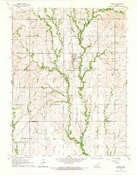
 1956 Manhattan1956 Print · USGSNorth-central Kansas in the mid-fifties reveals a landscape defined by the convergence of the Republican River and Smoky Hill River. Historians can trace the rail corridors of the Union Pacific RR and Missouri Pacific RR through towns like Manhattan and Clay Center.
 - 1957 Map of Manhattan
 1957 Manhattan1957 Print · USGSNortheast Kansas in the mid-1950s reveals a landscape of expanding military installations and new water projects. Genealogists and historians can trace the rail-to-river economy through the Union Pacific RR and old settlements like Clay Center or Marysville.
 - 1957 Map of Lincoln
 1957 Lincoln1957 Print · USGSSoutheastern Nebraska at mid-century shows a landscape of thriving rail towns and expanding infrastructure centered on Lincoln. Researchers can trace the path of the Chicago Burlington and Quincy railroad through communities like Weeping Water, Fairmont, and Seward.
 - 1958 Map of Lincoln
 1958 Lincoln1958 Print · USGSSoutheast Nebraska at the end of the 1950s shows a region defined by agricultural trade and the expansion of the state capital. Genealogists can trace family footprints across the Blue Valley and locate landmarks like the Lincoln AFB or the U.S. Veterans Hospital.
 - 1960 Map of Byron, 1961 Print
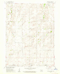
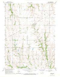
 1960 Byron1961 Print · USGSThe Nebraska-Kansas borderlands in the early sixties remain a patchwork of small-town school districts and prairie parishes. Trace family history through landmarks like Bethany Ch, School No 91, and Zion Cem along the winding Spring Creek.
 - 1960 Map of Chester, 1961 Print
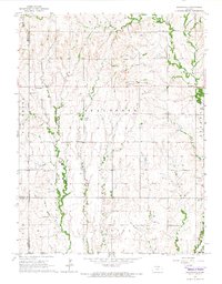
 1960 Chester1961 Print · USGSThe Nebraska-Kansas border in the early sixties was a landscape of rail-connected farming communities and rural schools. Genealogists can locate family burial sites at Chester Cem or St Johns Cem and trace the path of the Chicago Burlington and Quincy railroad.2 unique versions available
 - 1960 Map of Reynolds, 1961 Print
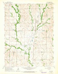
 1960 Reynolds1961 Print · USGSJefferson County at the dawn of the sixties shows a landscape of rural school districts and dual rail lines. Genealogists can trace family footprints near Reynolds and Rose Creek Cem, or follow the path of the Chicago Burlington and Quincy railroad.2 unique versions available
 - 1960 Map of Hubbell, 1961 Print
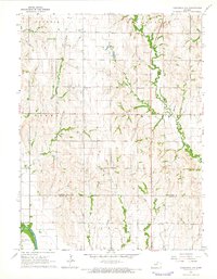
 1960 Hubbell1961 Print · USGSThe Nebraska-Kansas borderlands come alive in the early sixties, showing a landscape defined by rail and river. Genealogists can trace family footprints through St Pauls Cem, Williams Cem, and the tracks of the Chicago Burlington and Quincy.2 unique versions available
 - 1960 Map of Hebron SW, 1962 Print
 1960 Hebron SW1962 Print · USGSThe Nebraska-Kansas borderlands come into focus in the early sixties, showing the rural divide between Thayer County and Republic County. Genealogists and land historians can locate St James Ch, School No 67, and the path of the Chicago Burlington and Quincy railroad.
 - 1965 Map of Brantford, 1966 Print
 1965 Brantford1966 Print · USGSThe rural borders of Washington and Republic Counties are captured in the mid-1960s, showing a landscape defined by small farming communities and country churches. Genealogists can trace family roots at numerous sites including St Bernards Cem, Zion Ch, and the settlement of Brantford.
 - 1965 Map of Wayne, 1966 Print
 1965 Wayne1966 Print · USGSRepublic and Cloud counties are captured here in the mid-1960s, a landscape defined by small railroad towns and an intricate web of creek drainages. Researchers can locate several burial sites like Rose Hill Cem and trace the path of the Chicago Burlington and Quincy Railroad through Wayne and Talmo.
 - 1965 Map of Concordia NW, 1966 Print
 1965 Concordia NW1966 Print · USGSNorthwest of Concordia during the mid-sixties, this landscape captures the agricultural heart of the Kansas borderlands as the Republican River valley transitions into upland prairie. Researchers can locate family landmarks like Highland Ch, Pleasant Ridge Cem, and Saron Cem.2 unique versions available
 - 1965 Map of Agenda, 1966 Print
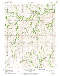
 1965 Agenda1966 Print · USGSNorth Central Kansas agriculture and rail transit are captured here in the mid-1960s as small-town life centered on the local grain and freight networks. Researchers can trace the CHICAGO ROCK ISLAND AND PACIFIC line through Agenda or locate family sites near Willoughby Cem and Agenda Cem.
 - 1965 Map of Kackley, 1967 Print
 1965 Kackley1967 Print · USGSThe Republican River valley in the mid-1960s shows a landscape of rail-fed settlements and riverside farming. Researchers can trace rural lineages through Oakdale Cem, the church at Ada Ch, and the twin rail lines of the Missouri Pacific and Santa Fe.
 - 1966 Map of Scandia, 1967 Print
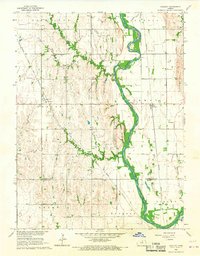
 1966 Scandia1967 Print · USGSRepublic County in the mid-1960s shows a landscape of intensive water management and rail commerce along the Republican River. Trace family roots at Riverview Cem or locate the old Sherdahl settlement near the Missouri Pacific line.
 - 1966 Map of Belleville SE, 1967 Print
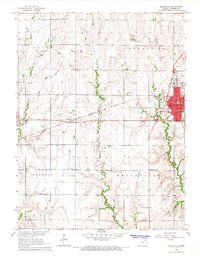
 1966 Belleville SE1967 Print · USGSRepublic County agriculture and rail transport intersect in the mid-sixties, showing the rural landscapes of Tabor and eastern Belleville. Researchers can trace family sites at Tabor Chapel, St Georges Cem, and the path of the Chicago Rock Island and Pacific railroad.
 - 1966 Map of Narka, 1967 Print
 1966 Narka1967 Print · USGSRepublic County agriculture and rail life come into focus in the mid-1960s as the town of Narka serves the surrounding prairie. Genealogists can trace family plots at National Cem and Maple Grove Cem or locate the old Chicago Rock Island and Pacific rail line.
 - 1966 Map of Haddam, 1967 Print
 1966 Haddam1967 Print · USGSThe northern Kansas prairie is captured here in the mid-1960s, centered on the railroad town of Haddam. Researchers can trace the legacy of the Chicago Burlington and Quincy line or locate family sites like Haddam Cem and Oliver Cem.
 - 1966 Map of Belleville, 1967 Print
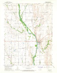
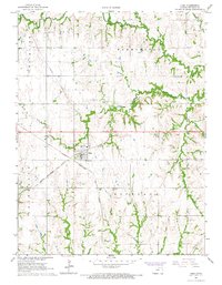
 1966 Belleville1967 Print · USGSRepublic County's agricultural and transit hub comes to life in the mid-1960s, centered on the growing town of Belleville. Genealogists and local historians can trace rural roots through numerous burial sites like Grace Hill Cem and Harkness Cem or locate former landmarks like the Belleville Center Sch.
 - 1966 Map of Cuba, 1967 Print
 1966 Cuba1967 Print · USGSRepublic County agriculture and rail transit converge at Cuba during the mid-sixties. Local researchers can trace the routes of the Chicago Burlington and Quincy railroad and locate rural landmarks like St Isidore Ch and Bohemian Cem.
 - 1966 Map of Mahaska, 1967 Print
 1966 Mahaska1967 Print · USGSThe northern Kansas prairie meets the Nebraska border in the mid-1960s, where rail lines and creek beds define the rural landscape. Researchers can trace the Chicago Rock Island and Pacific railroad through Mahaska or locate family plots at Mahaska Cem.
 - 1968 Map of Munden, 1971 Print
 1968 Munden1971 Print · USGSThe north-central Kansas borderlands come into focus in the late sixties, centered on the railroad town of Munden. Genealogists and historians can trace the rural infrastructure of Republic County through landmarks like the Rose Creek Cem, the Excelsior Community Center, and the corridors of the Chicago Rock Island and Pacific.
 - 1968 Map of Jamestown NW, 1971 Print
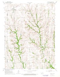
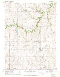
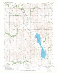 1968 Jamestown NW1971 Print · USGSNorth-Central Kansas is documented here in the late sixties, where the convergence of major rail lines and waterways shaped the rural landscape. Researchers can locate the St Lukes Ch Cem, the Caldwell Cem, and the sprawling Jamestown State Waterfowl Management Area.
Showing maps 1-25 of 32
Top cities of Republic County
- Belleville historical maps
- Scandia historical maps
- Courtland historical maps
- Cuba historical maps
- Norway historical maps
- Republic historical maps
See more
Frequently asked questions
- What are the different types of historical maps available for Republic County?
- What is the oldest map of Republic County?
- Where can I purchase historical maps of Republic County for my home or office?
- Where can I download high-res historical maps of Republic County?
- Are there historical topographic maps available for Republic County?
- Is there historical aerial imagery available for Republic County?
- Where are historical maps of Republic County sourced from?