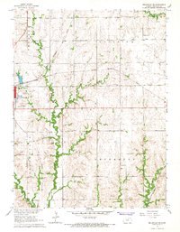
1966 Map of Belleville SE
USGS Topo · Published 1967About this map
Tabor and the eastern edge of Belleville anchor this mid-1960s survey of Republic County, where the agricultural landscape is divided into the townships of Freedom, Fairview, and Jefferson. The terrain is deeply etched by the winding course of Salt Creek and its tributaries, including Quincy Creek and Coal Creek. These waterways dictate the local geography, creating a network of timbered draws that contrast with the organized grid of section lines and unimproved roads.
Find a feature on this map
26 named features on this map. Tap any name to fly to it.
Don’t see what you’re looking for? This feature index may not catch every label — zoom into the map to look around manually.
Map Details
Editions of this 1966 Belleville SE Map
This is the sole edition of this map. No revisions or reprints were ever made.
Other maps of this area

1892 · Concordia
USGS Topo · 1:125,000

1893 · Washington
USGS Topo · 1:125,000

1955 · Manhattan
USGS Topo · 1:250,000

1956 · Manhattan
USGS Topo · 1:250,000

1957 · Manhattan
USGS Topo · 1:250,000

1965 · Wayne
USGS Topo · 1:24,000

1965 · Concordia NW
USGS Topo · 1:24,000

1965 · Agenda
USGS Topo · 1:24,000
1966 · Narka
USGS Topo · 1:24,000
1966 · Belleville
USGS Topo · 1:24,000