1900s (20th Century) Maps of Rice County, Kansas
Explore 31 historic maps of Rice County from the 1900s (20th Century). These maps offer a rare glimpse into what life looked like during the 1900s — showing old roads, neighborhoods, homes, and landmarks that have changed or disappeared over time.
Whether you're researching your family's past, planning a metal detecting trip, or studying how Rice County's landscape evolved across the 1900s, these high-resolution maps are a powerful tool for exploring the history of this region.
- Focus on a specific era: All maps on this page are from the 1900s, giving you a focused view of this time period.
- See what’s changed: Compare century-old streets, trails, and buildings to today's modern landscape using overlays and satellite layers.
- Research with precision: Use these maps for genealogy, historical research, land use analysis, or educational projects.
- View, download, or print: Maps are fully viewable online in high resolution, and can be downloaded or printed for your own records.
Start exploring Rice County's history through authentic maps from the 1900s. This is your window into the past.
Rice County, KS maps
(31)- 1942 Map of Salina
 1942 Salina1942 Print · USGSCentral Kansas during the early 1940s reveals a landscape transitioning between its deep agricultural roots and a massive new wartime footing. Researchers can trace the development of the Military Reservation and locate small rail-side settlements like Terra Cotta and Smolan.
 - 1955 Map of Great Bend, 1966 Print
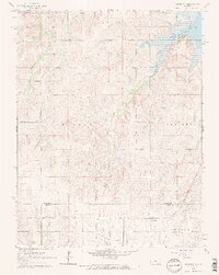
 1955 Great Bend1966 Print · USGSCentral Kansas during the mid-sixties transition reveals a landscape defined by new reservoirs and enduring rail corridors. Researchers can trace the development of towns like Hays and Great Bend or locate natural landmarks such as Round Mound and the wetlands of the Quivira National Wildlife Refuge.3 unique versions available
 - 1955 Map of Hutchinson, 1967 Print
 1955 Hutchinson1967 Print · USGSCentral Kansas in the mid-sixties reveals a landscape of growing reservoirs and evolving transportation corridors. Trace the development of towns like Hutchinson and Abilene alongside the Union Pacific Railroad and the expanding Interstate 70.3 unique versions available
 - 1957 Map of Great Bend
 1957 Great Bend1957 Print · USGSCentral Kansas at the peak of the postwar era shows a landscape of growing rail hubs and massive new water projects. Trace the routes of the Union Pacific through Hays or locate the newly formed shorelines of Cedar Bluff Reservoir and Kanopolis Reservoir.
 - 1958 Map of Great Bend
 1958 Great Bend1958 Print · USGSCentral Kansas in the late fifties reveals a landscape of high-plains agriculture and vital river crossings. Researchers can trace the development of regional hubs like Hays and Russell, or locate historic sites such as Fort Larned and the Cheyenne Bottoms wildlife area.2 unique versions available
 - 1959 Map of Hutchinson
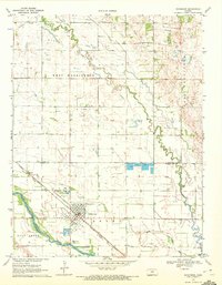
 1959 Hutchinson1959 Print · USGSCentral Kansas thrives at the intersection of rail and river in the mid-1950s, as post-war aviation infrastructure reshapes the prairie. Genealogists and historians can trace the paths of the AT&SF RR through Newton and Hutchinson, or locate military sites like Smoky Hill Air Force Base.2 unique versions available
 - 1964 Map of Holyrood, 1965 Print
 1964 Holyrood1965 Print · USGSCentral Kansas during the mid-sixties reveals a landscape defined by the convergence of major rail lines and a dense network of petroleum production. Researchers can trace the Atchison Topeka and Santa Fe tracks through Holyrood and locate the Bushton Cem near the Missouri Pacific line.
 - 1964 Map of Crawford, 1965 Print
 1964 Crawford1965 Print · USGSCentral Kansas agriculture meets the petroleum industry in the mid-1960s as the MISSOURI PACIFIC railroad connects rural townships. Genealogists can trace family footprints across several rural burial sites, including Scaife Cem and Forest Grove Cem, near the Click Southeast Oil Field.2 unique versions available
 - 1964 Map of Geneseo, 1965 Print
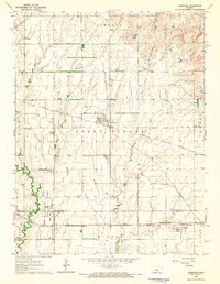
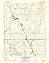
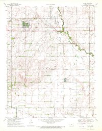
 1964 Geneseo1965 Print · USGSMid-century Rice County is defined by a dense network of competing railroads and expanding energy production. Genealogists and historians can trace family roots at the Kansas Center Cem or explore the infrastructure of the Geneseo-Edwards Oil Field and the settlement at Galt.3 unique versions available
 - 1964 Map of Lorraine, 1965 Print
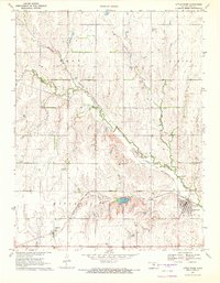
 1964 Lorraine1965 Print · USGSRailroads and oil fields dominate this mid-century Kansas landscape, where the towns of Lorraine and Frederick served as vital rural hubs. Genealogists and historians can trace rail lines like the St Louis - San Francisco and locate the Lorraine Cem.2 unique versions available
 - 1964 Map of Langley, 1965 Print
 1964 Langley1965 Print · USGSThe rural borderlands of Ellsworth and McPherson counties are captured here in the mid-1960s. Genealogists can trace family footprints around the village of Langley, the Langley Sch, and the riverside Sandpits along the Smoky Hill River.2 unique versions available
 - 1964 Map of Windom SW, 1966 Print
 1964 Windom SW1966 Print · USGSThe rural intersection of Rice and McPherson counties is captured here in the mid-1960s as a landscape of structured townships and prairie waterways. Researchers can locate community anchors like Rockville Sch, Andover Cem, and a Quarry near the Little Arkansas River.2 unique versions available
 - 1965 Map of Hutchinson NW, 1966 Print
 1965 Hutchinson NW1966 Print · USGSThe rural borderlands of Rice, Reno, and McPherson counties are captured here in the mid-1960s as a landscape of prairie agriculture and energy production. Researchers can locate the Welch Bornholdt Oil Field, the Thomas Grove Sch, and the winding Little Arkansas River.2 unique versions available
 - 1965 Map of Windom, 1966 Print
 1965 Windom1966 Print · USGSCentral Kansas prairie life is captured here in the mid-sixties, where the Little Arkansas River meets the oil fields. Genealogists can locate Bean Cem and the Townhall while tracing rail history along the Atchison Topeka and Santa Fe.2 unique versions available
 - 1967 Map of Alden, 1968 Print
 1967 Alden1968 Print · USGSThe Arkansas Valley in the late 1960s was a landscape defined by the convergence of rail, river, and energy production. Genealogists and local historians can trace rural family roots through landmarks like Triumph Ch, Peace Valley Cem, and Kilbourns Corner.
 - 1967 Map of Alden NW, 1968 Print
 1967 Alden NW1968 Print · USGSCentral Kansas wetlands and energy development meet in the late sixties at the border of Rice, Stafford, and Reno counties. Local historians can trace the early boundaries of Quivira National Wildlife Refuge and locate old Oil Wells near Dead Horse Slough.
 - 1967 Map of Sterling, 1968 Print
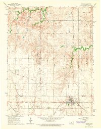
 1967 Sterling1968 Print · USGSSterling thrives as a college town and rail junction during the late sixties, where the Missouri Pacific and Santa Fe lines converge. Researchers can trace local landmarks like Sterling College, Sterling Cemetery, and the industrial Sandpits near the Arkansas River.
 - 1970 Map of Lyons, 1972 Print
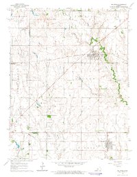
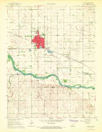
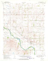
 1970 Lyons1972 Print · USGSLyons stood as a critical Kansas rail junction in the early seventies, where three major railroads met amidst a landscape shaped by petroleum and agriculture. Genealogists and local historians can trace family-named schools and sites like Saxman, Municipal Cemetery, and the Shumway Oil Field.
 - 1970 Map of Chase NE, 1972 Print
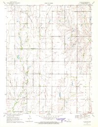
 1970 Chase NE1972 Print · USGSRice County agriculture meets energy production in the early seventies, as the petroleum industry reshaped this prairie landscape. Genealogists and historians can trace rural school districts like Sunny Four Sch and the church community at Ebenezer Ch.
 - 1970 Map of Lyons SE, 1972 Print
 1970 Lyons SE1972 Print · USGSRice County at the start of the seventies reveals a landscape defined by petroleum production and rail transit. Researchers can trace the St Louis - San Francisco line past the Welch Bornholdt Oil Field and the small settlement of Saxman.
 - 1970 Map of Raymond, 1972 Print
 1970 Raymond1972 Print · USGSThe Arkansas River valley in the early 1970s shows a landscape defined by the Atchison Topeka and Santa Fe railroad and local energy production. Genealogists and historians can locate Hilltop Cem, the settlement of Silica, and the extensive Chase Silica Oil Field.
 - 1970 Map of Nickerson, 1972 Print
 1970 Nickerson1972 Print · USGSNickerson sits at a vital rail and river junction in central Kansas during the early seventies. Genealogists and local historians can trace family locations near Wildmead Cem or explore the mid-century industrial footprint of the Wherry Oil Field and the Fish Farm.
 - 1970 Map of Little River, 1972 Print
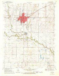
 1970 Little River1972 Print · USGSIn the early seventies, Rice County's landscape was defined by the intersection of the Atchison Topeka and Santa Fe railroad and the Kansas prairie. Trace the development of local oil production at Crawford Oil Field or locate small rural landmarks like the Townhall near Galt.2 unique versions available
 - 1970 Map of Lyons NW, 1972 Print
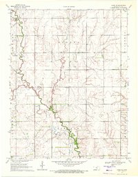
 1970 Lyons NW1972 Print · USGSThe rural plains of Rice County appear in the early 1970s as a landscape of energy and agriculture. Researchers can trace the path of the St Louis-San Francisco railroad past local landmarks like Pollard, Shumway Cem, and the Fairplay Sch.
 - 1970 Map of Chase, 1972 Print
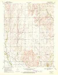
 1970 Chase1972 Print · USGSIn the early 1970s, Rice County was a hub of Kansas energy production dominated by the expansive Chase Silica Oil Field. Genealogists and historians can trace local landmarks like Springdale Cemetery, the Atchison Topeka and Santa Fe railroad, and Schafer Airfield.
Showing maps 1-25 of 31
Top cities of Rice County
- Lyons historical maps
- Sterling historical maps
- Little River historical maps
- Chase historical maps
- Bushton historical maps
- Geneseo historical maps
See more
Frequently asked questions
- What are the different types of historical maps available for Rice County?
- What is the oldest map of Rice County?
- Where can I purchase historical maps of Rice County for my home or office?
- Where can I download high-res historical maps of Rice County?
- Are there historical topographic maps available for Rice County?
- Is there historical aerial imagery available for Rice County?
- Where are historical maps of Rice County sourced from?