1900s (20th Century) Maps of Valley Center, Kansas
Explore 12 historic maps of Valley Center from the 1900s (20th Century). These maps offer a rare glimpse into what life looked like during the 1900s — showing old roads, neighborhoods, homes, and landmarks that have changed or disappeared over time.
Whether you're researching your family's past, planning a metal detecting trip, or studying how Valley Center's landscape evolved across the 1900s, these high-resolution maps are a powerful tool for exploring the history of this region.
- Focus on a specific era: All maps on this page are from the 1900s, giving you a focused view of this time period.
- See what’s changed: Compare century-old streets, trails, and buildings to today's modern landscape using overlays and satellite layers.
- Research with precision: Use these maps for genealogy, historical research, land use analysis, or educational projects.
- View, download, or print: Maps are fully viewable online in high resolution, and can be downloaded or printed for your own records.
Start exploring Valley Center's history through authentic maps from the 1900s. This is your window into the past.
Valley Center, KS maps
(12)- 1941 Map of Maize
 1941 Maize1941 Print · USGSSedgwick County prairie life is captured here just before the war, showing the area's transition into a major rail and river hub. Local historians can trace early schools like Prairie Queen Sch and the unique route of the Arkansas Valley Interurban Electric.
 - 1941 Map of Valley Center
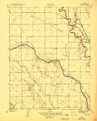
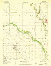
 1941 Valley Center1941 Print · USGSSedgwick County agricultural lands and growing townships are captured here at the start of the 1940s. Local historians can trace the foundations of Valley Center and Keehi alongside vanished landmarks like the Stearns Race Track and Hoss Sch.
 - 1942 Map of Valley Center
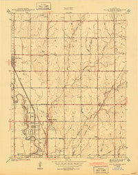
 1942 Valley Center1942 Print · USGSNorth of Wichita just before the war, this area shows a landscape defined by the Little Arkansas River and a busy intersection of four major railroads. Genealogists can locate numerous country schoolhouses like Riverview Sch and Hillside Grove Sch, as well as the MARBLE GROVE CEM and the old STEARNS RACE TRACK.
 - 1942 Map of Maize
 1942 Maize1942 Print · USGSSedgwick County at the start of the 1940s reveals a landscape of thriving rural schools and critical rail junctions. Genealogists can locate family landmarks like the Maize Cem or trace the early paths of the St Louis San Francisco railroad through Valley Center and Maize.2 unique versions available
 - 1955 Map of Wichita, 1959 Print
 1955 Wichita1959 Print · USGSSouth-central Kansas comes alive in the mid-1950s as Wichita grows into its role as a regional industrial and military powerhouse. Trace the rail-and-river network connecting El Dorado and Arkansas City through the Atchison Topeka and Santa Fe lines.3 unique versions available
 - 1956 Map of Valley Center, 1957 Print
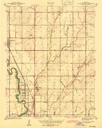
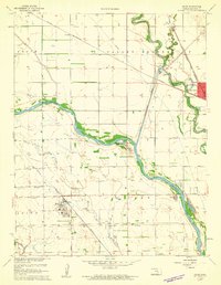
 1956 Valley Center1957 Print · USGSNorthern Sedgwick County undergoes a post-war transition in the mid-1950s as suburban growth meets established oil fields. Trace family roots and early subdivisions near Valley Center, Park City, and Riverview alongside historic schools like Kistler Sch.
 - 1956 Map of Maize, 1957 Print
 1956 Maize1957 Print · USGSMid-century Sedgwick County is captured here as a bustling intersection of river life and rail industry. Genealogists can locate the Maize Cem and early footprints of Maize and Valley Center, while tracing the paths of the Missouri Pacific and other legacy railroads.
 - 1958 Map of Wichita
 1958 Wichita1958 Print · USGSSouth Central Kansas in the late fifties was a landscape of aviation industry, oil exploration, and expanding turnpikes. Researchers can trace mid-century growth through McConnell Air Force Base, major facilities for Cessna Aircraft Company, and the active El Dorado Oil Field.
 - 1960 Map of Valley Center, 1961 Print
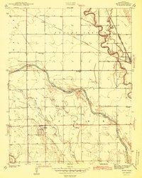
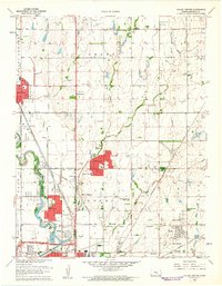 1960 Valley Center1961 Print · USGSSedgwick County experiences significant mid-century growth and industrial development as oil fields and new suburbs expand across the prairie. Researchers can trace family roots through Marble Grove Cem or locate former landmarks like the Drive-in Theater and Hillside Grove Sch.4 unique versions available
 - 1961 Map of Maize
 1961 Maize1961 Print · USGSThe Sedgwick County plains are shown in the early sixties as a vital crossroads of rail lines and river floodways. Genealogists and local historians can trace the Old Indian Boundary and locate landmarks like Maize Cem and West Elementary Sch.4 unique versions available
 - 1985 Map of Wichita
 1985 Wichita1985 Print · USGSThe mid-1980s landscape of the Wichita metro area is captured here during a peak era for the local aviation industry. Researchers can trace the sprawling rail network of the Santa Fe and Frisco or locate family landmarks at White Chapel Cem and Cheney Reservoir.
 - 1990 Map of Wichita
 1990 Wichita1990 Print · USGSThe Wichita metropolitan area and its surrounding agricultural plains are captured in the late twentieth century, showing a landscape defined by rapid suburban expansion and massive water projects. Genealogists can locate family landmarks in small towns like Garden Plain and Clonmel, or trace the development around Cheney Reservoir and McConnell Air Force Base.
End of results
Showing maps 1-12 of 12
Top cities near Valley Center
- Wichita historical maps
- Newton historical maps
- Andover historical maps
- Park City historical maps
- Bel Aire historical maps
- Rose Hill historical maps
See more
Top neighborhoods of Valley Center
Frequently asked questions
- What are the different types of historical maps available for Valley Center?
- What is the oldest map of Valley Center?
- Where can I purchase historical maps of Valley Center for my home or office?
- Where can I download high-res historical maps of Valley Center?
- Are there historical topographic maps available for Valley Center?
- Is there historical aerial imagery available for Valley Center?
- Where are historical maps of Valley Center sourced from?