1960s Maps of Valley Center, Kansas
Explore 2 historic maps of Valley Center from the 1960s. These maps offer a rare glimpse into what life looked like during the 1960s — showing old roads, neighborhoods, homes, and landmarks that have changed or disappeared over time.
Whether you're researching your family's past, planning a metal detecting trip, or studying how Valley Center's landscape evolved across the 1960s, these high-resolution maps are a powerful tool for exploring the history of this region.
- Focus on a specific era: All maps on this page are from the 1960s, giving you a focused view of this time period.
- See what’s changed: Compare century-old streets, trails, and buildings to today's modern landscape using overlays and satellite layers.
- Research with precision: Use these maps for genealogy, historical research, land use analysis, or educational projects.
- View, download, or print: Maps are fully viewable online in high resolution, and can be downloaded or printed for your own records.
Start exploring Valley Center's history through authentic maps from the 1960s. This is your window into the past.
Valley Center, KS maps
(2)- 1960 Map of Valley Center, 1961 Print
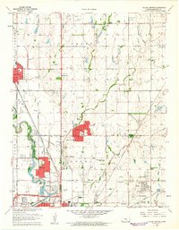 1960 Valley Center1961 Print · USGSSedgwick County experiences significant mid-century growth and industrial development as oil fields and new suburbs expand across the prairie. Researchers can trace family roots through Marble Grove Cem or locate former landmarks like the Drive-in Theater and Hillside Grove Sch.4 unique versions available
 - 1961 Map of Maize
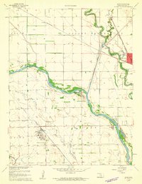 1961 Maize1961 Print · USGSThe Sedgwick County plains are shown in the early sixties as a vital crossroads of rail lines and river floodways. Genealogists and local historians can trace the Old Indian Boundary and locate landmarks like Maize Cem and West Elementary Sch.4 unique versions available
End of results
Showing maps 1-2 of 2
Top cities near Valley Center
- Wichita historical maps
- Newton historical maps
- Andover historical maps
- Park City historical maps
- Bel Aire historical maps
- Rose Hill historical maps
See more
Top neighborhoods of Valley Center
Frequently asked questions
- What are the different types of historical maps available for Valley Center?
- What is the oldest map of Valley Center?
- Where can I purchase historical maps of Valley Center for my home or office?
- Where can I download high-res historical maps of Valley Center?
- Are there historical topographic maps available for Valley Center?
- Is there historical aerial imagery available for Valley Center?
- Where are historical maps of Valley Center sourced from?