2020s Maps of St. John, Kansas
Explore 4 historic maps of St. John from the 2020s. These maps offer a rare glimpse into what life looked like during the 2020s — showing old roads, neighborhoods, homes, and landmarks that have changed or disappeared over time.
Whether you're researching your family's past, planning a metal detecting trip, or studying how St. John's landscape evolved across the 2020s, these high-resolution maps are a powerful tool for exploring the history of this region.
- Focus on a specific era: All maps on this page are from the 2020s, giving you a focused view of this time period.
- See what’s changed: Compare century-old streets, trails, and buildings to today's modern landscape using overlays and satellite layers.
- Research with precision: Use these maps for genealogy, historical research, land use analysis, or educational projects.
- View, download, or print: Maps are fully viewable online in high resolution, and can be downloaded or printed for your own records.
Start exploring St. John's history through authentic maps from the 2020s. This is your window into the past.
St. John, KS maps
(4)- 2022 Map of Saint John South, 2022 Print
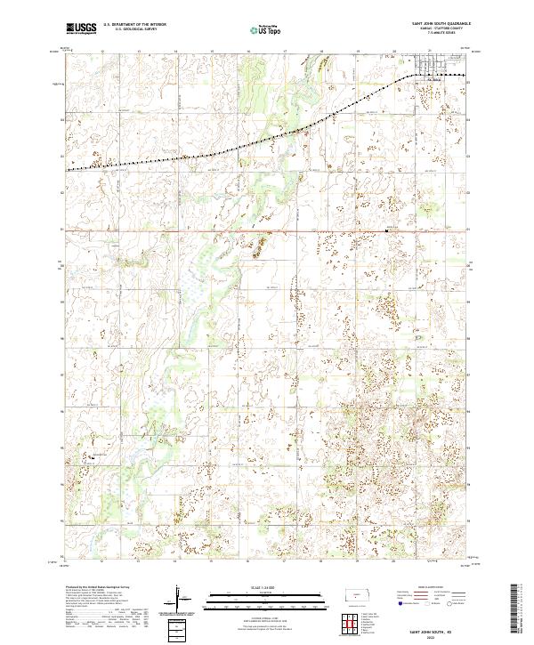 2022 Saint John South2022 Print · USGSThe southern outskirts of St. John meet the Kansas prairie in this 2022 survey of the Stafford County landscape. Researchers can trace the winding course of Rattlesnake Cr and locate rural burial grounds like Martin Cem and Neelands Cem.
 - 2022 Map of Stafford NW, 2022 Print
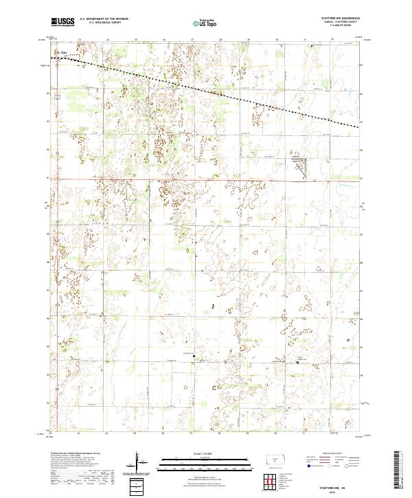 2022 Stafford NW2022 Print · USGSThe northwest reaches of Stafford County are captured here in the early twenty-first century, showcasing a landscape of section-line roads and prairie cemeteries. Genealogists and local researchers can locate the Leesburg Cem, Verning Cem, and the outskirts of St. John.
 - 2022 Map of Saint John North, 2022 Print
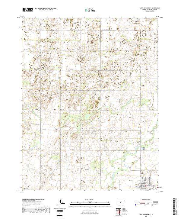 2022 Saint John North2022 Print · USGSThe northern reaches of the Stafford County seat come into focus during the early twenty-first century, showing the town's expansion and its rural surroundings. Genealogists and local historians can trace property locations along Zook Rd or explore the streets surrounding the Stafford County Courthouse.
 - 2022 Map of Hudson, 2022 Print
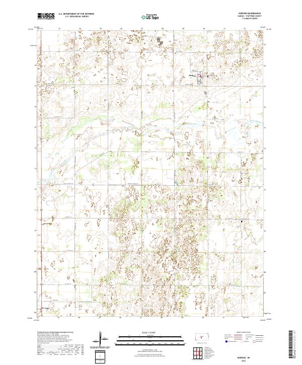 2022 Hudson2022 Print · USGSThe rural landscape of Stafford County comes alive in this contemporary survey of the area surrounding Hudson. Researchers can trace family history through local landmarks like Trinity Cem and Feldhut Cem or follow the waters of Rattlesnake Cr.
End of results
Showing maps 1-4 of 4
Top cities near St. John
- Stafford historical maps
- Macksville historical maps
- Hudson historical maps
- Seward historical maps
- Byers historical maps
- Radium historical maps
Frequently asked questions
- What are the different types of historical maps available for St. John?
- What is the oldest map of St. John?
- Where can I purchase historical maps of St. John for my home or office?
- Where can I download high-res historical maps of St. John?
- Are there historical topographic maps available for St. John?
- Is there historical aerial imagery available for St. John?
- Where are historical maps of St. John sourced from?