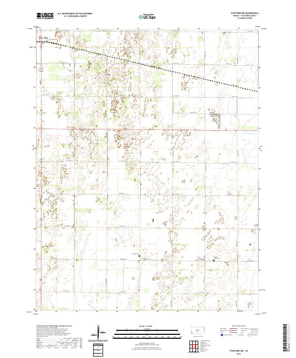
2022 Map of Stafford NW
USGS Topo · Published 2022About this map
The northwest corner of St. John anchors this portion of Stafford County, where the transition from town lots to the sprawling agricultural grid of central Kansas is immediate. The landscape is defined by a rigorous network of section roads like Leesburg Rd and E Old Hwy 50, which provide access to the isolated homesteads and farmland that characterize the region. Vital community history is preserved in small, scattered locations such as the Leesburg Cem and Prairie Chapel Cem, which often stand as the only remaining markers of earlier rural congregations. To the east, the Stafford Municipal Airport represents a modern point of infrastructure. Natural drainage is subtle, with the intermittent courses of Peace Cr and Dooleyville Cr weaving through the sections, highlighting the reliance on local topography for water management in this prairie environment.
Find a feature on this map
35 named features on this map. Tap any name to fly to it.
Don’t see what you’re looking for? This feature index may not catch every label — zoom into the map to look around manually.
Map Details
Editions of this 2022 Stafford NW Map
This is the sole edition of this map. No revisions or reprints were ever made.
Other maps of this area

1891 · Great Bend
USGS Topo · 1:125,000

1892 · Pratt
USGS Topo · 1:125,000

1893 · Great Bend
USGS Topo · 1:125,000

1894 · Pratt
USGS Topo · 1:125,000

1955 · Great Bend
USGS Topo · 1:250,000

1955 · Pratt
USGS Topo · 1:250,000

1957 · Great Bend
USGS Topo · 1:250,000

1958 · Great Bend
USGS Topo · 1:250,000

1959 · Pratt
USGS Topo · 1:250,000
1971 · Hudson SE
USGS Topo · 1:24,000