1950s Maps of Wyandotte County, Kansas
Explore 16 historic maps of Wyandotte County from the 1950s. These maps offer a rare glimpse into what life looked like during the 1950s — showing old roads, neighborhoods, homes, and landmarks that have changed or disappeared over time.
Whether you're researching your family's past, planning a metal detecting trip, or studying how Wyandotte County's landscape evolved across the 1950s, these high-resolution maps are a powerful tool for exploring the history of this region.
- Focus on a specific era: All maps on this page are from the 1950s, giving you a focused view of this time period.
- See what’s changed: Compare century-old streets, trails, and buildings to today's modern landscape using overlays and satellite layers.
- Research with precision: Use these maps for genealogy, historical research, land use analysis, or educational projects.
- View, download, or print: Maps are fully viewable online in high resolution, and can be downloaded or printed for your own records.
Start exploring Wyandotte County's history through authentic maps from the 1950s. This is your window into the past.
Wyandotte County, KS maps
(16)- 1950 Map of Basehor
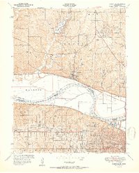
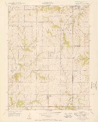 1950 Basehor1950 Print · USGSLeavenworth County agriculture and infrastructure are well-established by the late 1940s, centered on the growing community of Basehor. Researchers can trace old property landmarks like Little Stranger Church, the Kansas State Penitentiary, and Spring Hill School.3 unique versions available
 - 1950 Map of Kansas City
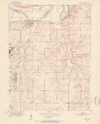
 1950 Kansas City1950 Print · USGSMid-century Kansas and Missouri are captured here during a period of industrial growth and shifting transportation. Genealogists and historians can trace rail lines like the Wabash RR or locate ancestral homes near the Potawatomi Indian Reservation and Horton.
 - 1950 Map of Lawrence
 1950 Lawrence1950 Print · USGSMid-century Kansas and Missouri come alive in this map of the river-valley corridors just as the interstate era was beginning. Researchers can trace the legacy of major rail lines like the Union Pacific RR and locate ancestral roots in towns from Lawrence to Harrisonville.
 - 1950 Map of Edwardsville, 1963 Print
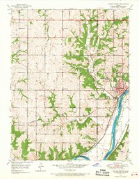
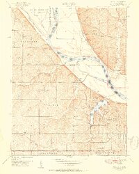
 1950 Edwardsville1963 Print · USGSThe Kansas River valley in the early fifties shows a bustling corridor of rail-and-river transit. Local historians can trace family roots at Edwardsville Cem or find early schools like Virginia Sch and Timmons Sch.3 unique versions available
 - 1950 Map of Bonner Springs, 1968 Print
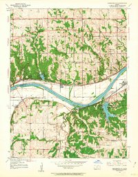
 1950 Bonner Springs1968 Print · USGSBonner Springs and the surrounding river bluffs are captured here at the start of the 1950s. Genealogists can locate family landmarks like Riverview Cem and Lenape Cem, or trace numerous local schoolhouses such as Twist Sch and Elm Grove Sch.4 unique versions available
 - 1951 Map of Edwardsville
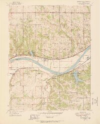 1951 Edwardsville1951 Print · USGSIn the early 1950s, the Kansas River valley supported a dense network of river-towns and railroads before widespread suburbanization. Genealogists can trace early homesteads and landmarks like Grinter Heights, Edwardsville Cem, and rural schools from Mission Sch to Zarah.2 unique versions available
 - 1951 Map of Parkville
 1951 Parkville1951 Print · USGSMid-century development straddles the Missouri River between Platte and Wyandotte counties as suburban growth reaches the river bluffs. Researchers can trace historic institutions like Park College and Western University alongside many local burial grounds like St Marys Cemetery.2 unique versions available
 - 1951 Map of Wolcott
 1951 Wolcott1951 Print · USGSThe Missouri River bottoms and Kansas bluffs come into focus in the early 1950s, showing a landscape of river bends and rural crossroads. Genealogists can trace family landmarks like the Dungan Cemetery or historic schools including Pleasant Ridge School and District No 45 School.
 - 1951 Map of North Kansas City
 1951 North Kansas City1951 Print · USGSThe Kansas City riverfront was a bustling hub of rail and aviation activity in the early fifties. Genealogists and local historians can trace family roots through landmarks like Quindaro, the Dunbar School, and the historic Antioch Church.2 unique versions available
 - 1951 Map of Bonner Springs
 1951 Bonner Springs1951 Print · USGSBonner Springs and the surrounding townships were hubs of activity in the early 1950s, centered on the Kansas River corridor. Genealogists and local historians can trace rural school locations like Elm Grove Sch and family burial sites at Riverview Cem or Lenape Cem.2 unique versions available
 - 1951 Map of De Soto, 1952 Print
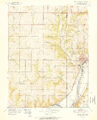
 1951 De Soto1952 Print · USGSDe Soto and the surrounding Kansas townships are captured here in the early fifties as the region's agricultural roots began to meet industrial expansion. Researchers can pinpoint the sprawling Sunflower Ordnance Works and several rural schools like Weaverly Sch and North Lone Elm Sch.6 unique versions available
 - 1954 Map of Kansas City
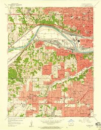
 1954 Kansas City1954 Print · USGSThe Missouri-Kansas borderlands flourished in the post-war era as river commerce and rail networks converged at the Missouri River. Genealogists and historians can trace the foundations of Kansas City and smaller rural hubs like Hiawatha or Sabetha.
 - 1956 Map of Kansas City, 1967 Print
 1956 Kansas City1967 Print · USGSThe Kansas-Missouri border region thrived during the mid-fifties, centered on the growing metropolitan cores and the busy river valleys. Researchers can trace the layout of significant government sites like Fort Leavenworth and the Lake City Army Ammunition Plant.4 unique versions available
 - 1956 Map of Lawrence, 1967 Print
 1956 Lawrence1967 Print · USGSEastern Kansas and the Missouri border country are captured here during the mid-century transition to the interstate era. Genealogists and local historians can trace family-named terrain like Summers Mound and the footprint of Sunflower Ordnance Works near Baldwin City.4 unique versions available
 - 1957 Map of Shawnee, 1958 Print
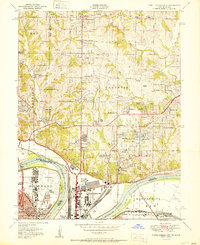
 1957 Shawnee1958 Print · USGSNortheastern Kansas is captured here during a decade of rapid suburban growth between the river and the county line. Genealogists and local historians can trace family-named landmarks and early schools like Hocker Grove Jr High Sch, Crestline Cemetery, and the expansive Argentine rail district.
 - 1957 Map of Kansas City, 1958 Print
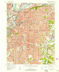 1957 Kansas City1958 Print · USGSKansas City at the dawn of the space age shows a bustling metropolitan hub still centered on its grand river crossings and rail terminals. Trace the city's mid-century footprint from the iconic Liberty Memorial and Union Station to the legendary Municipal Stadium and Swope Park.
End of results
Showing maps 1-16 of 16
Top cities of Wyandotte County
Frequently asked questions
- What are the different types of historical maps available for Wyandotte County?
- What is the oldest map of Wyandotte County?
- Where can I purchase historical maps of Wyandotte County for my home or office?
- Where can I download high-res historical maps of Wyandotte County?
- Are there historical topographic maps available for Wyandotte County?
- Is there historical aerial imagery available for Wyandotte County?
- Where are historical maps of Wyandotte County sourced from?