Old Maps of Park City, Kentucky for Academic Research
Study the evolution of Park City with 14 high-resolution historic maps. Whether you're teaching, researching, or modeling changes in land use, these maps provide essential visual documentation of urban, environmental, and geographic change.
- Analyze long-term change: Track patterns in development, transportation, and natural features.
- Ideal for environmental or urban studies: Support academic projects with primary historical map data.
- Use in the classroom or lab: Educators and researchers rely on these maps to bring historical context to life.
These maps are a powerful tool for teaching, research, and visualizing how Park City has changed over the decades.
Park City, KY maps
(14)- 1922 Map of Mammoth Cave, 1957 Print
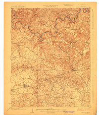
 1922 Mammoth Cave1957 Print · USGSThe Green River valley and the Kentucky karst country are captured here in the early 1920s, before the full development of the national park. Researchers can trace family-named landmarks and long-established crossings like Fishtrap Ferry, Good Spring Church, and the world-renowned Mammoth Cave.7 unique versions available
 - 1923 Map of Mammoth Cave
 1923 Mammoth Cave1923 Print · USGSThe subterranean wonders of Edmonson County are mapped in the early 1920s alongside the river ferries and rail towns of the Kentucky karst. Family historians can trace ancestral roots through dozens of local landmarks like Good Spring Church, Ollie School, and Houchins Ferry.6 unique versions available
 - 1954 Map of Evansville
 1954 Evansville1954 Print · USGSThe Ohio River borderlands between Indiana and Kentucky appear here during a period of robust industrial and military growth. Genealogists and researchers can trace the rail corridors of the Illinois Central and find landmarks like US Lock and Dam No 48 or Camp Breckinridge.
 - 1954 Map of Park City, 1955 Print
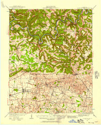
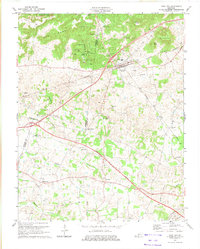
 1954 Park City1955 Print · USGSThe limestone country of Barren and Edmonson counties is captured here in the mid-1950s. Researchers can trace the legacy of travel and tourism through Diamond Caverns, the Dixie Highway, and rural stops like Bon Ayr.2 unique versions available
 - 1957 Map of Evansville, 1969 Print
 1957 Evansville1969 Print · USGSIndiana and Kentucky meet along the Ohio River in this mid-century survey of a vital industrial and transport corridor. Genealogists and historians can trace the development of river towns like Owensboro and Newburgh or locate old rail lines like the Southern Ry.3 unique versions available
 - 1961 Map of Evansville
 1961 Evansville1961 Print · USGSThe Ohio River valley and its surrounding coalfields are captured here during the late fifties and early sixties. Trace the industrial rail networks of the Illinois Central RR and explore regional landmarks like Mammoth Cave National Park and Angel Mounds State Memorial.2 unique versions available
 - 1966 Map of Park City, 1968 Print
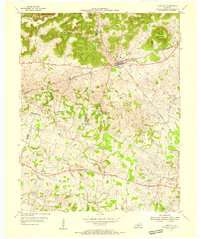
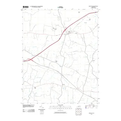
 1966 Park City1968 Print · USGSBarren and Edmonson counties are captured in the mid-sixties, where the gateway to the cavern country meets the rail lines. Genealogists can trace family landmarks like Cox Cem and rural congregations including Mt Vernon Ch and Woodland Ch.
 - 1973 Map of Park City, 1974 Print
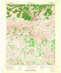
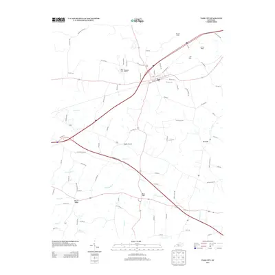
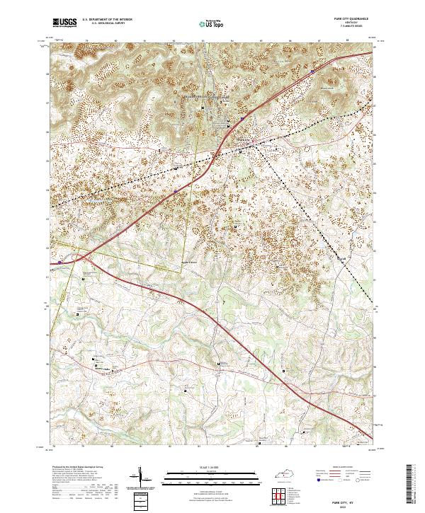
 1973 Park City1974 Print · USGSPark City and the surrounding knobs of Barren County are captured in the early seventies, just as the regional highway network was expanding. Genealogists and cave enthusiasts can trace family sites and local landmarks like Diamond Caverns, Zion Cem Ch, and the rural community of Merry Oaks.
 - 1981 Map of Beaver Dam, 1984 Print
 1981 Beaver Dam1984 Print · USGSThe Western Kentucky coal and river country comes into focus in the early 1980s as industry and recreation reshape the land. Researchers can trace family roots and old routes through Morgantown, Beaver Dam, and the early footprints of Mammoth Cave National Park.
 - 2010 Map of Park City, 2010 Print
 2010 Park City2010 Print · USGSCovers Park City, including Stovall, Bon Ayr, and other nearby areas
 - 2013 Map of Park City, 2013 Print
 2013 Park City2013 Print · USGSCovers Park City, including Stovall, Bon Ayr, and other nearby areas
 - 2016 Map of Park City, 2016 Print
 2016 Park City2016 Print · USGSCovers Park City, including Stovall, Bon Ayr, and other nearby areas
 - 2019 Map of Park City, 2019 Print
 2019 Park City2019 Print · USGSCovers Park City, including Stovall, Bon Ayr, and other nearby areas
 - 2022 Map of Park City, 2022 Print
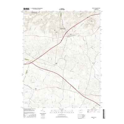
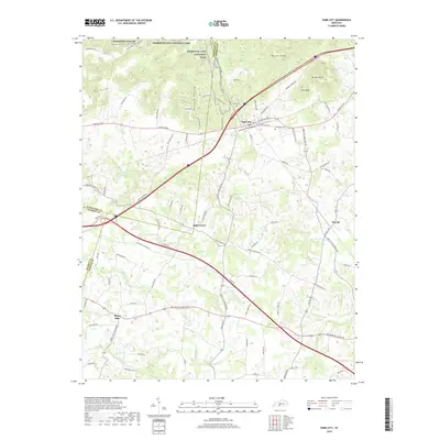
 2022 Park City2022 Print · USGSPark City and the southern fringes of the karst country are captured here in the early 2020s. Researchers can locate dozens of historic burial sites and rural congregations, from the Gray-Barrick Cemetery to the Bon Ayr Methodist Church Cemetery.
End of results
Showing maps 1-14 of 14
Top cities near Park City
- Glasgow historical maps
- Cave City historical maps
- Horse Cave historical maps
- Munfordville historical maps
- Brownsville historical maps
- Smiths Grove historical maps
See more
Frequently asked questions
- What are the different types of historical maps available for Park City?
- What is the oldest map of Park City?
- Where can I purchase historical maps of Park City for my home or office?
- Where can I download high-res historical maps of Park City?
- Are there historical topographic maps available for Park City?
- Is there historical aerial imagery available for Park City?
- Where are historical maps of Park City sourced from?