1900s (20th Century) Maps of Lee, Kentucky
Explore 7 historic maps of Lee from the 1900s (20th Century). These maps offer a rare glimpse into what life looked like during the 1900s — showing old roads, neighborhoods, homes, and landmarks that have changed or disappeared over time.
Whether you're researching your family's past, planning a metal detecting trip, or studying how Lee's landscape evolved across the 1900s, these high-resolution maps are a powerful tool for exploring the history of this region.
- Focus on a specific era: All maps on this page are from the 1900s, giving you a focused view of this time period.
- See what’s changed: Compare century-old streets, trails, and buildings to today's modern landscape using overlays and satellite layers.
- Research with precision: Use these maps for genealogy, historical research, land use analysis, or educational projects.
- View, download, or print: Maps are fully viewable online in high resolution, and can be downloaded or printed for your own records.
Start exploring Lee's history through authentic maps from the 1900s. This is your window into the past.
Lee, KY maps
(7)- 1922 Map of Leitchfield
 1922 Leitchfield1922 Print · USGSGrayson and Edmonson counties in the early twenties were defined by a robust network of small schools and local industry. Genealogists can trace family connections through landmarks like Duvall Cemetery, the Kentucky Rock Asphalt Co Mine, and the Rogers Springs School.
 - 1925 Map of Leitchfield
 1925 Leitchfield1925 Print · USGSGrayson and Edmonson counties are mapped in the mid-twenties as rural farming and coal communities. Genealogists can locate family landmarks like Rogers Springs School, the Meredith Coal Bank, and Beech Grove Church.2 unique versions available
 - 1953 Map of Ready, 1954 Print
 1953 Ready1954 Print · USGSEdmonson and Grayson Counties are captured here in the early fifties, showing a rural landscape defined by close-knit crossroads communities. Researchers can trace the locations of family landmarks and local institutions like Rabbit Flat Ch, Sunfish Sch, and the Woosley Cem.3 unique versions available
 - 1954 Map of Evansville
 1954 Evansville1954 Print · USGSThe Ohio River borderlands between Indiana and Kentucky appear here during a period of robust industrial and military growth. Genealogists and researchers can trace the rail corridors of the Illinois Central and find landmarks like US Lock and Dam No 48 or Camp Breckinridge.
 - 1957 Map of Evansville, 1969 Print
 1957 Evansville1969 Print · USGSIndiana and Kentucky meet along the Ohio River in this mid-century survey of a vital industrial and transport corridor. Genealogists and historians can trace the development of river towns like Owensboro and Newburgh or locate old rail lines like the Southern Ry.3 unique versions available
 - 1961 Map of Evansville
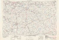 1961 Evansville1961 Print · USGSThe Ohio River valley and its surrounding coalfields are captured here during the late fifties and early sixties. Trace the industrial rail networks of the Illinois Central RR and explore regional landmarks like Mammoth Cave National Park and Angel Mounds State Memorial.2 unique versions available
 - 1981 Map of Beaver Dam, 1984 Print
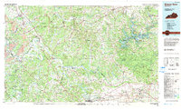 1981 Beaver Dam1984 Print · USGSThe Western Kentucky coal and river country comes into focus in the early 1980s as industry and recreation reshape the land. Researchers can trace family roots and old routes through Morgantown, Beaver Dam, and the early footprints of Mammoth Cave National Park.
End of results
Showing maps 1-7 of 7
Top cities near Lee
- Leitchfield historical maps
- Morgantown historical maps
- Brownsville historical maps
- Caneyville historical maps
- Woodbury historical maps
Frequently asked questions
- What are the different types of historical maps available for Lee?
- What is the oldest map of Lee?
- Where can I purchase historical maps of Lee for my home or office?
- Where can I download high-res historical maps of Lee?
- Are there historical topographic maps available for Lee?
- Is there historical aerial imagery available for Lee?
- Where are historical maps of Lee sourced from?