2020s Maps of Calloway County, Kentucky
Explore 13 historic maps of Calloway County from the 2020s. These maps offer a rare glimpse into what life looked like during the 2020s — showing old roads, neighborhoods, homes, and landmarks that have changed or disappeared over time.
Whether you're researching your family's past, planning a metal detecting trip, or studying how Calloway County's landscape evolved across the 2020s, these high-resolution maps are a powerful tool for exploring the history of this region.
- Focus on a specific era: All maps on this page are from the 2020s, giving you a focused view of this time period.
- See what’s changed: Compare century-old streets, trails, and buildings to today's modern landscape using overlays and satellite layers.
- Research with precision: Use these maps for genealogy, historical research, land use analysis, or educational projects.
- View, download, or print: Maps are fully viewable online in high resolution, and can be downloaded or printed for your own records.
Start exploring Calloway County's history through authentic maps from the 2020s. This is your window into the past.
Calloway County, KY maps
(13)- 2022 Map of Puryear, 2022 Print
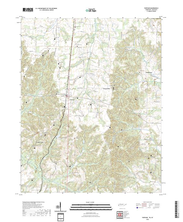 2022 Puryear2022 Print · USGSHenry County near the Kentucky border reveals a quiet landscape of family cemeteries and rural crossroads in the early twenty-first century. Genealogists can trace local heritage at Foundry Hill Baptist Cem, Littleton Cem, and the historic site of Conyersville.
 - 2022 Map of Buchanan, 2022 Print
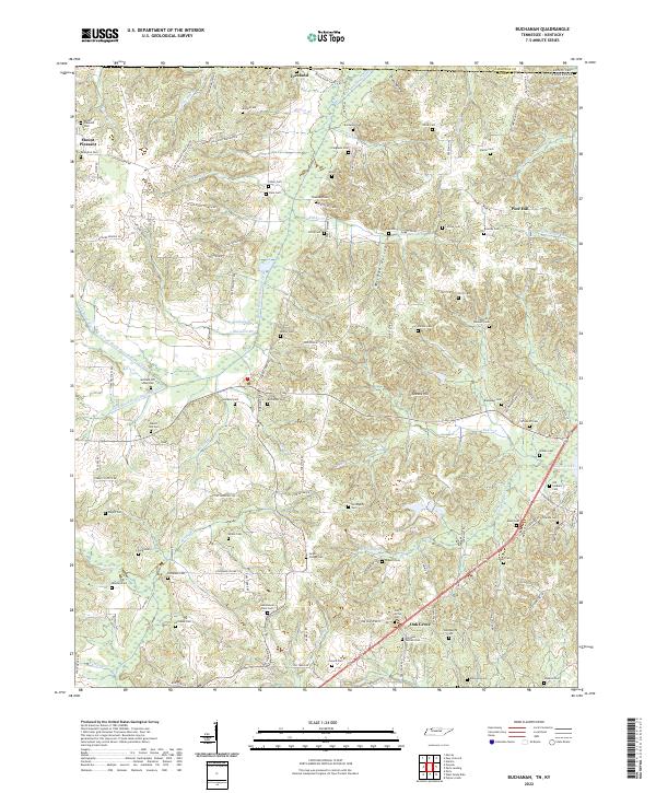 2022 Buchanan2022 Print · USGSThe Tennessee and Kentucky borderlands near Buchanan are captured here during a time of settled agricultural life. Genealogists can trace dozens of family burial sites including the Old Soldiers Cem, Heglar Chapel Cem, and Valentine Cem.
 - 2022 Map of Murray, 2022 Print
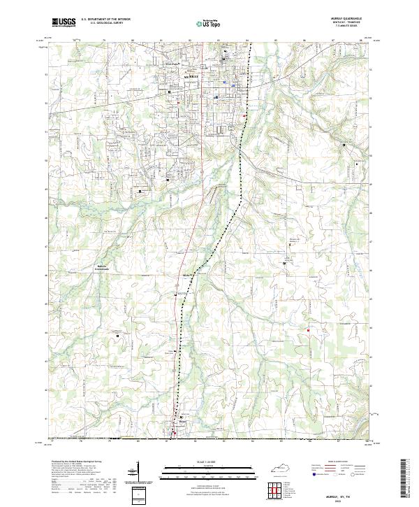 2022 Murray2022 Print · USGSThe college town of Murray and the Tennessee borderlands are captured in this recent survey. Genealogists can trace deep local roots at Old Salem Cem, Green Plains Cem, and the Murray City Cem African American.
 - 2022 Map of Kirksey, 2022 Print
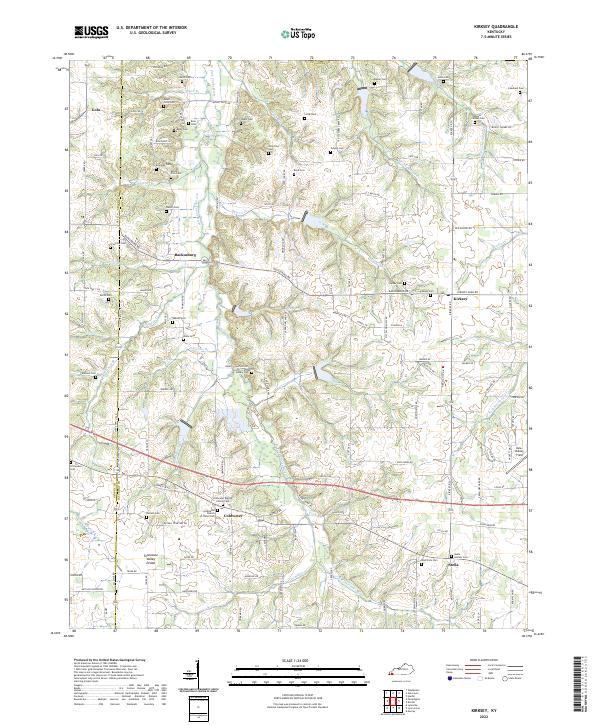 2022 Kirksey2022 Print · USGSWestern Kentucky's agricultural heartland and the Tennessee Valley Divide are documented here in the early twenty-first century. Genealogists and local historians can locate dozens of family burial sites, from Yandell Cem to the Stella Goshen Cem near Stella.
 - 2022 Map of Oak Level, 2022 Print
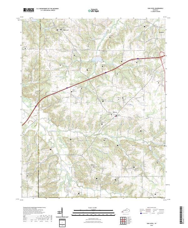 2022 Oak Level2022 Print · USGSWestern Kentucky's rural landscape comes alive in this survey of the communities near the West Fork Clarks River. Researchers can trace family sites across a dense network of country cemeteries and churches, including Oak Level Cem and Vanzora Baptist Church Cem.
 - 2022 Map of Dexter, 2022 Print
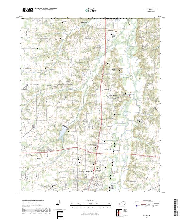 2022 Dexter2022 Print · USGSCalloway County agriculture and community life are well-established in this recent survey of the Clarks River valley. Genealogists can trace family roots through numerous sites like County Poor Farm Cem, Trevathan Cem Number 2, and the settlement of Wadesboro.
 - 2022 Map of Paris Landing, 2022 Print
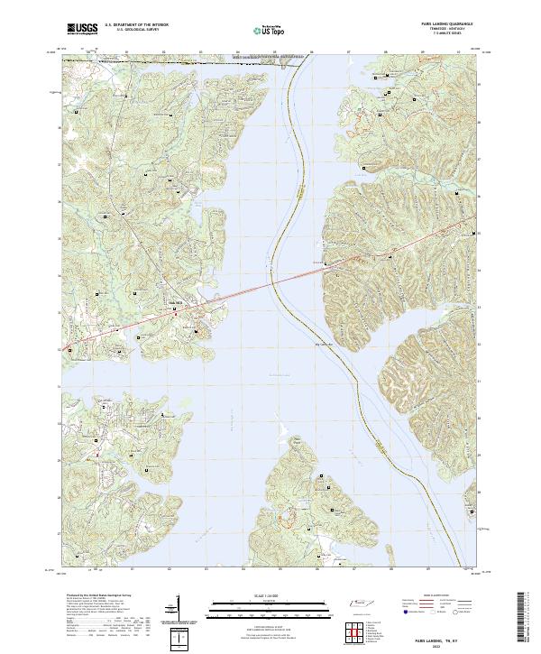 2022 Paris Landing2022 Print · USGSThe Tennessee and Big Sandy rivers meet at the state line in this recent study of Henry and Stewart counties. Genealogists can trace family names through dozens of burial sites like Saint Mary's Cem, Parker-Presnell Cem, and Taylor Cem.
 - 2022 Map of Rushing Bay, 2022 Print
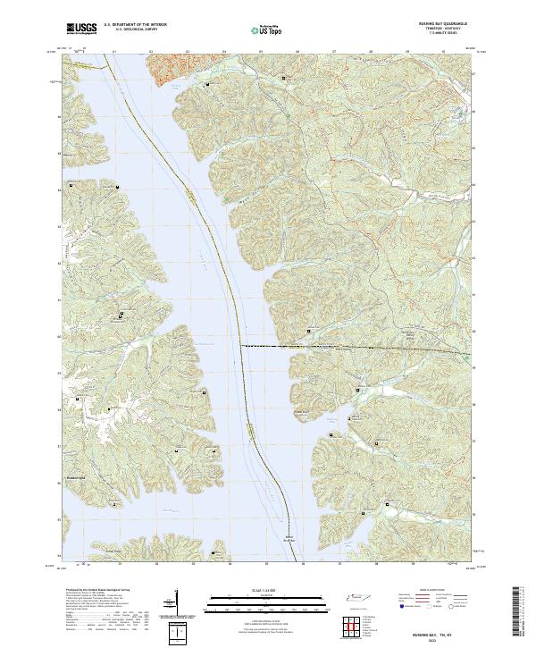 2022 Rushing Bay2022 Print · USGSThe Tennessee and Kentucky borderlands along Kentucky Lake are shown here in modern detail. Genealogists can trace family sites like Hooper Cemetery and Banner Cemetery alongside historical landmarks like Cedar Bluff and Blood River Bar.
 - 2022 Map of Hamlin, 2022 Print
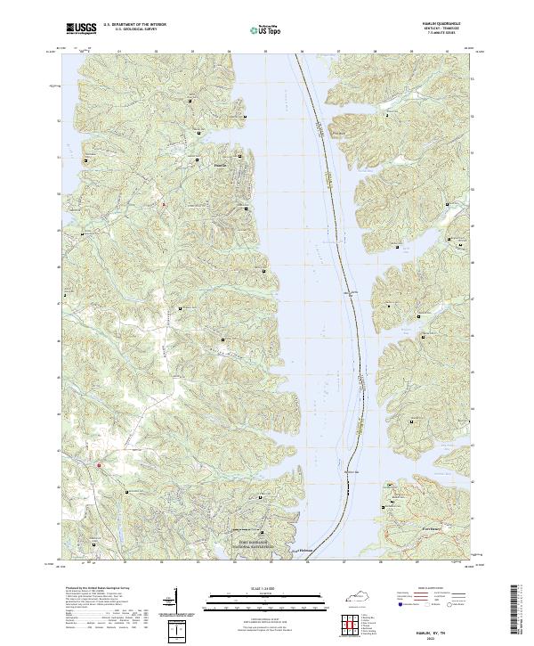 2022 Hamlin2022 Print · USGSThe Kentucky and Tennessee borderlands meet here along the shores of Kentucky Lake. Genealogists can trace family names through dozens of sites like McCuiston Cem and Brigham Cem near the Fort Donelson National Battlefield.
 - 2022 Map of New Concord, 2022 Print
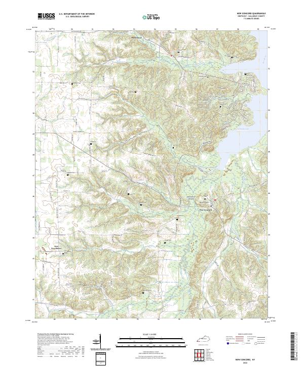 2022 New Concord2022 Print · USGSCalloway County at the edge of the Tennessee River valley shows a landscape of deep hollows and family homesteads. Genealogists can trace decades of local history through numerous family burial sites like Stubblefield Cem and Macedonia Cem near New Concord.
 - 2022 Map of Hardin, 2022 Print
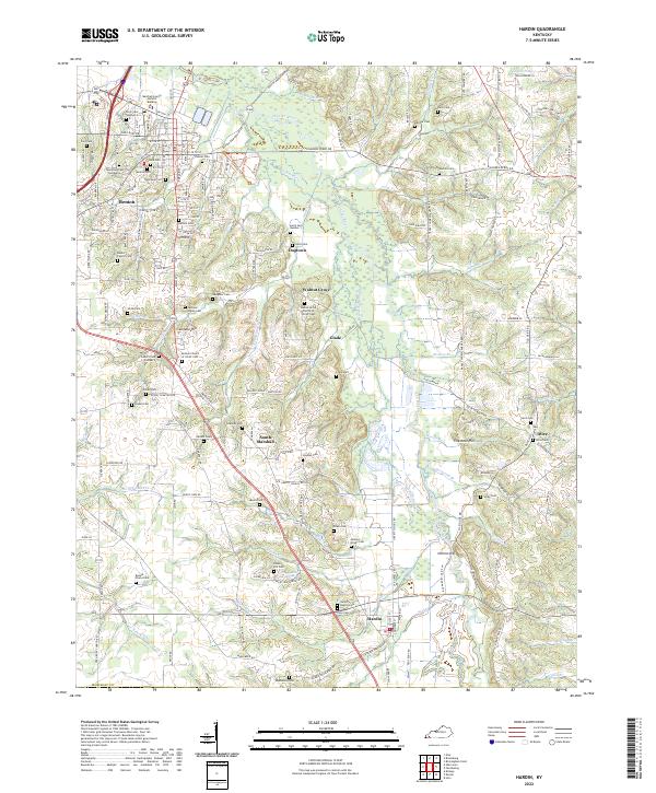 2022 Hardin2022 Print · USGSIn the 2020s, Marshall County retains its intricate web of family-named cemeteries and small rural settlements. Genealogists can trace family lines through landmarks like Bennie Starks Cem, Jackson-Starks Cem, and the community of South Marshall.
 - 2022 Map of Hico, 2022 Print
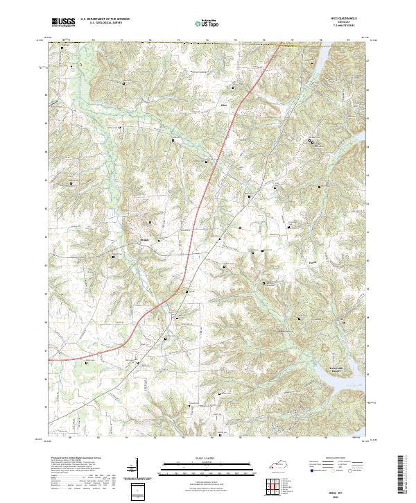 2022 Hico2022 Print · USGSCalloway County, Kentucky, near the shores of the Tennessee River, maintains its rural character in this recent survey. Genealogists can trace family landmarks and burial sites like Shiloh Cem, Scott Family Cem, and the historic community of Faxon.
 - 2022 Map of Lynn Grove, 2022 Print
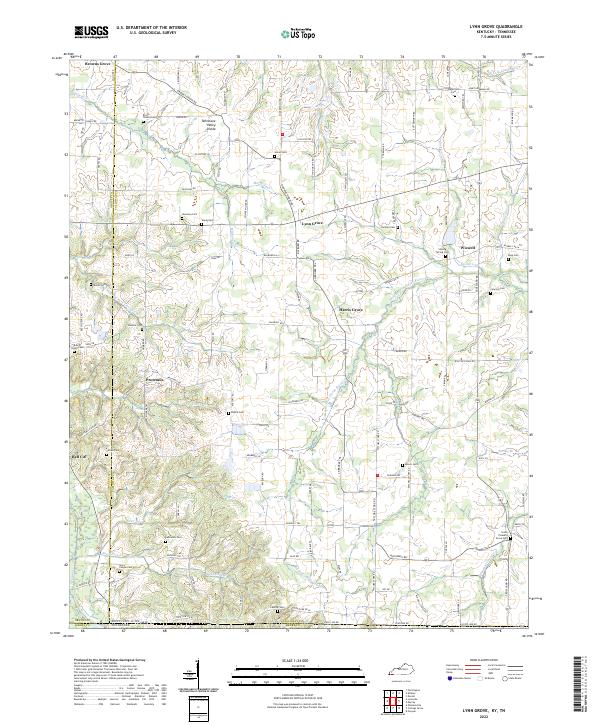 2022 Lynn Grove2022 Print · USGSCalloway County and the Kentucky-Tennessee borderlands appear in great detail during the early 2020s. Genealogists can trace family names at Salem Cem, Harmony Cem, and South Pleasant Grove Cem near the Middle Fork Clarks River.
End of results
Showing maps 1-13 of 13
Top cities of Calloway County
Frequently asked questions
- What are the different types of historical maps available for Calloway County?
- What is the oldest map of Calloway County?
- Where can I purchase historical maps of Calloway County for my home or office?
- Where can I download high-res historical maps of Calloway County?
- Are there historical topographic maps available for Calloway County?
- Is there historical aerial imagery available for Calloway County?
- Where are historical maps of Calloway County sourced from?