Old Maps of Campbell County, Kentucky for Hiking & Exploration
Hike through history with 85 historic maps of Campbell County. Explore old trails, ghost towns, and forgotten backroads — perfect for outdoor adventurers and local explorers.
- Rediscover forgotten places: Map out old mining camps, roads, and footpaths that no longer exist on modern maps.
- Layer with modern tools: Combine with LiDAR or satellite views to plan hikes through historical terrain.
- Made for exploration: Popular among hikers, overlanders, and local history lovers.
Use these maps to find adventure and explore the hidden past of Campbell County.
Campbell County, KY maps
(85)- 1898 Map of East Cincinnati, 1964 Print
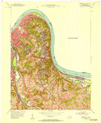
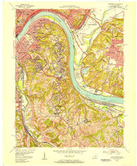
 1898 East Cincinnati1964 Print · USGSGreater Cincinnati and Northern Kentucky emerge as a bustling riverfront and rail hub at the turn of the century. Genealogists and historians can trace the early footprints of Coney Island Resort, the Longview Asylum, and the Cincinnati Waterworks.
 - 1914 Map of East Cincinnati
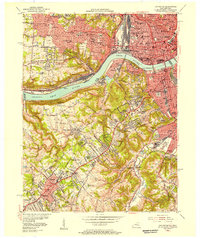
 1914 East Cincinnati1914 Print · USGSThe eastern Cincinnati suburbs and Northern Kentucky riverfront come alive in this pre-war survey of industrial and residential growth. Genealogists can trace family footprints near the St Aloysius Orphan Asylum, Alpine Bell School, or the Covington Reservoirs.4 unique versions available
 - 1914 Map of West Cincinnati
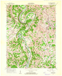
 1914 West Cincinnati1914 Print · USGSCincinnati and the Ohio River valley appear here in a period of intense industrial growth and suburban expansion just before the First World War. Researchers can trace the dense rail networks of the Chesapeake and Ohio or locate early institutions like the Ohio Military Institute and Spring Grove Cemetery.4 unique versions available
 - 1929 Map of Alexandria
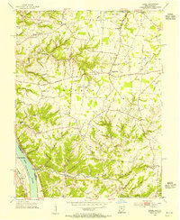
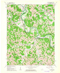
 1929 Alexandria1929 Print · USGSNorthern Kentucky and the Ohio River border appear here in the late twenties as a bustling landscape of ridge-top farms and river-valley rail towns. Genealogists can trace family roots through numerous local landmarks like Oak Island Ch, Grants Lick, and the many rural schools such as Carthage Sch.
 - 1931 Map of Felicity
 1931 Felicity1931 Print · USGSClermont County's riverfront and rolling uplands are captured here in the early thirties as a network of small schoolhouses and rail lines defined rural life. Researchers can trace the path of the Cincinnati Georgetown and Portsmouth RR or locate family sites near Felicity, Utopia, and Lock 34.2 unique versions available
 - 1936 Map of Alexandria
 1936 Alexandria1936 Print · USGSNorthern Kentucky and the Ohio River valley appear here in the mid-1930s, showing a landscape defined by sharp river bends and rural rail stops. Researchers can trace historic schools and parish centers like Sts Peter and Paul Sch, the winding Licking Valley Highway, and the riverside operations at Gubser Mill.2 unique versions available
 - 1950 Map of Covington, 1953 Print
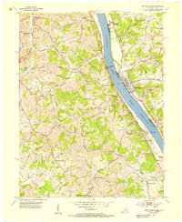
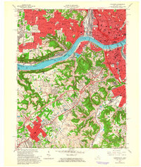
 1950 Covington1953 Print · USGSNorthern Kentucky's riverfront and southern suburbs are captured here at the mid-century mark as neighborhoods expanded along the Dixie Highway. Genealogists and historians can trace family plots in Highland Cem or locate community landmarks like the Villa Madonna and Dixie Heights High Sch.
 - 1952 Map of Newport, 1953 Print
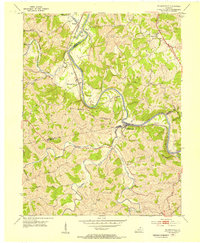
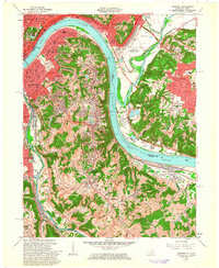
 1952 Newport1953 Print · USGSNorthern Kentucky during the early fifties shows a bustling riverfront and established hillside neighborhoods at the junction of two major rivers. Genealogists and historians can locate family landmarks like Evergreen Cemetery, Kenton Co Infirmary, and numerous schools including Bellevue High Sch.
 - 1953 Map of Laurel, 1955 Print
 1953 Laurel1955 Print · USGSClermont County's riverfront and upland hamlets are captured here in the early fifties, showing the rural character of the Ohio River valley. Researchers can locate the Chesapeake and Ohio rail line and historic community hubs like Point Pleasant, Laurel, and the Monroe Sch.
 - 1953 Map of Withamsville, 1955 Print
 1953 Withamsville1955 Print · USGSThe Ohio River valley in the early fifties shows a landscape of ridge-top settlements and active rail lines. Genealogists can trace family sites near Clough Chapel, Asbury Cem, and early schools like Township Sch.
 - 1953 Map of Butler, 1955 Print
 1953 Butler1955 Print · USGSThe Licking River valley in the early fifties shows a rugged landscape of winding ridges and railroad-dependent towns. Trace family roots at Butler Cem or Mt Auburn Cem, and locate rural landmarks like Fisher Tabernacle and Peach Grove.
 - 1953 Map of New Richmond, 1955 Print
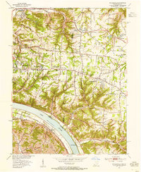
 1953 New Richmond1955 Print · USGSThe Ohio River valley in the early fifties showcases a landscape defined by riverside rail commerce and dispersed rural hamlets. Local historians can trace the foundations of New Richmond alongside community landmarks like Gubser Mill, Twelvemile Ch, and Lock and Dam 35.3 unique versions available
 - 1953 Map of De Mossville, 1955 Print
 1953 De Mossville1955 Print · USGSThe Licking River valley in the early fifties was a landscape of tight-knit rail communities and upland farms where Kenton, Campbell, and Pendleton counties meet. Genealogists can trace family footprints at Smith Cem, DeMossville, and country churches like Oak Island Ch.
 - 1953 Map of Alexandria, 1955 Print
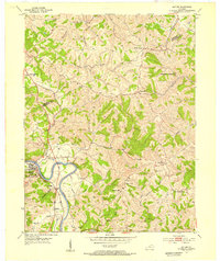
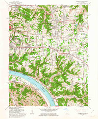
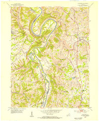 1953 Alexandria1955 Print · USGSNorthern Kentucky in the early fifties shows a landscape of winding river valleys and hilltop communities. Researchers can trace the Louisville and Nashville rail line and locate landmarks like the Tenmile House, White Villa, and Claryville.
 - 1953 Map of Moscow, 1955 Print
 1953 Moscow1955 Print · USGSThe Ohio River valley in the early fifties reveals a landscape defined by riverside rail travel and upland farming along the Ohio-Kentucky border. Genealogists can trace family sites at Vesper Cem and Flat Rock Ch, or locate old river works at Lock and Dam No 34.2 unique versions available
 - 1953 Map of Cincinnati, 1965 Print
 1953 Cincinnati1965 Print · USGSThe Ohio River valley and the industrial heartland of Indiana and Ohio are captured here during the mid-century peak of rail and river commerce. Genealogists and historians can trace connections between Cincinnati and outlying military sites like Camp Atterbury and Bakalar AFB.3 unique versions available
 - 1955 Map of Newport, 1957 Print
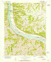
 1955 Newport1957 Print · USGSThe riverfront communities of Northern Kentucky and Southern Ohio are captured here in the mid-fifties as urban density expands into the surrounding hills. Genealogists and historians can trace institutional landmarks like Evergreen Cemetery, Lunken Airport, and the St Anne Convent.
 - 1955 Map of Covington, 1957 Print
 1955 Covington1957 Print · USGSGreater Cincinnati and Northern Kentucky come alive in this mid-fifties survey of the bustling riverfront and its growing suburbs. Researchers can trace historical church parishes and schools like St Marys Hosp, St Johns Cem, and Villa Madonna Academy across the river valley.
 - 1956 Map of Louisville, 1971 Print
 1956 Louisville1971 Print · USGSThe Ohio River valley and the Kentucky Bluegrass are captured here during a period of rapid mid-century growth and industrial activity. Genealogists and historians can trace rail-centered towns and military land use at Fort Knox and the Jefferson Proving Ground.2 unique versions available
 - 1957 Map of Cincinnati
 1957 Cincinnati1957 Print · USGSThe Ohio River valley and its surrounding highlands thrived during the mid-fifties industrial peak, centered on the bustling Cincinnati and Dayton metropolitan hubs. Researchers can trace the extensive rail networks and military sites like Wright-Patterson AFB and Camp Atterbury.
 - 1961 Map of Alexandria, 1962 Print
 1961 Alexandria1962 Print · USGSNorthern Kentucky in the early sixties remains a landscape of river-bend farms and ridge-line communities along the Kenton and Campbell county line. Genealogists and hikers can trace old family roads and landmark sites like Pleasant Ridge Ch, Grants Bend, and the Louisville and Nashville rail line.2 unique versions available
 - 1961 Map of De Mossville, 1963 Print
 1961 De Mossville1963 Print · USGSThe Licking River valley was defined by its winding waters and the Louisville and Nashville rail line in the early sixties. Genealogists can trace family names at Caldwell Cem or locate the rural hubs of De Mossville and Morning View.
 - 1961 Map of Covington, 1963 Print
 1961 Covington1963 Print · USGSThe Ohio River corridor comes alive in the early sixties as industrial centers and hillside neighborhoods bridge the state line. Genealogists and historians can trace St Josephs Cemetery, find the St Johns Orphanage, or locate the Anderson Ferry crossing.3 unique versions available
 - 1961 Map of Newport, 1963 Print
 1961 Newport1963 Print · USGSGreater Cincinnati and Northern Kentucky were entering a period of suburban maturation in the early sixties as riverfront industry met rising hilltop neighborhoods. Researchers can trace local landmarks like Coney Island Amusement Park, Evergreen Cemetery, and the VA Hospital at Fort Thomas.3 unique versions available
 - 1961 Map of Withamsville, 1963 Print
 1961 Withamsville1963 Print · USGSGreater Cincinnati was expanding rapidly during the early sixties, as suburban estates began to fill the heights above the river. Researchers can trace the development of Withamsville and Melbourne, find local landmarks like St Gregory Seminary, and locate the old Drive-in Theater.3 unique versions available
Showing maps 1-25 of 85
Top cities of Campbell County
- Newport historical maps
- Fort Thomas historical maps
- Alexandria historical maps
- Highland Heights historical maps
- Bellevue historical maps
- Cold Spring historical maps
See more
Frequently asked questions
- What are the different types of historical maps available for Campbell County?
- What is the oldest map of Campbell County?
- Where can I purchase historical maps of Campbell County for my home or office?
- Where can I download high-res historical maps of Campbell County?
- Are there historical topographic maps available for Campbell County?
- Is there historical aerial imagery available for Campbell County?
- Where are historical maps of Campbell County sourced from?