Old Maps of Carroll County, Kentucky for Genealogy
Trace your family roots with 56 historic maps of Carroll County. These high-res maps reveal old neighborhoods, homesites, landmarks, and streets — helping you uncover where your ancestors lived and how the area evolved over time.
- Explore historic neighborhoods: Identify where your relatives may have lived in the 1800s or 1900s.
- Compare maps over time: Trace the changes in streets, buildings, and landmarks for multi-generational research.
- Perfect for genealogy & ancestry research: Used by family historians and researchers to map out lineage and migration.
These maps are an incredible resource for exploring your personal connection to Carroll County's past.
Carroll County, KY maps
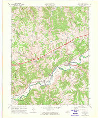
(56)- 1943 Map of Vevay North
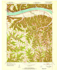
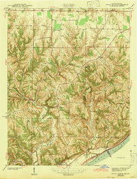 1943 Vevay North1943 Print · USGSSoutheast Indiana during the early years of the war shows a landscape of ridge-top farms and river valley settlements. Genealogists can trace family footprints through numerous rural landmarks like Mt Sterling, Stow Cem, and Jacksonville Sch.2 unique versions available
 - 1943 Map of Brooksburg
 1943 Brooksburg1943 Print · USGSJefferson and Switzerland counties meet along the Ohio River in this early 1940s survey of the Indiana-Kentucky border. Trace the river-based economy and rural transit of the era through the Carrollton Ferry and family landmarks like Mc Kay Cem and McKay Sch.
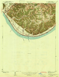
 - 1943 Map of Vevay South
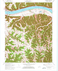
 1943 Vevay South1943 Print · USGSThe Indiana side of the Ohio River is captured in the early 1940s, showing the riverside town of Vevay and its surrounding hills. Genealogists can trace family landmarks like Potato Bug Hill, the Bridge Sch, and the County Infirmary.
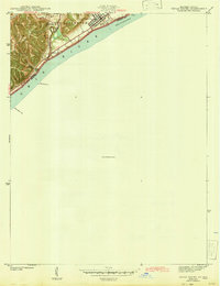
 - 1951 Map of Sanders, 1953 Print
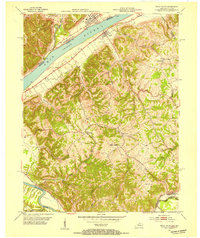
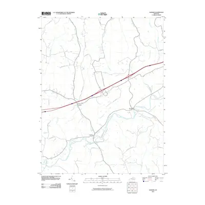
 1951 Sanders1953 Print · USGSNorthern Kentucky in the early fifties was defined by the steam and steel of the Louisville and Nashville railroad as it wound through the Eagle Creek valley. Genealogists can locate family landmarks like Furnish Cem, Drury Chapel, and the remote Park Ridge Sch.
 - 1952 Map of Vevay South, 1954 Print
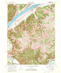
 1952 Vevay South1954 Print · USGSThe Ohio River valley at the Indiana-Kentucky border was a landscape of riverfront hubs and isolated hill settlements in the early fifties. Genealogists and historians can trace family plots at O'Neal Cem or Stafford Cem and locate rural landmarks like Marvin Chapel and the Easterday settlement.2 unique versions available
 - 1952 Map of Worthville, 1954 Print
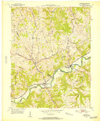
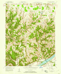
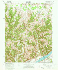
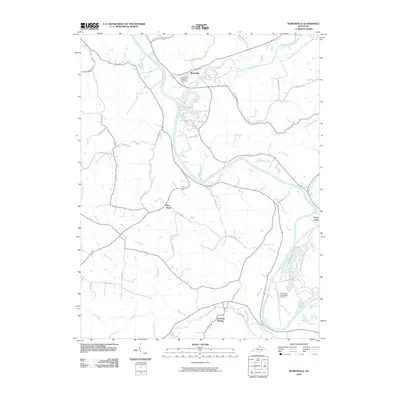
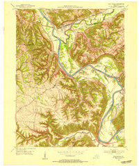 1952 Worthville1954 Print · USGSThe Kentucky River valley in the early 1950s shows a landscape of sharp ridges and deep creek bottoms at the junction of three counties. Genealogists can locate family-named landmarks like Emily Run and Gullion Run or the riverside community of Worthville.3 unique versions available
 - 1952 Map of Campbellsburg, 1954 Print
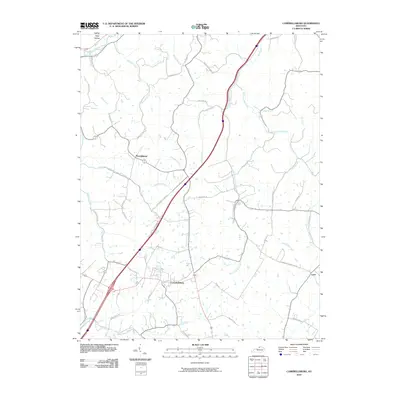
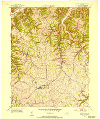 1952 Campbellsburg1954 Print · USGSThe Henry County highlands come alive in the early fifties, showing the interplay of rail and river near Campbellsburg. Genealogists can trace family footprints near Hopewell Ch or along the Louisville and Nashville line through Turners Station.
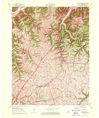
 - 1953 Map of Carrollton, 1954 Print
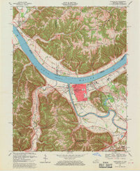
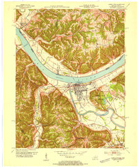 1953 Carrollton1954 Print · USGSThe confluence of the Ohio and Kentucky Rivers comes alive in the early 1950s, showing the riverside growth of Carrollton and Prestonville. Researchers can trace ancestral roots through sites like McKay Cemetery, Spring Branch Church, and River View School.2 unique versions available
 - 1953 Map of Madison East, 1955 Print
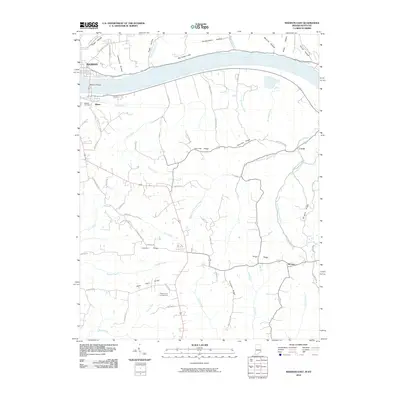
 1953 Madison East1955 Print · USGSThe Ohio River valley and the Kentucky uplands are captured in the early fifties, documenting a landscape of ridge-top farms and river towns. Genealogists can trace family connections through numerous rural landmarks like Mt Carmel Ch, Hunters Bottom, and Locust Sch.2 unique versions available
 - 1956 Map of Louisville, 1971 Print
 1956 Louisville1971 Print · USGSThe Ohio River valley and the Kentucky Bluegrass are captured here during a period of rapid mid-century growth and industrial activity. Genealogists and historians can trace rail-centered towns and military land use at Fort Knox and the Jefferson Proving Ground.2 unique versions available
 - 1957 Map of Vevay North, 1958 Print
 1957 Vevay North1958 Print · USGSThe Ohio River hills of Switzerland County come alive in the late 1950s, showing the intricate landscape of ridges and creek beds. Researchers can find old rural landmarks like Plum Creek Ch, the river town of Vevay, and the aptly named Popcorn Ridge.2 unique versions available
 - 1964 Map of Louisville
 1964 Louisville1964 Print · USGSThe Ohio River valley and Kentucky Bluegrass are captured in the mid-1960s, showing a region balanced between industrial growth and its agrarian roots. Genealogists and historians can trace the development of county seats like Shelbyville and Paris, or locate established institutions such as Georgetown College and Bernheim Forest.
 - 1967 Map of Vevay South, 1969 Print
 1967 Vevay South1969 Print · USGSThe Ohio River borderlands between Kentucky and Indiana are captured here in the late sixties, showcasing a landscape of riverside industry and steep ridges. Genealogists can trace family names and landmarks from the riverfronts of Vevay and Ghent to inland sites like Sharon Ch and Eagle Station.3 unique versions available
 - 1967 Map of Carrollton, 1970 Print
 1967 Carrollton1970 Print · USGSThe confluence of the Kentucky and Ohio Rivers defines this late 1960s landscape, where the bustling streets of Carrollton meet the river economy. Genealogists and historians can trace local landmarks like St Johns Sch, the IOOF Cem, and the rural Old Bethel Cem across the Indiana border.4 unique versions available
 - 1969 Map of Sanders, 1972 Print
 1969 Sanders1972 Print · USGSNorthern Kentucky at the end of the sixties is defined here by the winding Eagle Creek valley and the Louisville and Nashville railroad. Genealogists can trace family names and sites around Sanders, Sparta, and Bramlette Ch.2 unique versions available
 - 1969 Map of Campbellsburg, 1972 Print
 1969 Campbellsburg1972 Print · USGSHenry County is captured in the late sixties as a landscape of ridge-top farms and busy rail corridors. Genealogists and local historians can trace family-named routes like Monfort Lane or locate centers of community like Hopewell Ch and Turners Station.
 - 1971 Map of Madison East, 1973 Print
 1971 Madison East1973 Print · USGSThe Ohio River corridor at the Indiana-Kentucky border is shown here in the early seventies, featuring the riverfront hub of Madison. Researchers can trace old ridge-top settlements and rural landmarks like St Peters Ch, Monitor, and Mt Carmel Ch.4 unique versions available
 - 1971 Map of Vevay North, 1973 Print
 1971 Vevay North1973 Print · USGSThe river town of Vevay and its rural hinterlands are captured in the early 1970s, showcasing a landscape of ridge-top roads and winding creek valleys. Genealogists can trace family landmarks like Fredonia Ch, Popcorn Ridge, and the early layout of Mt Sterling.3 unique versions available
 - 1986 Map of Madison
 1986 Madison1986 Print · USGSSouthern Indiana and Northern Kentucky are shown here in the mid-eighties, centered on the river corridor and the sprawling Jefferson Proving Ground. Genealogists and historians can trace rail lines like the Seaboard System and locate river towns from Madison to Bethlehem.
 - 1986 Map of Falmouth
 1986 Falmouth1986 Print · USGSNorthern Kentucky and the Ohio River valley are shown here in the mid-1980s, highlighting the region's complex river-and-rail geography. Genealogists and researchers can trace the roads connecting Big Bone Lick, Zion Church, and river towns like Falmouth and Augusta.2 unique versions available
 - 1990 Map of Madison, 1991 Print
 1990 Madison1991 Print · USGSThe Ohio River valley and the southern Indiana plains are documented here in the final decade of the twentieth century. Genealogists and historians can trace family-named crossroads and established rail towns like Dudleytown, Austin, and Crothersville along the P C RR line.
 - 2010 Map of Worthville, 2010 Print
 2010 Worthville2010 Print · USGSCovers Carroll County, including Worthville, Drennon Springs, and other nearby areas
 - 2010 Map of Sanders, 2010 Print
 2010 Sanders2010 Print · USGSCovers Carroll County, including Sanders, Carson, and other nearby areas
 - 2010 Map of Campbellsburg, 2010 Print
 2010 Campbellsburg2010 Print · USGSCovers Carroll County, including Campbellsburg, Turners Station, and other nearby areas
 - 2010 Map of Madison East, 2010 Print
 2010 Madison East2010 Print · USGSCovers Carroll County, including Madison, Milton, and other nearby areas
Showing maps 1-25 of 56
Top cities of Carroll County
- Carrollton historical maps
- Ghent historical maps
- Sanders historical maps
- Worthville historical maps
- Prestonville historical maps
Frequently asked questions
- What are the different types of historical maps available for Carroll County?
- What is the oldest map of Carroll County?
- Where can I purchase historical maps of Carroll County for my home or office?
- Where can I download high-res historical maps of Carroll County?
- Are there historical topographic maps available for Carroll County?
- Is there historical aerial imagery available for Carroll County?
- Where are historical maps of Carroll County sourced from?