Old Maps of Carter County, Kentucky for Hiking & Exploration
Hike through history with 118 historic maps of Carter County. Explore old trails, ghost towns, and forgotten backroads — perfect for outdoor adventurers and local explorers.
- Rediscover forgotten places: Map out old mining camps, roads, and footpaths that no longer exist on modern maps.
- Layer with modern tools: Combine with LiDAR or satellite views to plan hikes through historical terrain.
- Made for exploration: Popular among hikers, overlanders, and local history lovers.
Use these maps to find adventure and explore the hidden past of Carter County.
Carter County, KY maps
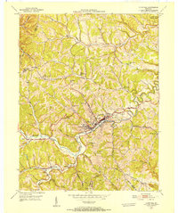
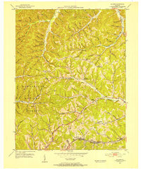
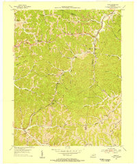
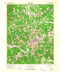
(118)- 1903 Map of Kenova
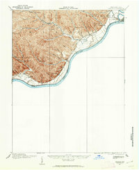
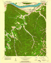
 1903 Kenova1903 Print · USGSThe tri-state river junction at Ashland and Kenova was a bustling industrial hub after the turn of the century. Trace early rail lines and mining settlements like Coalton and Boghead, or locate family landmarks along the Little Sandy River and Means Tunnel.5 unique versions available
 - 1904 Map of Kenova
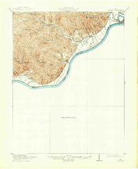
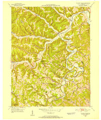
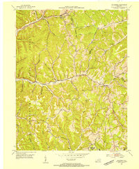
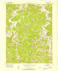
 1904 Kenova1904 Print · USGSThe tri-state confluence of the Ohio River and Big Sandy River hums with early industrial activity at the start of the century. Genealogists can trace rail-side settlements and remote homesteads along Blaine Creek and near Mt Savage or Webbville.
 - 1915 Map of Garrison, 1952 Print
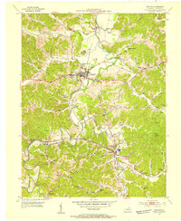
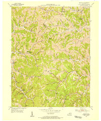
 1915 Garrison1952 Print · USGSThe riverfront and uplands of the Ohio Valley come alive in this mid-century publication of a Great War-era survey. Genealogists and local historians can trace the many rural schoolhouses like Elmtree School and Leatherwood School or find the early footprint of Portsmouth.
 - 1918 Map of Garrison, 1932 Print
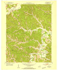
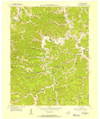
 1918 Garrison1932 Print · USGSThe river valley at the Ohio and Kentucky border was a landscape of small schools and isolated runs during the mid-1910s. Researchers can trace the placement of local institutions like the Scioto County Infirmary and rural schools including Pond Run School and Carey Run School.
 - 1929 Map of Morehead
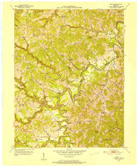
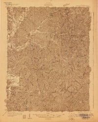 1929 Morehead1929 Print · USGSRowan and Morgan counties were centers of rail and clay production when this late-1920s survey was conducted. Local historians can locate early post offices like Elliottville PO (Hogtown) and trace the paths of the Chesapeake and Ohio through the Clack Mtn Tunnel.
 - 1935 Map of Morehead
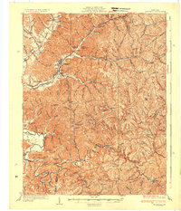 1935 Morehead1935 Print · USGSIn the mid-1930s, the mountain hollows around Morehead were connected by a dense network of country schools and the Chesapeake and Ohio railroad. Trace family sites at Blairs Mills PO, Zilpo, and the tunnels through Clack Mountain.
 - 1949 Map of Garrison, 1961 Print
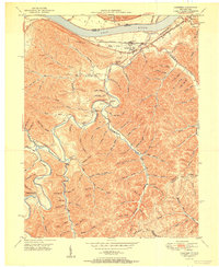
 1949 Garrison1961 Print · USGSThe Ohio River valley and the interior hollows of Lewis County are captured here just after the war. Genealogists can trace family landmarks like the Waring Cem, Red Brush Sch, and several rural churches along Kinniconick Creek.5 unique versions available
 - 1950 Map of Bruin, 1952 Print
 1950 Bruin1952 Print · USGSElliott and Carter counties in the early fifties show a landscape of deep hollows and winding creek-bottom settlements. Researchers can locate many family cemeteries and rural school sites such as Ibex Waddell Sch and Flannery Cem along the Little Sandy River.
 - 1950 Map of Grahn, 1952 Print
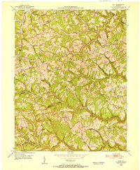
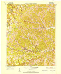 1950 Grahn1952 Print · USGSCarter County's rugged karst hills are captured here in the early fifties, showing a landscape defined by deep hollows and narrow creek bottoms. Researchers can trace the Chesapeake and Ohio rail line past the Aden Tunnel, find family roots at Littleton Cem, or locate the Clay Mines near Grahn.
 - 1950 Map of Wesleyville, 1952 Print
 1950 Wesleyville1952 Print · USGSNortheastern Kentucky hill country at the start of the fifties reveals a landscape of isolated hollows and tightly-knit rural communities. Genealogists and hikers can trace old family burial grounds like Jordan Cem or locate the historic Wesleyville Post Office and Smith Creek Sch.
 - 1950 Map of Olive Hill, 1952 Print
 1950 Olive Hill1952 Print · USGSMid-century Carter County comes alive in this survey of the Olive Hill area, where the river-and-rail economy of the Appalachians is on full display. Genealogists and historians can trace family-named ridges and hollows, locating old landmarks like Erie College, James Chapel, and the settlement of Soldier.
 - 1950 Map of Ault, 1952 Print
 1950 Ault1952 Print · USGSNortheastern Kentucky life in the early fifties revolves around winding creek-beds and ridge-top schools. Trace ancestral roots through localized landmarks like Gimlet (PO), Mocabee Ford, and the many rural schools including Rock Springs Sch and Bunker Hill Sch.
 - 1950 Map of Tygarts Valley, 1952 Print
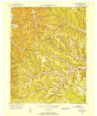
 1950 Tygarts Valley1952 Print · USGSNortheastern Kentucky’s rugged iron-making and coal-mining history is preserved here just as the mid-century landscape was maturing. Researchers can trace rural family roots at Wolf P O, Lower Grassy Ch, and the historic Charlotte Furnace site.
 - 1951 Map of Garrison
 1951 Garrison1951 Print · USGSThe riverfront and rugged hollows of Lewis County are captured here just after the war, when the railroad still dominated the shoreline. Genealogists can locate family-named sites like Skidmore Cemetery and Tannery School along the winding Kinniconick Creek.
 - 1951 Map of Soldier, 1952 Print
 1951 Soldier1952 Print · USGSEastern Kentucky hills at the start of the 1950s show a landscape shaped by narrow creek valleys and the Chesapeake and Ohio railroad. Researchers can locate remote rural landmarks like the Bald Point School, Masters Cem, and the village of Bedford.2 unique versions available
 - 1953 Map of Haldeman, 1954 Print
 1953 Haldeman1954 Print · USGSRowan County in the early 1950s is shown here as a landscape of rural schools and winding creek valleys. Researchers can trace the Chesapeake and Ohio rail line or locate community hubs like Haldeman, Elliottville, and the Oak Grove Ch.2 unique versions available
 - 1953 Map of Grayson, 1954 Print
 1953 Grayson1954 Print · USGSGrayson and the Little Sandy River valley are captured in the early 1950s, showing a rural landscape shaped by the rail and clay industries. Researchers can locate many family landmarks, such as Savage Memorial Ch, the Fire Clay Pit, and Pactolus.2 unique versions available
 - 1953 Map of Oldtown, 1954 Print
 1953 Oldtown1954 Print · USGSSettled along the river and creek valleys of Greenup and Carter counties in the early fifties, this area shows a landscape of small farms and emerging energy extraction. Genealogists can locate family landmarks such as the Warnock Cem, Salem Ch, and several rural schoolhouses like Lost Creek Sch.3 unique versions available
 - 1953 Map of Rush, 1955 Print
 1953 Rush1955 Print · USGSEastern Kentucky's coal and gas country comes into focus during the early fifties along the Chesapeake and Ohio line. Genealogists can locate family landmarks such as Gravel Lick Cemetery and Geigersville School among the active Strip Mines.2 unique versions available
 - 1953 Map of Argillite, 1955 Print
 1953 Argillite1955 Print · USGSGreenup and Boyd County during the early fifties show a rural landscape transitioning between the old iron furnace era and modern coal mining. Genealogists can trace family landmarks like Reeves Cem and Howard Cem alongside numerous country schools such as Palmyra Sch and Montgomery Sch.
 - 1953 Map of Webbville, 1955 Print
 1953 Webbville1955 Print · USGSLawrence County saw a landscape of remote hollows and narrow creek-side settlements in the early fifties. Genealogists and historians can trace family locations through named sites like Pollys Chapel, Hammond Cem, and the Old Kentucky Home Sch.3 unique versions available
 - 1953 Map of Willard, 1955 Print
 1953 Willard1955 Print · USGSThe hill country of Carter and Lawrence counties is captured here in the early fifties as small mining and farming communities lined the Little Sandy River. Local researchers can locate family landmarks like Kitchen Cem, several rural schoolhouses, and industrial sites such as E K Mines Br.2 unique versions available
 - 1957 Map of Huntington, 1966 Print
 1957 Huntington1966 Print · USGSThe industrial heart of the Ohio River valley is captured here in the mid-sixties, showing the growth of Huntington and Ashland. Researchers can trace the extensive rail networks of the Chesapeake and Ohio RR and locate sites like the Chief Cornstalk Hunting Ground.3 unique versions available
 - 1960 Map of Huntington
 1960 Huntington1960 Print · USGSThe tri-state river valley thrived in the late fifties as a hub of heavy industry and Appalachian rail transit. Genealogists and historians can trace the connection between river towns like Ashland and Portsmouth or locate family homesteads near Coleman Ridge.
 - 1962 Map of Olive Hill, 1964 Print
 1962 Olive Hill1964 Print · USGSOlive Hill and the surrounding rural hollows of Carter County are shown in detail during the early 1960s. Researchers can trace the path of the Chesapeake and Ohio railroad through old communities like Lawton and Globe.
Showing maps 1-25 of 118
Top cities of Carter County
Frequently asked questions
- What are the different types of historical maps available for Carter County?
- What is the oldest map of Carter County?
- Where can I purchase historical maps of Carter County for my home or office?
- Where can I download high-res historical maps of Carter County?
- Are there historical topographic maps available for Carter County?
- Is there historical aerial imagery available for Carter County?
- Where are historical maps of Carter County sourced from?