
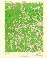
1953 Map of Haldeman
USGS Topo · Published 1954About this map
The Chesapeake and Ohio railroad corridor anchors the northern edge of this Rowan County survey, where industry and transportation followed the winding path of Triplett Creek. The settlement at Haldeman and nearby Hays Crossing serve as focal points for a landscape defined by sharp ridges and narrow stream valleys. Much of the southwestern portion of the sheet is managed within the Cumberland National Forest, while the eastern reaches include the village of Elliottville.
Find a feature on this map
60 named features on this map. Tap any name to fly to it.
Don’t see what you’re looking for? This feature index may not catch every label — zoom into the map to look around manually.
Map Details
Editions of this 1953 Haldeman Map
2 editions found
Other maps of this area

1929 · Morehead
USGS Topo · 1:48,000

1935 · Morehead
USGS Topo · 1:62,500

1950 · Olive Hill
USGS Topo · 1:24,000

1950 · Ault
USGS Topo · 1:24,000

1950 · Sandy Hook
USGS Topo · 1:24,000

1951 · Soldier
USGS Topo · 1:24,000

1951 · Cranston
USGS Topo · 1:24,000

1953 · Bangor
USGS Topo · 1:24,000
1953 · Wrigley
USGS Topo · 1:24,000
1953 · Morehead
USGS Topo · 1:24,000