2020s Maps of Christian County, Kentucky
Explore 20 historic maps of Christian County from the 2020s. These maps offer a rare glimpse into what life looked like during the 2020s — showing old roads, neighborhoods, homes, and landmarks that have changed or disappeared over time.
Whether you're researching your family's past, planning a metal detecting trip, or studying how Christian County's landscape evolved across the 2020s, these high-resolution maps are a powerful tool for exploring the history of this region.
- Focus on a specific era: All maps on this page are from the 2020s, giving you a focused view of this time period.
- See what’s changed: Compare century-old streets, trails, and buildings to today's modern landscape using overlays and satellite layers.
- Research with precision: Use these maps for genealogy, historical research, land use analysis, or educational projects.
- View, download, or print: Maps are fully viewable online in high resolution, and can be downloaded or printed for your own records.
Start exploring Christian County's history through authentic maps from the 2020s. This is your window into the past.
Christian County, KY maps
(20)- 2022 Map of Gracey, 2022 Print
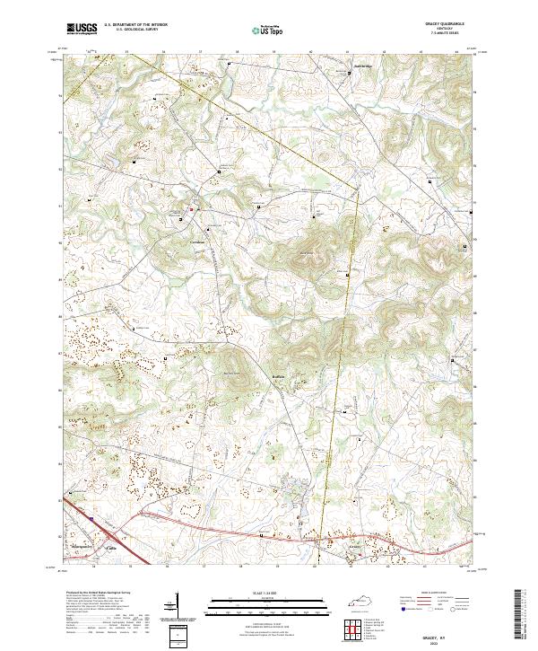 2022 Gracey2022 Print · USGSThe crossroads of Christian and Trigg Counties come into focus in this recent survey of Western Kentucky's farming country. Family historians can trace numerous rural burial sites like Bainbridge Grove Cem and Childress Cem near the banks of Horse Cr.
 - 2022 Map of Oak Grove, 2022 Print
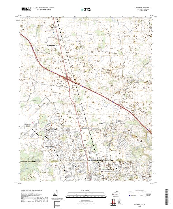 2022 Oak Grove2022 Print · USGSThe border between Kentucky and Tennessee meets at the edge of Fort Campbell in this contemporary look at the region. Researchers can trace military landmarks like Campbell Army Airfield alongside family sites like the Elliott Family Cem and Gee Cem.
 - 2022 Map of Church Hill, 2022 Print
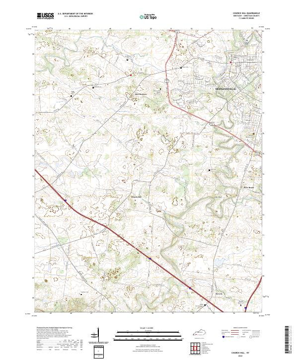 2022 Church Hill2022 Print · USGSChristian County's rolling farmland and river forks come alive in this recent survey of the Kentucky countryside. Genealogists can trace family heritage at Gordonsville Baptist Church Cem, McComb Cem, and the small community of Merrittstown.
 - 2022 Map of Herndon, 2022 Print
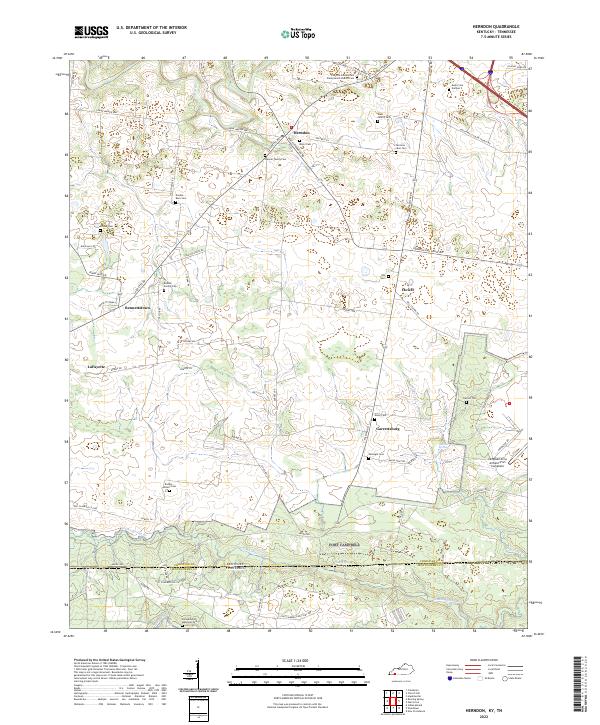 2022 Herndon2022 Print · USGSChristian County, Kentucky, and Montgomery County, Tennessee, meet here in this modern survey of the rural borderlands. Genealogists and local historians can locate numerous family burial grounds like Double Barn Cem and Dixon Cem, or trace the boundary of the Fort Campbell Military Res.
 - 2022 Map of Roaring Spring, 2022 Print
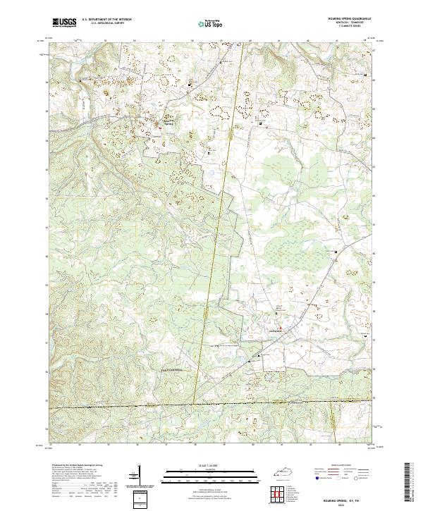 2022 Roaring Spring2022 Print · USGSNear the Kentucky-Tennessee border, this modern topographic survey captures the crossroads communities of Roaring Spring and LaFayette. Researchers can locate numerous family burial sites like John Roach Cem and Joiner Cem along the banks of Casey Cr.
 - 2022 Map of Pembroke, 2022 Print
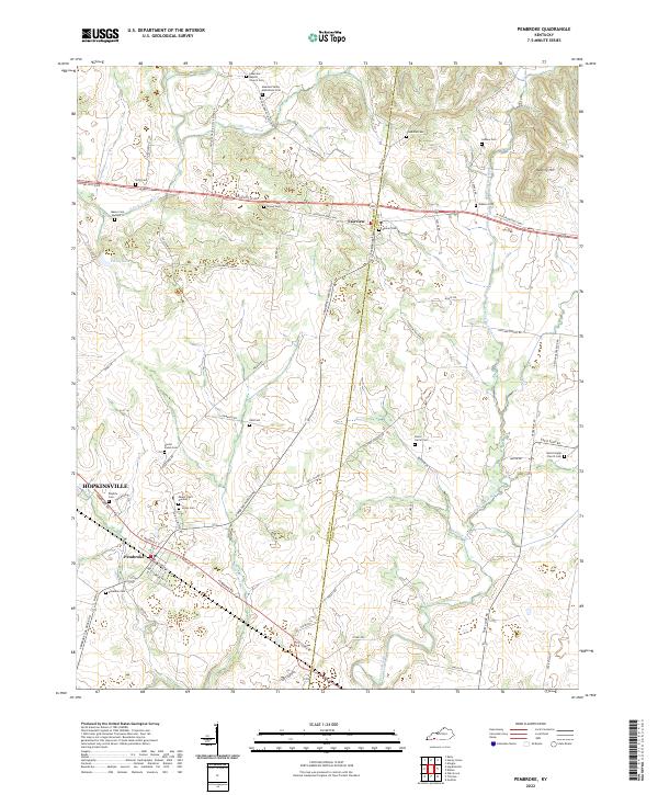 2022 Pembroke2022 Print · USGSSouthern Kentucky farmland and rural crossroads come into focus in this recent study of the Christian and Todd County line. Genealogists can trace decades of family history through numerous burial sites like Austin Cason Cem, Brown Cem, and Rosedale Cem.
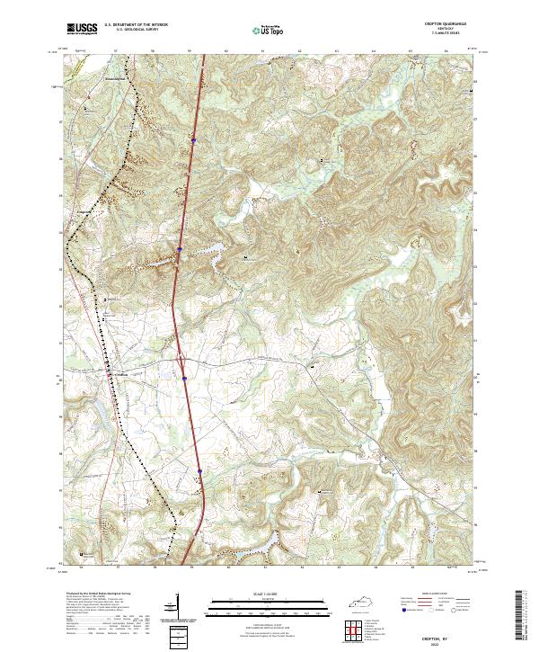
 - 2022 Map of Dawson Springs SE, 2022 Print
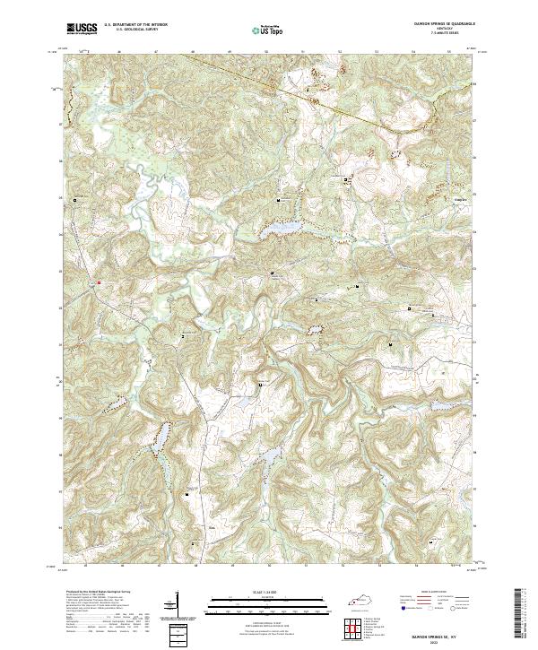 2022 Dawson Springs SE2022 Print · USGSChristian and Hopkins counties are depicted here in the early 2020s, showing a landscape defined by the Tradewater River and rural outposts. Genealogists can trace family lines through numerous burial sites like Crofton Amish Cem and McKnight Cem.
 - 2022 Map of Dawson Springs SW, 2022 Print
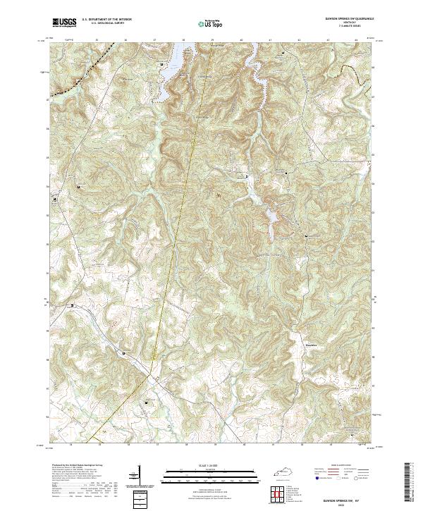 2022 Dawson Springs SW2022 Print · USGSChristian and Caldwell counties are shown here in the early 2020s, centered on the wooded ridges and the waters of Lake Beshear. Researchers can locate numerous family-named landmarks and burial sites like Rogers Cem, Irvin Cem, and Newsom Cem.
 - 2022 Map of Saint Charles, 2022 Print
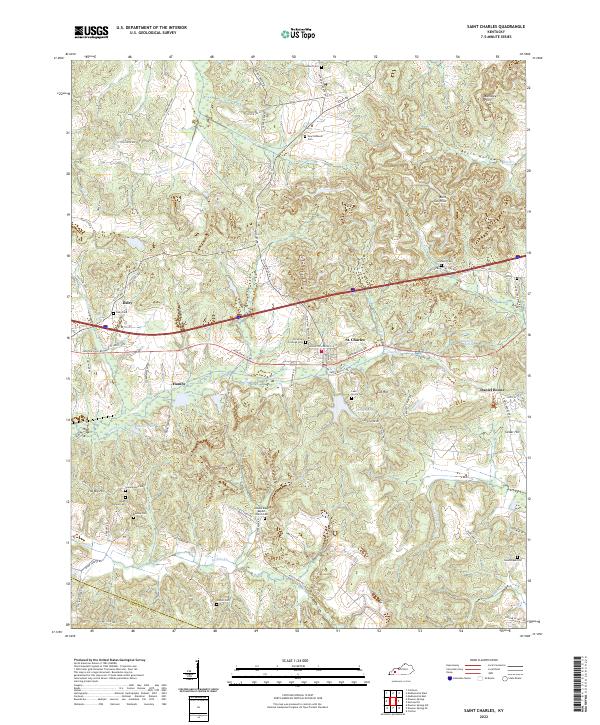 2022 Saint Charles2022 Print · USGSSettlement and industry intersect in this corner of Kentucky, where the legacy of coal mining remains visible in the landscape. Genealogists can trace family roots at New Suthards Cem, Union Temple Ch, and the small community of Ilsley.
 - 2022 Map of Haleys Mill, 2022 Print
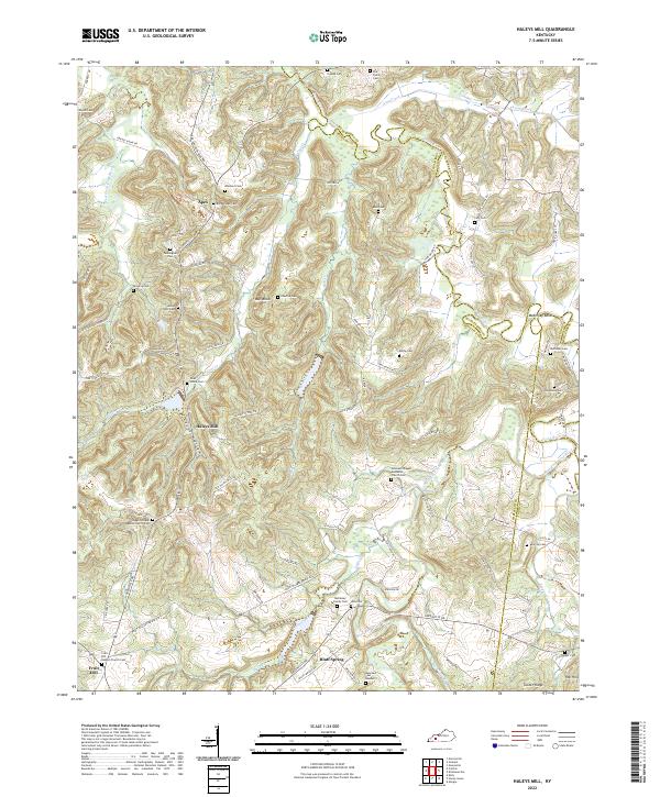 2022 Haleys Mill2022 Print · USGSChristian County's rural heartland is meticulously documented in this recent survey of the region's cemeteries and waterways. Genealogists and local historians can trace family ties at Lite Family Cemetery, Hale Cemetery, and Johnsons Chapel Methodist Church Cemetery.
 - 2022 Map of Pleasant Green Hill, 2022 Print
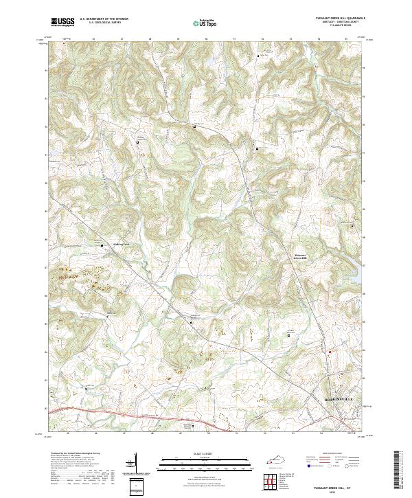 2022 Pleasant Green Hill2022 Print · USGSThe rural uplands and creek valleys of Christian County are captured here in the early twenty-first century, just as the urban reach of Hopkinsville extends northward. Genealogists can locate several family burial sites including the Langhi Family Cem, Moore Cem, and Dick Boyd Cem.
 - 2022 Map of Trenton, 2022 Print
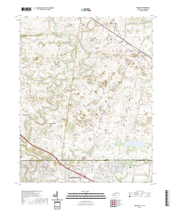 2022 Trenton2022 Print · USGSThe Kentucky and Tennessee borderlands come alive in this detailed look at rural life and crossroads settlements. Genealogists can trace family lines through numerous sites like Edgewood Cem, Barkers Mill, and Mount Zion Missionary Baptist Church.
 - 2022 Map of Kelly, 2022 Print
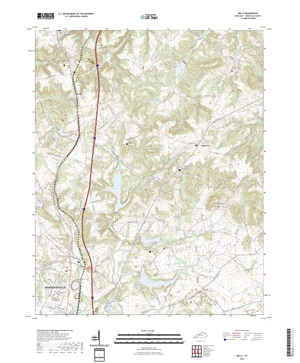 2022 Kelly2022 Print · USGSChristian County's rural northern fringes and the edge of Hopkinsville are captured here in the early twenty-first century. Genealogists can locate family landmarks such as the Bobbitt Family Cemetery, Martha Boyd Cemetery, and the community at Dogwood.
 - 2022 Map of Honey Grove, 2022 Print
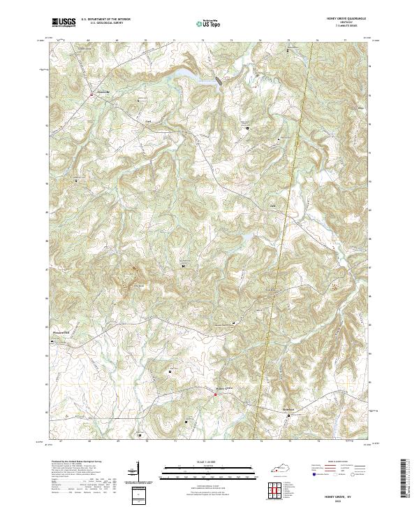 2022 Honey Grove2022 Print · USGSThe rural border of Christian and Todd Counties is captured here in the 2020s. Genealogists can trace family names across a dozen sites, including O'Daniel Cem, Hayes Cem, and the community at Britmart.
 - 2022 Map of Caledonia, 2022 Print
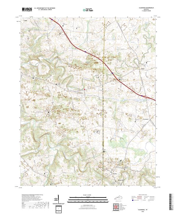 2022 Caledonia2022 Print · USGSThe rolling lands along the Trigg and Christian County border appear here in fine detail, showing a landscape defined by the Little River and Sinking Fork. Researchers can locate numerous family burial sites and rural centers like Caledonia, Peedee, and the Old Presbyterian Cem.
 - 2022 Map of Hopkinsville, 2022 Print
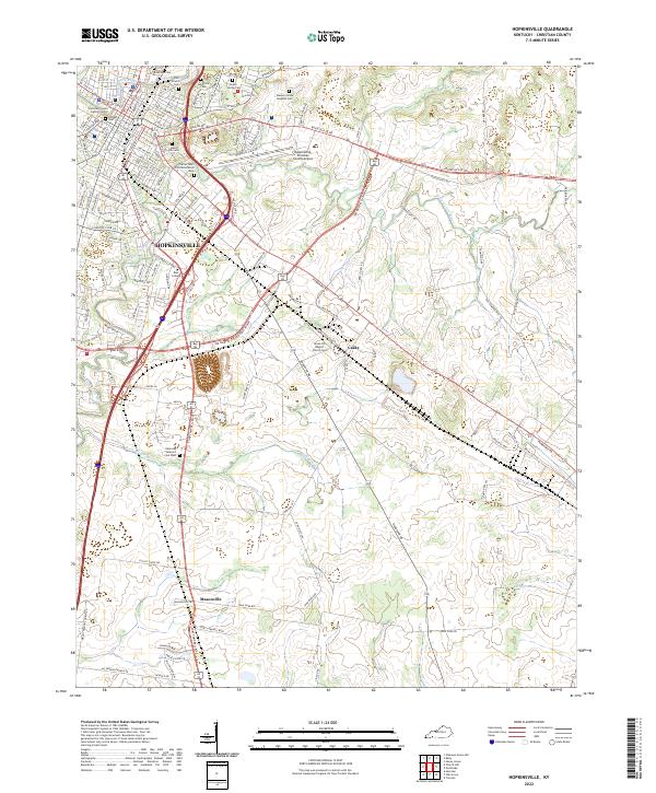 2022 Hopkinsville2022 Print · USGSHopkinsville and southern Christian County are shown in the early 2020s as the city expands along the forks of the Little River. Genealogists and historians can locate numerous cemeteries including Riverside Cem and the Kentucky Veteran's Cem West, or trace the grounds of the Trail of Tears Commemorative Park.
 - 2022 Map of Crofton, 2022 Print
 2022 Crofton2022 Print · USGSNorthern Christian County and the border of Hopkins County appear here in the early 2020s. Genealogists can trace family landmarks across numerous sites like Petersburg Cem, Macedonia Church Cem, and the waters of McFarland Cr.
 - 2022 Map of Nortonville, 2022 Print
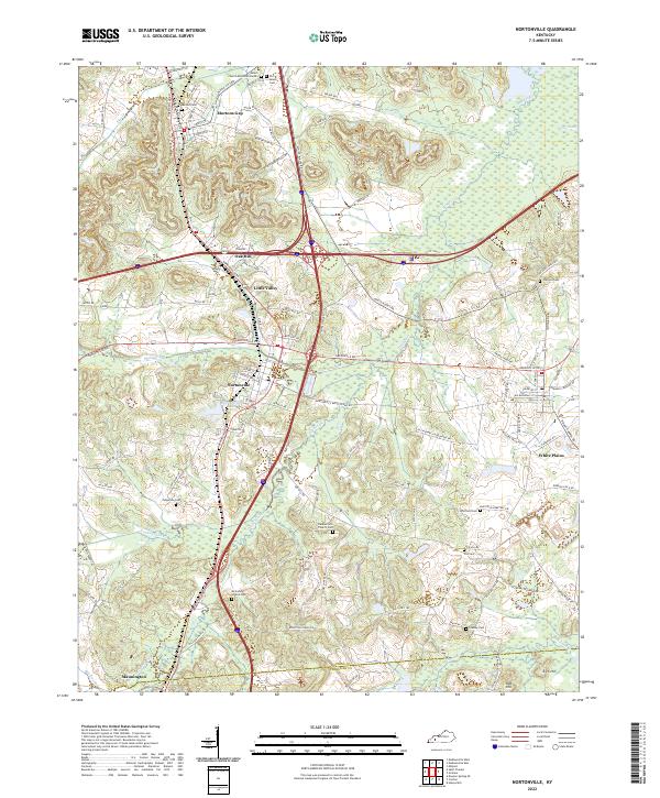 2022 Nortonville2022 Print · USGSThe intersection of modern highways and old county roads in southwestern Kentucky reveals a landscape of enduring rural communities. Genealogists can trace family names through numerous burial sites like Morton Cem and Fox Cem, or locate homesteads near Mortons Gap and White Plains.
 - 2022 Map of Dawson Springs, 2022 Print
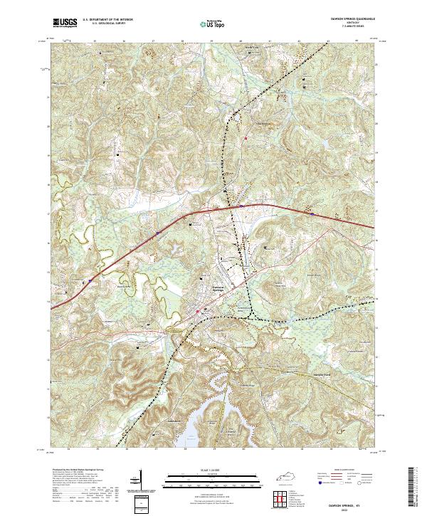 2022 Dawson Springs2022 Print · USGSDawson Springs and the surrounding river valleys are captured here in the early twenty-first century as the region manages its complex water and rail networks. Genealogists can locate numerous family burial sites like Walnut Grove Cem and Piney Grove Cem near the shores of Lake Beshear.
 - 2022 Map of Graham, 2022 Print
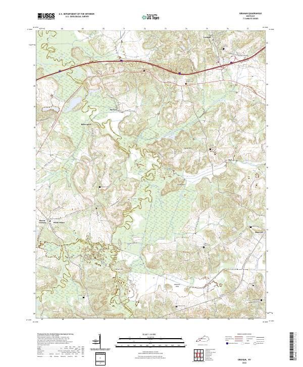 2022 Graham2022 Print · USGSWestern Kentucky's rural landscape is captured here at the junction of three counties, where river bottomlands meet established uplands. You can trace family roots at Graham Hill Cem or explore the geography around McNary, Bakersport, and the Pond River.
End of results
Showing maps 1-20 of 20
Top cities of Christian County
- Hopkinsville historical maps
- Oak Grove historical maps
- Crofton historical maps
- Pembroke historical maps
- LaFayette historical maps
Frequently asked questions
- What are the different types of historical maps available for Christian County?
- What is the oldest map of Christian County?
- Where can I purchase historical maps of Christian County for my home or office?
- Where can I download high-res historical maps of Christian County?
- Are there historical topographic maps available for Christian County?
- Is there historical aerial imagery available for Christian County?
- Where are historical maps of Christian County sourced from?