Old Maps of Christian County, Kentucky for Academic Research
Study the evolution of Christian County with 158 high-resolution historic maps. Whether you're teaching, researching, or modeling changes in land use, these maps provide essential visual documentation of urban, environmental, and geographic change.
- Analyze long-term change: Track patterns in development, transportation, and natural features.
- Ideal for environmental or urban studies: Support academic projects with primary historical map data.
- Use in the classroom or lab: Educators and researchers rely on these maps to bring historical context to life.
These maps are a powerful tool for teaching, research, and visualizing how Christian County has changed over the decades.
Christian County, KY maps
(158)- 1909 Map of Dawson Springs
 1909 Dawson Springs1909 Print · USGSWestern Kentucky at the peak of its rail-and-river era shows a landscape dotted with country schools and small depots. Genealogists can trace family roots through numerous landmarks like Hamby Sta, Pooles Mill Bridge, and Cross Roads Church.
 - 1911 Map of Dawson Springs
 1911 Dawson Springs1911 Print · USGSWestern Kentucky’s coal and rail corridors are captured here just after the turn of the century. Genealogists can trace family footprints through dozens of rural sites like the Daniel Boone School, Franklin's Store, and the Fox Run Mine.2 unique versions available
 - 1912 Map of Nortonville
 1912 Nortonville1912 Print · USGSWestern Kentucky at the start of the decade is defined here by its busy rail junctions and rural merchant economy. Genealogists and historians can trace family roots through numerous country schools and stores, including Clement School, Jordons Store, and Greens Chapel.3 unique versions available
 - 1944 Map of Clarksville, 1946 Print
 1944 Clarksville1946 Print · USGSThe Kentucky-Tennessee border during the mid-forties shows a landscape transformed by the massive expansion of Camp Campbell. Researchers can trace the early layout of the base and its Small Arms Ranges alongside historic sites like Dunbar Cave and the Sunnyside Church.
 - 1950 Map of Caledonia, 1965 Print
 1950 Caledonia1965 Print · USGSTrigg and Christian Counties are captured in the mid-twentieth century as a landscape of rural schoolhouses, family cemeteries, and karst springs. Researchers can trace the heritage of Caledonia and Julien through landmarks like Binns Mill, Averitt Sch, and Locust Grove Ch.
 - 1950 Map of Pembroke, 1968 Print
 1950 Pembroke1968 Print · USGSAgricultural Christian County comes alive in this mid-century portrait, showing the area as it transitioned from rail-focused trade to highway travel. Genealogists can trace family lines through numerous sites like Rosedale Cem, Barnetts Chapel, and the County Home.2 unique versions available
 - 1951 Map of Pembroke
 1951 Pembroke1951 Print · USGSChristian and Todd counties are shown here in the early fifties, where the railroad and highway networks intersect. Genealogists can trace family names and rural landmarks like Rosedale Cem, Barnetts Chapel, and the Jefferson Davis State Park monument.2 unique versions available
 - 1951 Map of Church Hill
 1951 Church Hill1951 Print · USGSChristian County farmland south of Hopkinsville is captured here in the early fifties, showing a rural landscape tied together by country roads and the Little River. Genealogists can locate family landmarks like the Mcclain Chapel, Hebron Ch, and Walnut Grove Sch.
 - 1951 Map of Caledonia
 1951 Caledonia1951 Print · USGSThe rural borderlands of Trigg and Christian counties are documented here in the early fifties, showing a landscape of sinkhole springs and small crossroads. Genealogists can locate family landmarks like Binns Mill, Locust Grove Ch, and the Old Presbyterian Cem.
 - 1951 Map of Hopkinsville
 1951 Hopkinsville1951 Print · USGSChristian County at mid-century was a bustling rail junction centered on the growth of Hopkinsville. Genealogists and historians can trace the foundations of the community through landmarks like Riverside Cem, Bethel College, and the sprawling Western State Hospital.
 - 1951 Map of Roaring Spring, 1953 Print
 1951 Roaring Spring1953 Print · USGSThe Kentucky and Tennessee borderlands appear in the early fifties as the military presence transformed the landscape. Trace rural roots at Corinth Ch or find former homesites now marked as ruins inside the Fort Campbell Military Reservation.
 - 1951 Map of Hammacksville, 1953 Print
 1951 Hammacksville1953 Print · USGSThe Kentucky-Tennessee borderlands in the early fifties show a landscape of winding river bends and railroad-aligned settlements. Genealogists can trace family roots through numerous local landmarks, from Rosenwald Sch to the rural Barkers Mill community.
 - 1951 Map of Herndon, 1953 Print
 1951 Herndon1953 Print · USGSThe Kentucky and Tennessee borderlands are captured here in the early fifties during the expansion of the Fort Campbell Military Reservation. Local historians can trace old homesteads and landmarks like Flat Lick Ch, Bennettstown, and South Christian Sch.
 - 1951 Map of Oak Grove, 1953 Print
 1951 Oak Grove1953 Print · USGSThe Kentucky and Tennessee borderlands are captured here in the early fifties as military expansion meets rural life. Researchers can trace the development of Fort Campbell alongside old community hubs like Fidelio, St Elmo, and the Tennessee Central Railroad.
 - 1952 Map of Pleasant Green Hill, 1953 Print
 1952 Pleasant Green Hill1953 Print · USGSChristian County at the dawn of the fifties reveals a landscape defined by a network of rural churches and family cemeteries. Genealogists can trace local heritage through sites like Harmony Grove Ch, Fuller Cem, and the old Mt Zoar Sch.
 - 1952 Map of Kelly, 1953 Print
 1952 Kelly1953 Print · USGSChristian County's rural landscape is captured here in the early fifties as the Louisville and Nashville railroad serviced local communities like Kelly. Genealogists can trace family roots through several small burial grounds and churches, including Boyd Cem and Wolf Chapel.
 - 1952 Map of Honey Grove, 1953 Print
 1952 Honey Grove1953 Print · USGSChristian and Todd counties at the start of the fifties show a landscape of small farming communities and family-named landmarks. Genealogists can trace family roots at O'Daniel Cem or locate vanished local schools like Lacy Sch and Flat Rock Sch.3 unique versions available
 - 1952 Map of Crofton, 1954 Print
 1952 Crofton1954 Print · USGSCrofton and the northern Christian County borderlands are captured here in the early fifties, where the railroad and coal industry shaped the landscape. Genealogists can locate numerous family burial sites and rural landmarks like Old Petersburg Ch, Orange Grove Sch, and Monk-Radliff Cem.
 - 1953 Map of Dawson Springs SE
 1953 Dawson Springs SE1953 Print · USGSNorthwestern Christian County comes to life in this early 1950s survey, showing a landscape of small settlements and emerging coal mines. Genealogists and local historians can trace family roots through landmarks like Bethel Ch, Consolation Sch, and the Ladd Cem.2 unique versions available
 - 1953 Map of Haleys Mill, 1954 Print
 1953 Haleys Mill1954 Print · USGSNorthwestern Christian County in the early fifties is captured here as a network of creek-side settlements and family homesteads. Genealogists can locate numerous burial grounds and rural congregations like Prowse Cem, Haleys Mill, and Judge Chapel.2 unique versions available
 - 1953 Map of Nortonville, 1954 Print
 1953 Nortonville1954 Print · USGSThe rail and mining landscape of Hopkins County is on full display in the early 1950s, showing a region defined by its industrial resources. Genealogists can trace family heritage through sites like Old Salem Ch and Whitfield Cem or the rural settlement of White Plains.
 - 1953 Map of Gracey, 1954 Print
 1953 Gracey1954 Print · USGSChristian and Trigg counties appear here in the early fifties, during a period of steady rail-side growth and established farm life. Genealogists and historians can trace family roots through sites like Cerulean Springs, Montgomery Ch, and Roach Cem.
 - 1953 Map of Dawson Springs SW, 1954 Print
 1953 Dawson Springs SW1954 Print · USGSMid-century Christian and Caldwell Counties are seen here during a period of rural stability, centered on the wooded expanse of the Pennyrile State Forest. Family historians can trace ancestral roots through several small churches and cemeteries, including Woods Chapel, Vanhooser Cem, and the settlement at Hawkins.
 - 1953 Map of Graham, 1954 Print
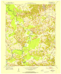 1953 Graham1954 Print · USGSWestern Kentucky coal country and river bottomlands come alive in the early fifties, documenting the landscape of the Pond River forks. Genealogists and historians can trace community roots through numerous landmarks like Yeargins Chapel, Mt Carmel, and the Illinois Central rail line.
 - 1954 Map of Evansville
 1954 Evansville1954 Print · USGSThe Ohio River borderlands between Indiana and Kentucky appear here during a period of robust industrial and military growth. Genealogists and researchers can trace the rail corridors of the Illinois Central and find landmarks like US Lock and Dam No 48 or Camp Breckinridge.
Showing maps 1-25 of 158
Top cities of Christian County
- Hopkinsville historical maps
- Oak Grove historical maps
- Crofton historical maps
- Pembroke historical maps
- LaFayette historical maps
Frequently asked questions
- What are the different types of historical maps available for Christian County?
- What is the oldest map of Christian County?
- Where can I purchase historical maps of Christian County for my home or office?
- Where can I download high-res historical maps of Christian County?
- Are there historical topographic maps available for Christian County?
- Is there historical aerial imagery available for Christian County?
- Where are historical maps of Christian County sourced from?