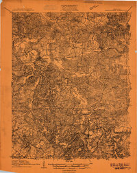
1909 Map of Dawson Springs
USGS Topo · Published 1909About this map
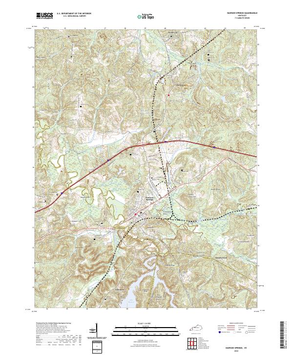
Dawson Springs serves as the central hub of this 1909 topographical study, positioned where the Illinois Central railroad crosses the winding Tradewater River. The landscape is defined by its rural density, marked by a high concentration of community institutions such as St Johns Church and the Union Grove School, reflecting a period of active local development at the junctions of Hopkins, Caldwell, and Christian counties.
Find a feature on this map
37 named features on this map. Tap any name to fly to it.
Don’t see what you’re looking for? This feature index may not catch every label — zoom into the map to look around manually.
Map Details
Editions of this 1909 Dawson Springs Map
This is the sole edition of this map. No revisions or reprints were ever made.
Historical Maps of Dawson Springs Through Time
9 maps found
1909 Dawson Springs
Hopkins County, KY
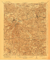
1911 Dawson Springs
Hopkins County, KY
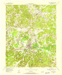
1954 Dawson Springs
Hopkins County, KY
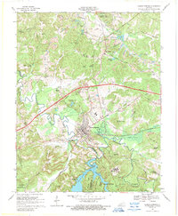
1968 Dawson Springs
Hopkins County, KY

2010 Dawson Springs
Hopkins County, KY

2013 Dawson Springs
Hopkins County, KY

2016 Dawson Springs
Hopkins County, KY

2019 Dawson Springs
Hopkins County, KY
2022 Dawson Springs
Hopkins County, KY