
1909 Map of Earlington
USGS Topo · Published 1909About this map
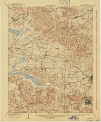
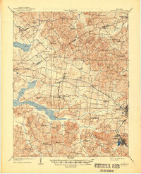
Earlington and Madisonville anchor the eastern landscape of this Western Kentucky survey, where the rail-driven economy of the early 20th century is clearly defined by the Louisville and Nashville RR and the Illinois Central RR. The terrain is deeply dissected by a dense network of waterways including Clear Creek and Pond Creek, with small agrarian communities like Coiltown, Circle City, and Slaughtersville scattered among the ridges. Genealogists will find a high density of rural institutions, such as Burnt Mill Church, Silent Run PO, and Oakland Store, which served the outlying farmstead populations.
Find a feature on this map
71 named features on this map. Tap any name to fly to it.
Don’t see what you’re looking for? This feature index may not catch every label — zoom into the map to look around manually.
Map Details
Editions of this 1909 Earlington Map
3 editions found
Other maps of this area

1906 · Sebree
USGS Topo · 1:62,500

1907 · Earlington
USGS Topo · 1:48,000

1907 · Morganfield
USGS Topo · 1:62,500

1908 · Calhoun
USGS Topo · 1:62,500

1908 · Princeton
USGS Topo · 1:62,500

1909 · Dawson Springs
USGS Topo · 1:48,000

1909 · Madisonville
USGS Topo · 1:62,500

1909 · Providence
USGS Topo · 1:62,500

1910 · Princeton
USGS Topo · 1:62,500

1911 · Dawson Springs
USGS Topo · 1:62,500