Loading...
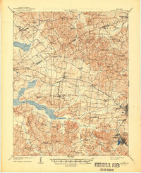
Loading map...1909 Map of Earlington
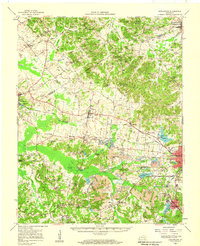
USGS Topo · Published 1949About this map
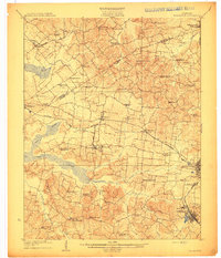
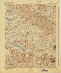
Earlington and Madisonville anchor this 1907 survey of Hopkins and Webster Counties, revealing a landscape defined by its turn-of-the-century rail networks and rural community centers. The Louisville and Nashville RR and the Illinois Central RR cut through the region, facilitating the growth of settlements like Hecla, Victoria, and the uniquely named Circle City. Beyond the towns, the map is remarkably dense with specific local landmarks, including Gaddis Store and dozens of country schools such as Fiddlebow School and Yadkin School.
Find a feature on this map
63 named features on this map. Tap any name to fly to it.
Don’t see what you’re looking for? This feature index may not catch every label — zoom into the map to look around manually.
Map Details
Date Portrayed1909
Date Published1949
PublisherU.S. Geological Survey
Map TypeTopographic
Scale1:62,500
Physical Dimensions17.1 x 21 inches
Editions of this 1909 Earlington Map
3 editions found
Historical Maps of Madisonville Through Time
3 maps found

Featured Locations
Source Details
SourceU.S. Geological Survey
CopyrightPublic Domain