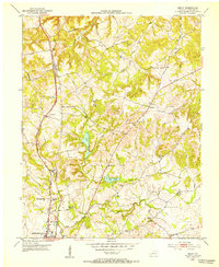
1952 Map of Kelly
USGS Topo · Published 1953About this map
The Louisville and Nashville railroad forms a primary north-south spine through this section of Christian County, anchoring the community of Kelly and connecting the northern reaches to the edge of Hopkinsville. This early 1950s landscape is defined by the headwaters of several regional drainage systems, including the Tradewater River and the West Fork Pond River, which wind through a mosaic of farmsteads and small country crossroads. Local social life is evidenced by numerous landmarks such as New Zion Ch, Antioch Ch, and Wolf Chapel.
Find a feature on this map
35 named features on this map. Tap any name to fly to it.
Don’t see what you’re looking for? This feature index may not catch every label — zoom into the map to look around manually.
Map Details
Editions of this 1952 Kelly Map
This is the sole edition of this map. No revisions or reprints were ever made.
Other maps of this area
1909 · Dawson Springs
USGS Topo · 1:48,000
1911 · Dawson Springs
USGS Topo · 1:62,500
1912 · Nortonville
USGS Topo · 1:62,500
1950 · Pembroke
USGS Topo · 1:24,000
1951 · Pembroke
USGS Topo · 1:24,000
1951 · Church Hill
USGS Topo · 1:24,000
1951 · Hopkinsville
USGS Topo · 1:24,000
1952 · Pleasant Green Hill
USGS Topo · 1:24,000
1952 · Honey Grove
USGS Topo · 1:24,000
1952 · Crofton
USGS Topo · 1:24,000