Old Maps of Welco Station, Kentucky for Genealogy
Trace your family roots with 14 historic maps of Welco Station. These high-res maps reveal old neighborhoods, homesites, landmarks, and streets — helping you uncover where your ancestors lived and how the area evolved over time.
- Explore historic neighborhoods: Identify where your relatives may have lived in the 1800s or 1900s.
- Compare maps over time: Trace the changes in streets, buildings, and landmarks for multi-generational research.
- Perfect for genealogy & ancestry research: Used by family historians and researchers to map out lineage and migration.
These maps are an incredible resource for exploring your personal connection to Welco Station's past.
Welco Station, KY maps
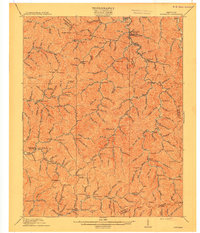
(14)- 1890 Map of Whitesburg
 1890 Whitesburg1890 Print · USGSThe Cumberland Plateau in the 1880s is a world of deep hollows and isolated mountain settlements. Genealogists can trace family roots in early communities like Whitesburgh and Pikeville or locate crossings at Pound Gap and Shelby Gap.
 - 1892 Map of Whitesburg
 1892 Whitesburg1892 Print · USGSEastern Kentucky and the Virginia borderlands appear here in the late nineteenth century as a landscape of isolated mountain hollows. Genealogists and historians can trace early family settlements along Kingdom Come Creek, Beef Hide, and the strategic passage at Pound Gap.4 unique versions available
 - 1912 Map of Hindman
 1912 Hindman1912 Print · USGSThe Kentucky hills around Hindman appear in remarkable detail during the early twentieth century, showing a landscape defined by isolated hollows. Genealogists can trace early homesteads and communities like Elmrock, Kite, and Democrat, as well as numerous numbered schoolhouses along Troublesome Creek.
 - 1915 Map of Hindman
 1915 Hindman1915 Print · USGSEastern Kentucky's high ridges and deep hollows are captured here during the mid-1910s, showing a landscape defined by isolated farmsteads and rural school districts. Genealogists can trace family footprints near Hindman or locate small settlements like Handshoe, Iris, and the WC TU School.4 unique versions available
 - 1954 Map of Wayland, 1956 Print
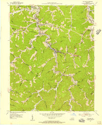 1954 Wayland1956 Print · USGSThe coal and rail valleys of Floyd and Knott Counties are shown here during the mid-1950s, a period of heavy industrial and community activity. Genealogists can trace family roots through numerous remote hollows featuring the Gibson Cem, Stonecoal Ch, and the Stumbo Memorial Hospital.3 unique versions available
 - 1957 Map of Jenkins, 1974 Print
 1957 Jenkins1974 Print · USGSThe Cumberland Plateau in the mid-twentieth century reveals a complex landscape of winding river valleys and deep-seated industry. Genealogists and historians can trace the development of Hazard, Jenkins, and Pikeville alongside extensive Numerous Oil and Gas Fields and the routes of the Chesapeake & Ohio Railway.
 - 1960 Map of Jenkins
 1960 Jenkins1960 Print · USGSEastern Kentucky and the West Virginia borderlands are captured at a mid-century peak of the coal and rail era. Trace the industrial corridors of the Chesapeake and Ohio RR through mountain hubs like Hazard and Jenkins.
 - 1977 Map of Pikeville, 1983 Print
 1977 Pikeville1983 Print · USGSThe Central Appalachian coalfields and the rugged borders of Kentucky and Virginia come into focus during the late seventies. Researchers can trace the rail networks of the C & O and L & N through towns like Jenkins, Whitesburg, and Pikeville.
 - 1992 Map of Wayland
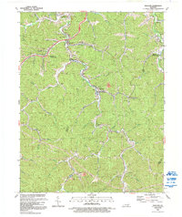 1992 Wayland1992 Print · USGSThe coal country of Floyd and Knott Counties comes into focus during the early nineties, showing a landscape shaped by mining and the railroad. Researchers can trace family history through sites like Raven Cem and rail-dependent towns including Wayland, Lackey, and Garrett.
 - 2010 Map of Wayland, 2010 Print
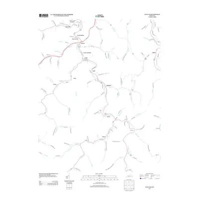
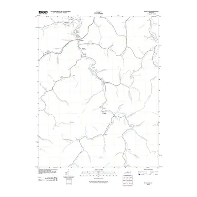 2010 Wayland2010 Print · USGSCovers Welco Station, including Wayland, Garrett, and other nearby areas
 - 2013 Map of Wayland, 2013 Print
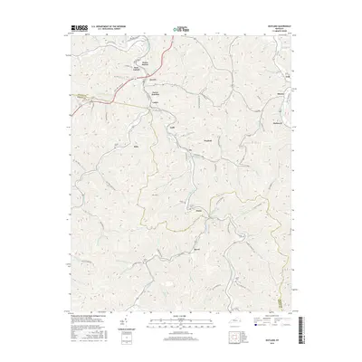
 2013 Wayland2013 Print · USGSCovers Welco Station, including Wayland, Garrett, and other nearby areas
 - 2016 Map of Wayland, 2016 Print
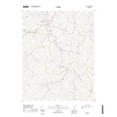
 2016 Wayland2016 Print · USGSCovers Welco Station, including Wayland, Garrett, and other nearby areas
 - 2019 Map of Wayland, 2019 Print
 2019 Wayland2019 Print · USGSCovers Welco Station, including Wayland, Garrett, and other nearby areas
 - 2022 Map of Wayland, 2022 Print
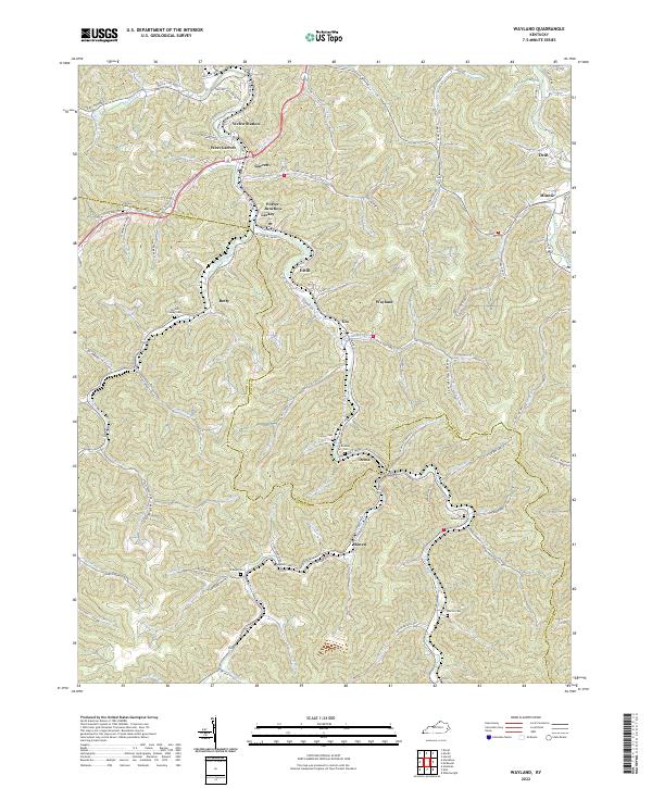 2022 Wayland2022 Print · USGSThe mountain valleys of Floyd and Knott Counties are detailed here in this contemporary topographic survey. Researchers can trace family history through numerous labeled burial sites like Triplett Conley Cem and Gibson Cem or explore settlements such as Wayland and Garrett.
End of results
Showing maps 1-14 of 14
Top cities near Welco Station
- Prestonsburg historical maps
- Wheelwright historical maps
- Hindman historical maps
- Betsy Layne historical maps
- Martin historical maps
- Pippa Passes historical maps
See more
Frequently asked questions
- What are the different types of historical maps available for Welco Station?
- What is the oldest map of Welco Station?
- Where can I purchase historical maps of Welco Station for my home or office?
- Where can I download high-res historical maps of Welco Station?
- Are there historical topographic maps available for Welco Station?
- Is there historical aerial imagery available for Welco Station?
- Where are historical maps of Welco Station sourced from?