Old Maps of Fulton County, Kentucky for Metal Detecting
Plan your next treasure hunt with 103 historic maps of Fulton County. Find old homesites, ghost towns, trails, and gathering spots that may be lost to time — perfect for identifying promising metal detecting locations.
- Locate forgotten sites: Uncover places like long-lost settlements, abandoned rail lines, or gathering spots.
- Plan better hunts: Use map overlays combined with LiDAR or satellite views to narrow in on historically rich areas.
- Made for detectorists: Thousands of hobbyists use these maps to discover relics, coins, and hidden history.
Use these historic maps to boost your research and find new opportunities beneath the surface of Fulton County.
Fulton County, KY maps
(103)- 1925 Map of Reelfoot Lake
 1925 Reelfoot Lake1925 Print · USGSNorthwestern Tennessee in the mid-twenties is defined here by the intricate waters of the Reelfoot basin and the shifting course of the Mississippi. Genealogists and historians can trace family-named sites like Rodgers School and Jones School, or locate old river landings including Cates and Whites Landing.3 unique versions available
 - 1939 Map of Reelfoot Lake
 1939 Reelfoot Lake1939 Print · USGSReelfoot Lake and the Mississippi River bottoms are captured here in the late thirties, showing a landscape defined by water and woods. Genealogists and historians can trace family locations near Owl City, Free Will Ch & Cem, and Chandlers Mill Sch.2 unique versions available
 - 1939 Map of Portageville, 1941 Print
 1939 Portageville1941 Print · USGSThe Missouri Bootheel meets the winding Mississippi River in the 1930s, showing a landscape defined by drainage bayous and new rail towns. Genealogists can locate family landmarks like Branham Cem and numerous rural schoolhouses including Walnut Grove Sch and Stanley Sch.2 unique versions available
 - 1939 Map of Hickman, 1941 Print
 1939 Hickman1941 Print · USGSWestern Kentucky and the Missouri bootheel meet at the river in the late 1930s, showing a landscape of flood control and rural growth. Genealogists can locate family-named sites like Hubbard Cem, Stubbs Sch, and the riverside settlement of Dorena.4 unique versions available
 - 1939 Map of New Madrid, 1941 Print
 1939 New Madrid1941 Print · USGSThe Missouri Bootheel is documented here during the late thirties, centered on the dramatic New Madrid Bend of the Mississippi River. Trace the early drainage networks and rail lines that shaped towns like New Madrid, Lilbourn, and Catron.
 - 1939 Map of Bayouville, 1942 Print
 1939 Bayouville1942 Print · USGSThe Missouri bootheel and the winding Kentucky riverfront are shown here just before the war. Genealogists can trace family names and local hubs like Pinhook Ch & Sch, Sugar Tree Ridge Sch, and the St Louis Southwestern RR.2 unique versions available
 - 1951 Map of Cayce, 1952 Print
 1951 Cayce1952 Print · USGSThe Kentucky-Tennessee borderlands appear here in the early postwar era as a landscape of rural churches and rail crossings. Genealogists and historians can trace family locations near Cayce, Alexander Cem, and the tracks of the Gulf Mobile and Ohio.2 unique versions available
 - 1951 Map of Bondurant, 1952 Print
 1951 Bondurant1952 Print · USGSThe Kentucky-Tennessee borderlands and the Mississippi River bottoms are captured here during the early fifties. Genealogists and historians can trace the Illinois Central rail line through rural hubs like Bondurant, Sassafras Ridge, and Tyler.
 - 1951 Map of Oakton, 1952 Print
 1951 Oakton1952 Print · USGSWestern Kentucky’s riverfront and rail corridors are captured here in the early fifties, documenting a landscape of small agricultural hubs and bluff-side terrain. Genealogists can trace early homesteads and social centers like Oakton, Whaynes Corner, and Oakwood Ch.2 unique versions available
 - 1951 Map of Hickman, 1953 Print
 1951 Hickman1953 Print · USGSThe river bluffs at Hickman overlook a complex tri-state landscape during the early 1950s. Genealogists and local historians can trace the foundations of rural Kentucky and Missouri life through landmarks like Dorena Sch, Poplar Grove Ch, and the Illinois Central railroad lines.
 - 1951 Map of Wolf Island, 1953 Print
 1951 Wolf Island1953 Print · USGSThe Mississippi River floodplain at the Kentucky-Missouri border is captured here in the early fifties, showing a landscape shaped by shifting currents. Researchers can trace the mid-century channel and landforms like Wolf Island No 5, Medley Bar, and the banks near Chalk Bluff.2 unique versions available
 - 1951 Map of New Madrid SE, 1953 Print
 1951 New Madrid SE1953 Print · USGSThe Mississippi River's dramatic loops define this mid-century survey of the isolated Kentucky Bend region. Researchers can trace the shifting state lines and river features like Kentucky Point, Watson Lake, and the sandbars of Madrid Bar.3 unique versions available
 - 1951 Map of Hubbard Lake, 1953 Print
 1951 Hubbard Lake1953 Print · USGSThe Kentucky Bend is captured here in the early fifties, showing the unique river-bound exclave created by the looping Mississippi. Genealogists can locate family landmarks on this isolated peninsula including the Kentucky Bend Sch and local Cem.2 unique versions available
 - 1952 Map of Crutchfield, 1953 Print
 1952 Crutchfield1953 Print · USGSWestern Kentucky and the Tennessee borderlands are captured here in the early fifties during a period of steady rural growth. Researchers can trace local lineage through numerous landmarks like Huddleston Cem, Ledbetter Sch, and the Carr Institute in South Fulton.
 - 1952 Map of Water Valley, 1953 Print
 1952 Water Valley1953 Print · USGSIn the early 1950s, the border between Kentucky and Tennessee was a landscape of rail-driven towns and winding bayous. Genealogists and historians can trace family roots through landmarks like Camp Beauregard Cem, the settlement of Feliciana, and the Illinois Central rail line.
 - 1952 Map of Water Valley, 1957 Print
 1952 Water Valley1957 Print · USGSWestern Kentucky and northern Tennessee are captured here in the early fifties as the Illinois Central railroad linked farming hubs and small towns. Genealogists can trace family names through dozens of landmarks like Camp Beauregard Cem, McWhort Cem, and Shiloh Sch Ch.
 - 1954 Map of New Madrid, 1955 Print
 1954 New Madrid1955 Print · USGSThe Missouri Bootheel in the early fifties shows a landscape of reclaimed bottomlands and riverfront commerce. Genealogists can trace family footprints at the Rosenwald School, Hunter Cem, and small rural junctions like Ristine or La Forge.2 unique versions available
 - 1954 Map of Hickman, 1966 Print
 1954 Hickman1966 Print · USGSThe tristate river country of Kentucky, Missouri, and Tennessee is captured here during the mid-century era of river control and rural rail. Genealogists can trace family landmarks like Sylvan Shade Sch, Dorena, and the river landings at Williams Ldg.
 - 1955 Map of Portageville
 1955 Portageville1955 Print · USGSThe Missouri Bootheel and Tennessee borderlands are captured here in the mid-fifties, showing a landscape shaped by the Mississippi River. Researchers can trace old rural schoolhouses like LaFont Sch, family burial grounds such as Darnell Cem, and the rail-side growth of Portageville.
 - 1955 Map of Hickman
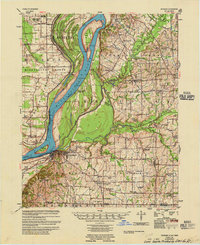 1955 Hickman1955 Print · USGSMid-century life along the Mississippi River meanders is captured here during a period of heavy river engineering and rural expansion. Genealogists can trace family names and local sites like Sassafras Ridge Cem, Dorena Ch, and the Illinois Central rail line.2 unique versions available
 - 1955 Map of Bayouville
 1955 Bayouville1955 Print · USGSThe river bottomlands of the Missouri-Kentucky border are shown in the mid-1950s as a landscape of intensive levee engineering and rural community nodes. Researchers can locate many now-obscure sites like Henderson Mound, Barnes Ridge Ch, and the school at Madrid Bend.
 - 1956 Map of Reelfoot Lake, 1957 Print
 1956 Reelfoot Lake1957 Print · USGSNorthwest Tennessee in the 1950s was a landscape defined by the shifting waters of the Mississippi and the cypress brakes of Reelfoot. Researchers can trace rural lineages through sites like Crocketts Chapel & Cem, Star of Bethlehem Ch, and the defunct rails of the Illinois Central Railroad.
 - 1956 Map of Dyersburg, 1960 Print
 1956 Dyersburg1960 Print · USGSThe Four Rivers region comes alive in the mid-fifties, capturing the intricate borderlands of Tennessee, Kentucky, and Missouri. Genealogists and historians can trace the rail-and-river networks connecting Dyersburg, Caruthersville, and the shoreline of Reelfoot Lake.4 unique versions available
 - 1964 Map of Tiptonville, 1965 Print
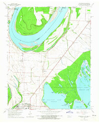 1964 Tiptonville1965 Print · USGSTiptonville and the Mississippi River bottoms are captured in the mid-sixties, showing a landscape defined by shifting river channels and the waters of Reelfoot Lake. Genealogists can locate family sites like Cronanville Cem, Mt Zion Ch, and the Indian Mound.2 unique versions available
 - 1967 Map of Reelfoot Lake
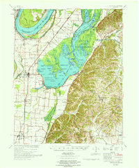 1967 Reelfoot Lake1967 Print · USGSReelfoot Lake and the Mississippi riverfront are captured here in the mid-sixties, showing a landscape defined by wetlands and rail-line towns. Researchers can trace family sites at Owl City or Samburg, and locate landmarks like Mt Zion Ch and Oak Ridge Sch.
Showing maps 1-25 of 103
Top cities of Fulton County
Frequently asked questions
- What are the different types of historical maps available for Fulton County?
- What is the oldest map of Fulton County?
- Where can I purchase historical maps of Fulton County for my home or office?
- Where can I download high-res historical maps of Fulton County?
- Are there historical topographic maps available for Fulton County?
- Is there historical aerial imagery available for Fulton County?
- Where are historical maps of Fulton County sourced from?