2020s Maps of Grayson County, Kentucky
Explore 17 historic maps of Grayson County from the 2020s. These maps offer a rare glimpse into what life looked like during the 2020s — showing old roads, neighborhoods, homes, and landmarks that have changed or disappeared over time.
Whether you're researching your family's past, planning a metal detecting trip, or studying how Grayson County's landscape evolved across the 2020s, these high-resolution maps are a powerful tool for exploring the history of this region.
- Focus on a specific era: All maps on this page are from the 2020s, giving you a focused view of this time period.
- See what’s changed: Compare century-old streets, trails, and buildings to today's modern landscape using overlays and satellite layers.
- Research with precision: Use these maps for genealogy, historical research, land use analysis, or educational projects.
- View, download, or print: Maps are fully viewable online in high resolution, and can be downloaded or printed for your own records.
Start exploring Grayson County's history through authentic maps from the 2020s. This is your window into the past.
Grayson County, KY maps
(17)- 2022 Map of Millerstown, 2022 Print
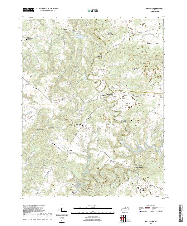 2022 Millerstown2022 Print · USGSThe Nolin River valley at the Grayson and Hart County borders is shown here in the 2020s, revealing a landscape of winding river bends and historic family cemeteries. Researchers can trace rural lineages at Mount Zion Christian Church Cem, Wheelers Mill, and Broad Ford.
 - 2022 Map of Bee Spring, 2022 Print
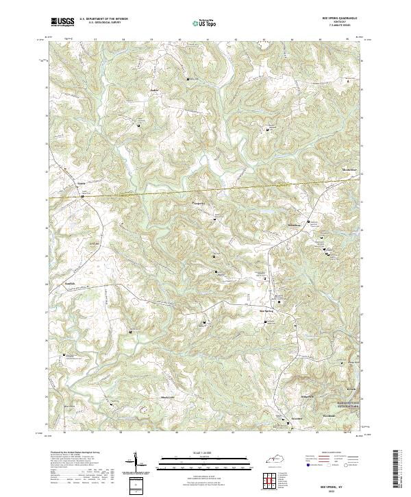 2022 Bee Spring2022 Print · USGSEdmonson and Grayson counties are captured here at the doorstep of the national park during the early 2020s. Researchers can trace family history through dozens of small burial sites like the Washington Meredith Masonic Cem and the Vincent Cem Number 2.
 - 2022 Map of Big Clifty, 2022 Print
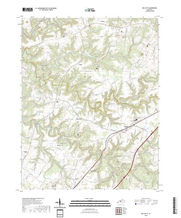 2022 Big Clifty2022 Print · USGSBig Clifty and the ridges of the Grayson-Hardin county line are captured here in the early twenty-first century. Researchers can trace local heritage through numerous burial sites like Jacobs Graveyard, Cedar Hill Cem, and the parish grounds at Saint Paul.
 - 2022 Map of Ready, 2022 Print
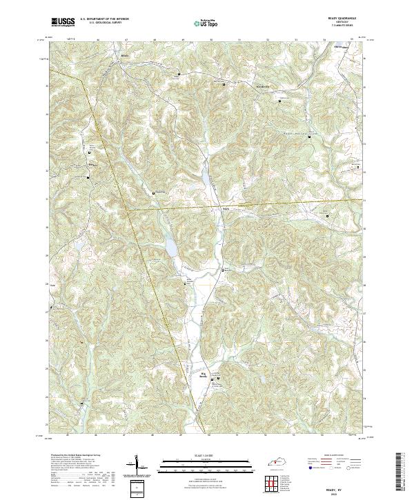 2022 Ready2022 Print · USGSThe hills where Butler, Grayson, and Edmonson counties meet come alive in this detailed look at rural Kentucky life. Researchers can trace family history through a remarkable number of named burial sites, including the Dan Woosley Pioneer Cem, Saint Mary Cem, and Old Big Reedy Cem.
 - 2022 Map of Olaton, 2022 Print
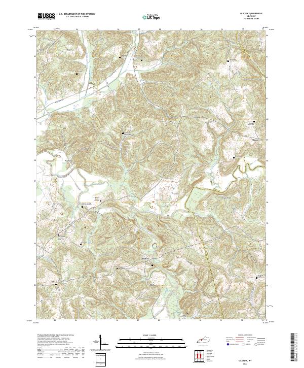 2022 Olaton2022 Print · USGSIn the western Kentucky hills, this survey captures the rural landscape along the Rough River and Caney Creek. Genealogists can trace family locations through numerous sites like Barrett Burying Ground, Huff Creek Church Cem, and the N J Faught Farm.
 - 2022 Map of McDaniels, 2022 Print
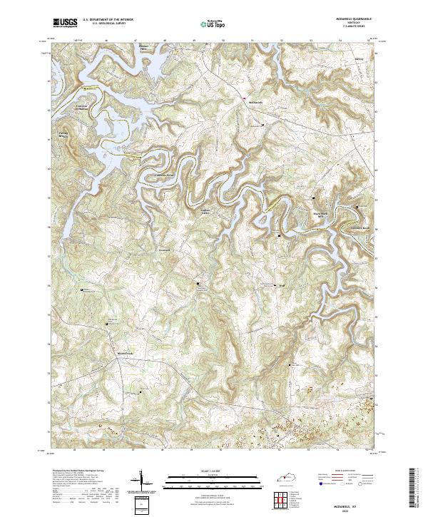 2022 McDaniels2022 Print · USGSThe Breckinridge and Grayson county line follows the winding Rough River in the early twenty-first century. Family researchers can trace deep local roots at Ann Mariah Shain Deweese Cem, Horn Back Mill, and the community at Short Creek.
 - 2022 Map of Madrid, 2022 Print
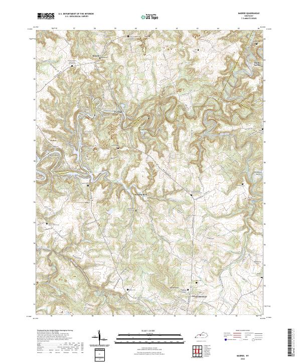 2022 Madrid2022 Print · USGSCentral Kentucky's rural landscape is mapped here at the junction of three counties, showing a community defined by the winding Rough River. Genealogists can trace deep local roots through numerous family-named landmarks and sites like Madrid Cem, Eveleigh Church Cem, and The Sink.
 - 2022 Map of Clarkson, 2022 Print
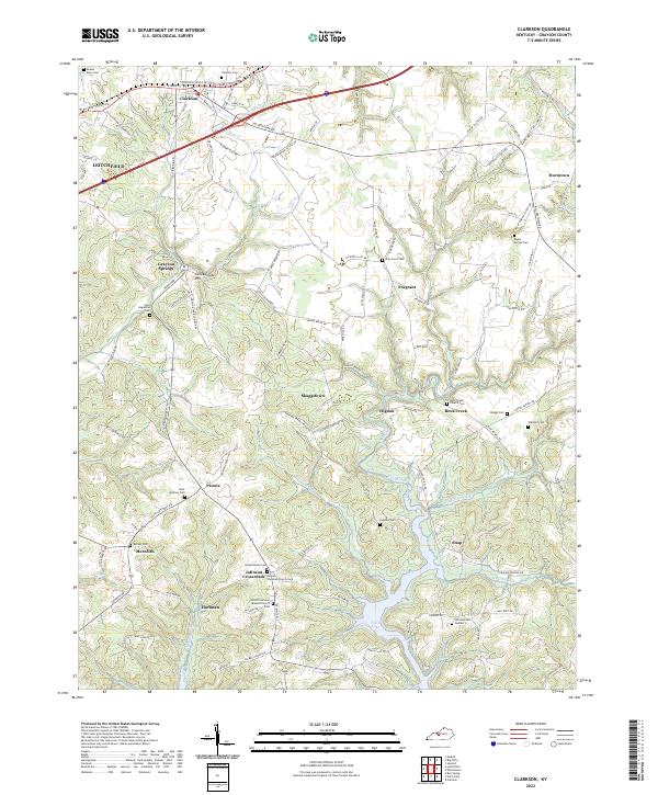 2022 Clarkson2022 Print · USGSThe rural landscape of Grayson County in the early twenty-first century reveals a dense network of country churches and family burial grounds. Genealogists can trace local heritage through sites like Peonia Christian Church, Saint Anthony Cem, and the settlement of Johnson Crossroads.
 - 2022 Map of Spring Lick, 2022 Print
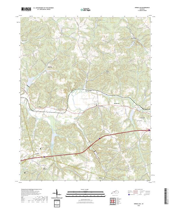 2022 Spring Lick2022 Print · USGSGrayson County and its neighbors are captured in the early 2020s, showing a landscape defined by ridgeline roads and creek valleys. Researchers can trace rural settlements like Jugville and Neafus alongside historic sites like Harmony Cem.
 - 2022 Map of Caneyville, 2022 Print
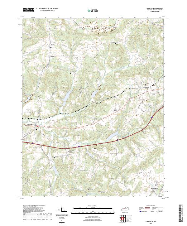 2022 Caneyville2022 Print · USGSThe rural landscape of Grayson County is centered on Caneyville and its surrounding creek forks during the early twenty-first century. Genealogists can trace family lines through numerous sites like the Elder - Anderson Cem and Wilson United Baptist Church Cem.
 - 2022 Map of Falls of Rough, 2022 Print
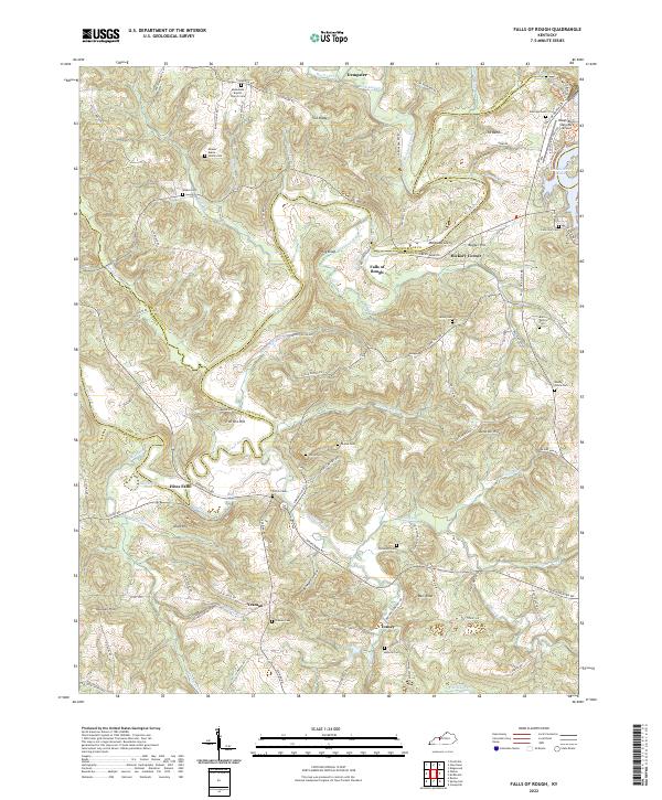 2022 Falls of Rough2022 Print · USGSThe rural borders of Breckinridge and Grayson counties come alive in the early 2020s, centered on the winding Rough River. Genealogists and local historians can trace family roots through numerous remote sites like Macedonia Baptist Church Cem, Hites Falls, and Yeaman.
 - 2022 Map of Rosine, 2022 Print
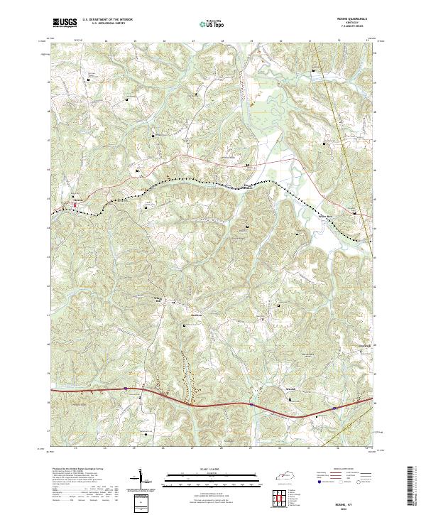 2022 Rosine2022 Print · USGSOhio County is documented here in the early twenty-first century, showing the enduring rural layout of communities like Rosine and Horse Branch. Genealogists and local historians can locate numerous family burial grounds including McCord Cem, Wilson Cem, and Arnold Ridge Cem.
 - 2022 Map of Welchs Creek, 2022 Print
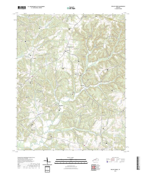 2022 Welchs Creek2022 Print · USGSButler County's rural heartland is meticulously documented here during the early twenty-first century, showing a landscape of deep-rooted family settlements. Genealogists and historians can trace lineage through dozens of local landmarks like Chapel Union Church Cem, Huldeville, and the Pharris - Lindsey Cem.
 - 2022 Map of Leitchfield, 2022 Print
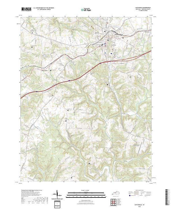 2022 Leitchfield2022 Print · USGSLeitchfield and its neighboring settlements of Clarkson and Black Rock are captured here in the early twenty-first century. Researchers can trace dozens of family cemeteries and local landmarks, including Claggett United Baptist Church Cem, Allens Lake, and the Grayson County Judicial Center.
 - 2022 Map of Summit, 2022 Print
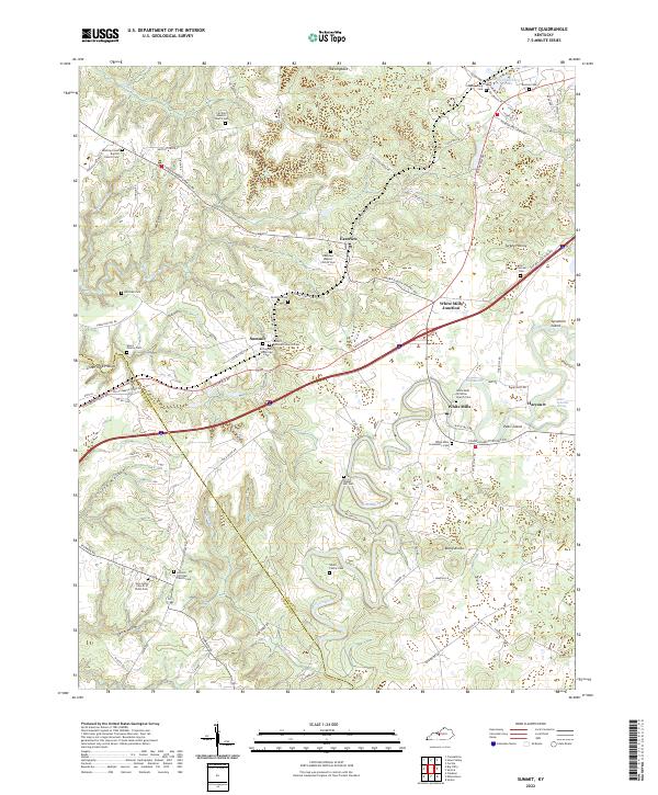 2022 Summit2022 Print · USGSHardin and Grayson counties appear at the start of the 2020s, showing a landscape defined by the winding Nolin River. Genealogists can trace family sites like the Richardson Woolridge Cem or visit local landmarks like Saint Ignatius Spring.
 - 2022 Map of Cub Run, 2022 Print
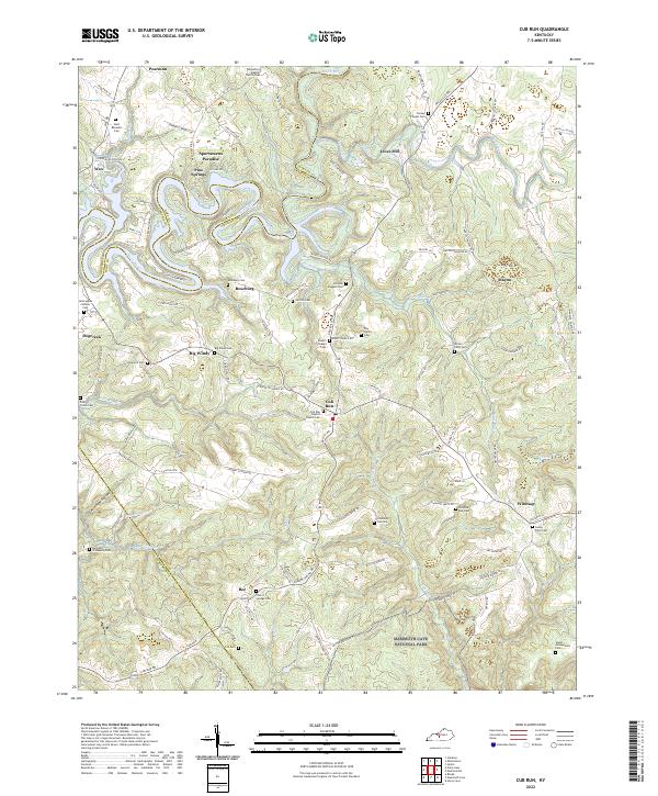 2022 Cub Run2022 Print · USGSCentral Kentucky's karst hills and river bends are captured here in the 2020s, showing the intersection of Mammoth Cave National Park and rural Hart County. Trace family history at Old Cub Run Cem, Roseburg, and the Jim Bob Jaggers Cem.
 - 2022 Map of Nolin Lake, 2022 Print
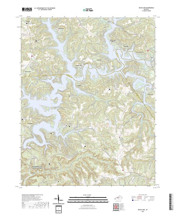 2022 Nolin Lake2022 Print · USGSThe Edmonson County hills meet the waters of the Nolin River in this detailed study of the area just north of the national park. Researchers can locate many family burial sites and rural steeples, including the Thompson Family Cem and the Union Light Missionary Baptist Cem.
End of results
Showing maps 1-17 of 17
Top cities of Grayson County
Frequently asked questions
- What are the different types of historical maps available for Grayson County?
- What is the oldest map of Grayson County?
- Where can I purchase historical maps of Grayson County for my home or office?
- Where can I download high-res historical maps of Grayson County?
- Are there historical topographic maps available for Grayson County?
- Is there historical aerial imagery available for Grayson County?
- Where are historical maps of Grayson County sourced from?