2020s Maps of Elizabethtown, Kentucky
Explore 4 historic maps of Elizabethtown from the 2020s. These maps offer a rare glimpse into what life looked like during the 2020s — showing old roads, neighborhoods, homes, and landmarks that have changed or disappeared over time.
Whether you're researching your family's past, planning a metal detecting trip, or studying how Elizabethtown's landscape evolved across the 2020s, these high-resolution maps are a powerful tool for exploring the history of this region.
- Focus on a specific era: All maps on this page are from the 2020s, giving you a focused view of this time period.
- See what’s changed: Compare century-old streets, trails, and buildings to today's modern landscape using overlays and satellite layers.
- Research with precision: Use these maps for genealogy, historical research, land use analysis, or educational projects.
- View, download, or print: Maps are fully viewable online in high resolution, and can be downloaded or printed for your own records.
Start exploring Elizabethtown's history through authentic maps from the 2020s. This is your window into the past.
Elizabethtown, KY maps
(4)- 2022 Map of Cecilia, 2022 Print
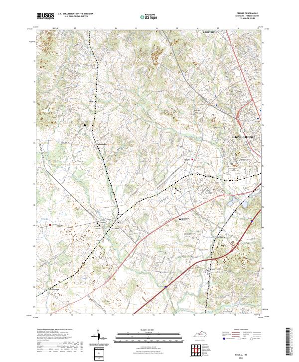 2022 Cecilia2022 Print · USGSThe community of Cecilia and western Elizabethtown appear here in the early 2020s, showing a landscape of established schools, cemeteries, and airfields. Researchers can trace family history at Saint John Cem or locate landmarks like Addington Field and the P & L RR.
 - 2022 Map of Colesburg, 2022 Print
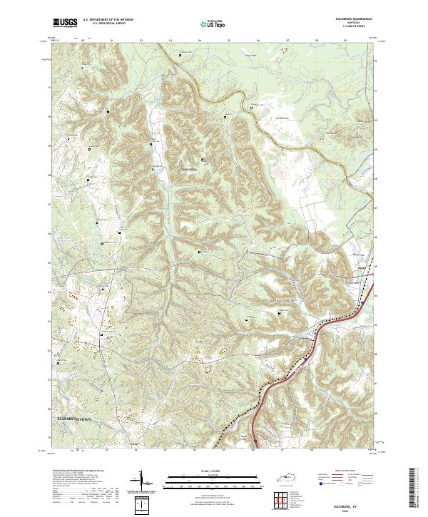 2022 Colesburg2022 Print · USGSSettled along the Bullitt and Hardin County line in the early 2020s, this area features a distinct mix of river flats and knobs. Genealogists can trace family landmarks like Cedar Creek Cem, Booth, and Stovall Cem Number 2.
 - 2022 Map of Vine Grove, 2022 Print
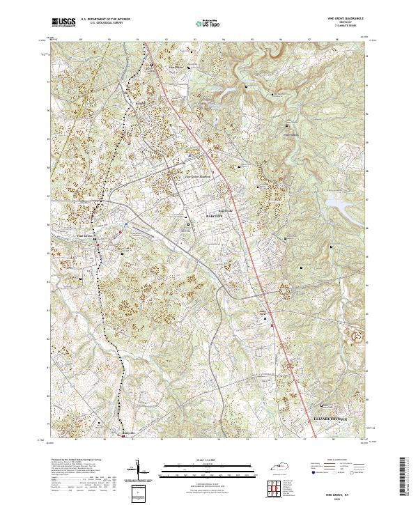 2022 Vine Grove2022 Print · USGSHardin County settlements and military history converge in this contemporary look at the Vine Grove area and the northern reaches of Elizabethtown. Researchers can locate numerous burial grounds and landmarks like Saint Brigid Cem, the Vine Grove Airport, and Fort Knox Cem Number 83.
 - 2022 Map of Elizabethtown, 2022 Print
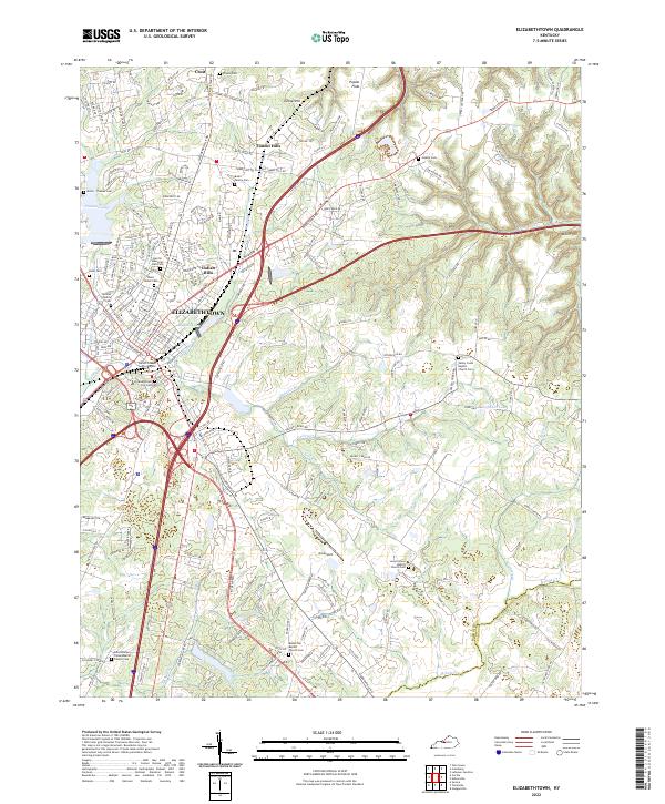 2022 Elizabethtown2022 Print · USGSElizabethtown and the rolling Hardin County countryside are shown here in the early twenty-first century as suburban growth meets long-standing family farmsteads. Trace local history through the Bush Family Cem, Oz Airport, and the Hardin County Justice Center.
End of results
Showing maps 1-4 of 4
Top cities near Elizabethtown
- Radcliff historical maps
- Vine Grove historical maps
- Rineyville historical maps
- Hodgenville historical maps
- Lebanon Junction historical maps
- Sonora historical maps
Top neighborhoods of Elizabethtown
Frequently asked questions
- What are the different types of historical maps available for Elizabethtown?
- What is the oldest map of Elizabethtown?
- Where can I purchase historical maps of Elizabethtown for my home or office?
- Where can I download high-res historical maps of Elizabethtown?
- Are there historical topographic maps available for Elizabethtown?
- Is there historical aerial imagery available for Elizabethtown?
- Where are historical maps of Elizabethtown sourced from?