Old Maps of West Point, Kentucky for Genealogy
Trace your family roots with 30 historic maps of West Point. These high-res maps reveal old neighborhoods, homesites, landmarks, and streets — helping you uncover where your ancestors lived and how the area evolved over time.
- Explore historic neighborhoods: Identify where your relatives may have lived in the 1800s or 1900s.
- Compare maps over time: Trace the changes in streets, buildings, and landmarks for multi-generational research.
- Perfect for genealogy & ancestry research: Used by family historians and researchers to map out lineage and migration.
These maps are an incredible resource for exploring your personal connection to West Point's past.
West Point, KY maps
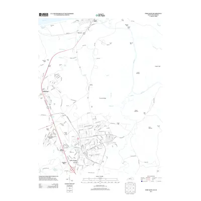
(30)- 1909 Map of Kosmosdale
 1909 Kosmosdale1909 Print · USGSSouthwest of Louisville at the turn of the century, the river valley meets the steep slopes of Muldraughs Hill. Researchers can trace early rural life through several family-named schoolhouses and small settlements like Kosmosdale, Valley Sta, and the County Infirmary.
 - 1912 Map of Kosmosdale
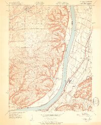
 1912 Kosmosdale1912 Print · USGSThe Ohio River valley and the Kentucky Knobs come alive in this pre-war survey, showing the expansion of southern Louisville and the rural hills of Jefferson and Bullitt counties. Researchers can locate vanished landmarks like Locust Point P.O. and the County Infirmary, or trace the old riverboat stops at Stewarts Landing.4 unique versions available
 - 1936 Map of Vine Grove
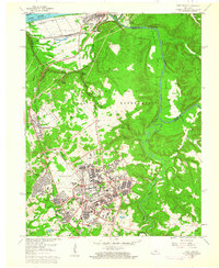
 1936 Vine Grove1936 Print · USGSHardin and Bullitt counties are shown here during a period of massive military expansion before the mid-century. Researchers can trace the development of Fort Knox alongside established communities like Vine Grove and old rural landmarks like Stovall Chapel or the Glenbeddis Sch.
 - 1943 Map of Vine Grove
 1943 Vine Grove1943 Print · USGSHardin and Meade Counties appear here during a period of massive mid-century growth at Fort Knox. Genealogists can trace family homesteads near landmarks like Stovall Chapel, Red Hill, and the many rural schools including Hays Sch and Deckard Sch.
 - 1946 Map of Fort Knox
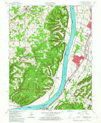
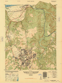 1946 Fort Knox1946 Print · USGSFort Knox and the surrounding Kentucky riverlands are captured just after the war as the military installation reached its modern maturity. Researchers can trace the layout of Godman Field, locate the famous Bullion Depository, and find family landmarks like Montgomery Cem or the town of West Point.
 - 1946 Map of Vine Grove, 1959 Print
 1946 Vine Grove1959 Print · USGSMid-century Hardin County is defined by the massive expansion of the Fort Knox Military Reservation and its surrounding rail-and-highway hubs. Researchers can trace dozens of family cemeteries and vanished landmarks like the Woolridge Ferry Bridge, Sherrard Sch, and the community of Pitts Point.
 - 1950 Map of Fort Knox
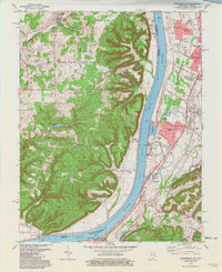
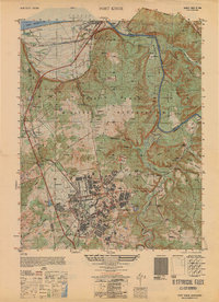 1950 Fort Knox1950 Print · USGSFort Knox and its surroundings in the years following the war show a landscape transformed by military necessity and river valley geography. Researchers can trace the layout of the US Bullion Depository and Godman Field alongside older communities like West Point and Goldville.
 - 1950 Map of Kosmosdale, 1959 Print
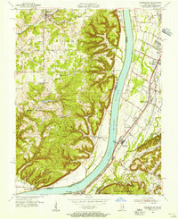
 1950 Kosmosdale1959 Print · USGSGreater Louisville and the Ohio River valley are captured here at mid-century, showing the city's industrial south side meeting rural river towns. Genealogists and historians can trace family locations through Lanesville Cem, the Waverly Hills Sanatorium, and Churchill Downs.
 - 1951 Map of Kosmosdale
 1951 Kosmosdale1951 Print · USGSThe Ohio River valley south of Louisville was a busy corridor of rail and road commerce in the early fifties. Genealogists and historians can trace local landmarks like Kosmosdale Sch, Mill Creek Cem, and the boundaries of the Fort Knox Military Reservation.2 unique versions available
 - 1955 Map of Kosmosdale, 1956 Print
 1955 Kosmosdale1956 Print · USGSThe river valley south of Louisville comes alive in the mid-fifties, showing the vital corridors of the Illinois Central and Dixie Highway. Genealogists and historians can trace family locations near Bethany, Meadow Lawn, and the rural Elizabeth Ch.
 - 1956 Map of Louisville, 1971 Print
 1956 Louisville1971 Print · USGSThe Ohio River valley and the Kentucky Bluegrass are captured here during a period of rapid mid-century growth and industrial activity. Genealogists and historians can trace rail-centered towns and military land use at Fort Knox and the Jefferson Proving Ground.2 unique versions available
 - 1957 Map of Winchester, 1968 Print
 1957 Winchester1968 Print · USGSCentral Kentucky's landscape in the mid-twentieth century features the sprawling Fort Knox and the early parkway system. Genealogists and historians can trace rail lines like the Southern Railway and find landmarks from Bernheim Forest to Pilot Knob.3 unique versions available
 - 1960 Map of Winchester
 1960 Winchester1960 Print · USGSCentral Kentucky's diverse landscape is shown here at mid-century, from the bluegrass plains to the rugged Pottsville Escarpment. Genealogists and historians can trace the rail-and-river network connecting towns like Bardstown and Stanford alongside landmarks like Lake Cumberland.
 - 1960 Map of Fort Knox, 1961 Print
 1960 Fort Knox1961 Print · USGSFort Knox and the surrounding river valleys are captured here during the height of the Cold War era. Researchers can trace the layout of the U S Bullion Depository and Godman Army Airfield or locate family plots like Boone Cem and McIntire Cem.3 unique versions available
 - 1960 Map of Kosmosdale, 1961 Print
 1960 Kosmosdale1961 Print · USGSThe Ohio River valley near the Harrison and Jefferson County line is captured here during a period of significant growth. You can trace the development of residential neighborhoods like Meadow Lawn and Valley Station alongside older sites like Elizabeth Ch and Kosmosdale.3 unique versions available
 - 1964 Map of Louisville
 1964 Louisville1964 Print · USGSThe Ohio River valley and Kentucky Bluegrass are captured in the mid-1960s, showing a region balanced between industrial growth and its agrarian roots. Genealogists and historians can trace the development of county seats like Shelbyville and Paris, or locate established institutions such as Georgetown College and Bernheim Forest.
 - 1981 Map of Kosmosdale
 1981 Kosmosdale1981 Print · USGSThe Ohio River corridor south of Louisville in the early eighties shows a landscape of suburban expansion meeting heavy river-industry. Researchers can trace family roots at De Pauw Cem, locate the former site of Watson Lane Sch, or explore the rail networks of the Illinois Central Gulf.3 unique versions available
 - 1981 Map of Elizabethtown, 1983 Print
 1981 Elizabethtown1983 Print · USGSCentral Kentucky in the early eighties shows a landscape of military installations, state parks, and historic sites. Genealogists and historians can trace rail lines like the Louisville and Nashville or locate sites like Lebanon National Cemetery and the Lincoln Memorial National Historic Site.
 - 1986 Map of Louisville
 1986 Louisville1986 Print · USGSMid-1980s Louisville and southern Indiana are shown here during a decade of significant suburban growth and infrastructure development. Researchers can trace the layout of Cave Hill Cemetery, the expansion of Standiford Field, and industrial sites like the Indiana Army Ammunition Plant.2 unique versions available
 - 1991 Map of Fort Knox, 1992 Print
 1991 Fort Knox1992 Print · USGSIn the early 1990s, the area around Fort Knox shows the full maturity of its military footprint alongside early river settlements. Genealogists and historians can trace numerous family burial grounds like Geoghegan Cem and Bleakley Cem preserved within the Fort Knox Military Reservation.
 - 2010 Map of Fort Knox, 2010 Print
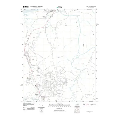 2010 Fort Knox2010 Print · USGSCovers West Point, including Louisville, Radcliff, and other nearby areas
 - 2011 Map of Kosmosdale, 2011 Print
 2011 Kosmosdale2011 Print · USGSCovers West Point, including Louisville, Elizabeth, and other nearby areas
 - 2013 Map of Kosmosdale, 2013 Print
 2013 Kosmosdale2013 Print · USGSCovers West Point, including Louisville, Elizabeth, and other nearby areas
 - 2013 Map of Fort Knox, 2013 Print
 2013 Fort Knox2013 Print · USGSCovers West Point, including Louisville, Radcliff, and other nearby areas
 - 2016 Map of Kosmosdale, 2016 Print
 2016 Kosmosdale2016 Print · USGSCovers West Point, including Louisville, Elizabeth, and other nearby areas
Showing maps 1-25 of 30
Top cities near West Point
- Louisville historical maps
- Elizabethtown historical maps
- Radcliff historical maps
- Shively historical maps
- Shepherdsville historical maps
- Vine Grove historical maps
See more
Top neighborhoods of West Point
Frequently asked questions
- What are the different types of historical maps available for West Point?
- What is the oldest map of West Point?
- Where can I purchase historical maps of West Point for my home or office?
- Where can I download high-res historical maps of West Point?
- Are there historical topographic maps available for West Point?
- Is there historical aerial imagery available for West Point?
- Where are historical maps of West Point sourced from?