Old Maps of Cumberland, Kentucky for Academic Research
Study the evolution of Cumberland with 41 high-resolution historic maps. Whether you're teaching, researching, or modeling changes in land use, these maps provide essential visual documentation of urban, environmental, and geographic change.
- Analyze long-term change: Track patterns in development, transportation, and natural features.
- Ideal for environmental or urban studies: Support academic projects with primary historical map data.
- Use in the classroom or lab: Educators and researchers rely on these maps to bring historical context to life.
These maps are a powerful tool for teaching, research, and visualizing how Cumberland has changed over the decades.
Cumberland, KY maps
(41)- 1887 Map of Jonesville
 1887 Jonesville1887 Print · USGSThe rugged borderlands of Virginia, Kentucky, and Tennessee are captured in the late nineteenth century during a time of isolated valley settlements. Genealogists and historians can trace family locations near Jonesville, Sneedville, and the remote Kyle's Ford along the Powell River.
 - 1890 Map of Whitesburg
 1890 Whitesburg1890 Print · USGSThe Cumberland Plateau in the 1880s is a world of deep hollows and isolated mountain settlements. Genealogists can trace family roots in early communities like Whitesburgh and Pikeville or locate crossings at Pound Gap and Shelby Gap.
 - 1891 Map of Jonesville
 1891 Jonesville1891 Print · USGSThe tri-state borderlands of Virginia, Kentucky, and Tennessee are captured here in the late nineteenth century. Researchers can trace early river crossings and mountain settlements like Poteet Ford, Shafers P.O., and Mt Pleasant.9 unique versions available
 - 1892 Map of Whitesburg
 1892 Whitesburg1892 Print · USGSEastern Kentucky and the Virginia borderlands appear here in the late nineteenth century as a landscape of isolated mountain hollows. Genealogists and historians can trace early family settlements along Kingdom Come Creek, Beef Hide, and the strategic passage at Pound Gap.4 unique versions available
 - 1894 Map of Estillville, 1909 Print
 1894 Estillville1909 Print · USGSThe Appalachian highlands at the turn of the century show a landscape of isolated mountain hollows and emerging rail hubs. Genealogists can trace family footprints across river crossings like Speer Ferry and vanished industry at Zion Mills or Brick Store.3 unique versions available
 - 1913 Map of Oven Fork
 1913 Oven Fork1913 Print · USGSLetcher County's steep ridges and narrow hollows are shown here in the early twentieth century, just as the Lexington and Eastern Ry arrived. Genealogists can trace family settlements from Whitesburg to Blackey, and locate early schools and landmarks like Campbranch Chapel or Pound Gap.
 - 1915 Map of Whitesburg
 1915 Whitesburg1915 Print · USGSLetcher County at the start of the twentieth century shows a landscape of deep hollows and growing rail towns. Genealogists can trace family roots through numerous numbered schoolhouses and settlements like Whitesburg, Blackey, and Indian Bottom.4 unique versions available
 - 1916 Map of Nolansburg
 1916 Nolansburg1916 Print · USGSThe rugged Cumberland Plateau along the Kentucky and Virginia border is captured here during the first World War. Researchers can trace early railroad history and mountain genealogy through labels like Nolansburg, Panorama Station, and the slopes of Black Mountain.
 - 1919 Map of Nolansburg
 1919 Nolansburg1919 Print · USGSHarlan County and the Virginia borderlands are captured here during the height of early twentieth-century mountain development. Local historians can trace the foundations of the Pine Mountain Settlement School and vanished industrial sites like Leona Mines PO and Bondurant.3 unique versions available
 - 1921 Map of Big Stone Gap
 1921 Big Stone Gap1921 Print · USGSIn the early 1920s, the coal and rail networks of Wise and Lee Counties were at their peak. Genealogists and historians can trace old settlements and rural hubs like Keokee, Johnsons Mill PO, and Stonega along the Southern RR and the Powell River.
 - 1922 Map of Big Stone Gap
 1922 Big Stone Gap1922 Print · USGSSouthwest Virginia's coal and rail corridors are captured here in the early 1920s, showing the height of industrial development in the Cumberland Mountains. Trace family roots and vanished landmarks near Appalachia, Keokee, and the historic Seminary School along the Powell River.
 - 1929 Map of Big Stone Gap
 1929 Big Stone Gap1929 Print · USGSThe coal and rail networks of the Kentucky-Virginia border country are frozen in time just before the Great Depression. Genealogists and historians can trace family roots through mountain settlements like Lynch, Keokee, and Appalachia, or locate landmarks such as Robbins Chapel and Cluttis Post Office.3 unique versions available
 - 1935 Map of Benham
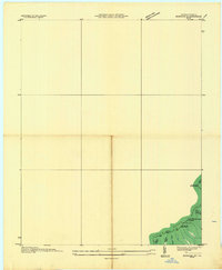 1935 Benham1935 Print · USGSThe Kentucky-Virginia state line runs along the high ridges of the Cumberland Plateau during the mid-1930s. Researchers can trace coal operations like Potato Hill Stonega Coal No 71 and topographic landmarks such as Deep Gap.
 - 1954 Map of Benham, 1956 Print
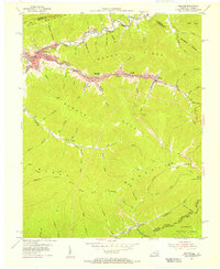 1954 Benham1956 Print · USGSCentral Harlan County coal towns thrive in the mid-fifties along the steep ridges of Black Mountain. Researchers can trace the Louisville and Nashville rail lines serving Benham and Lynch, or locate family sites like Creech Cem.4 unique versions available
 - 1954 Map of Louellen, 1956 Print
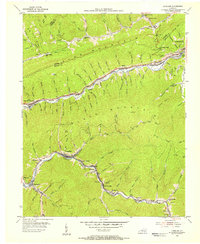 1954 Louellen1956 Print · USGSEastern Kentucky coal country is captured here during the mid-fifties, dominated by the L & N railroad. Researchers can trace coal camp life through Louellen, Highsplint, and remote sites like Bear Branch Sch or Hurricane Gap Ch.4 unique versions available
 - 1954 Map of Roxana, 1956 Print
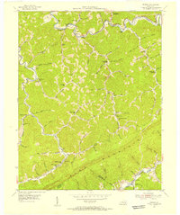 1954 Roxana1956 Print · USGSThe Kentucky mountains in the early fifties reveal a landscape of isolated hollows and ridge-line borders before modern development. Traced by the Louisville and Nashville rail, you can locate family landmarks like the Hot Spot Premium PO, Tolson Branch Ch, and numerous neighborhood schools.3 unique versions available
 - 1955 Map of Johnson City
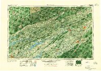 1955 Johnson City1955 Print · USGSEast Tennessee and the bordering highlands of Virginia and Kentucky appear here during the post-war industrial boom. You can trace the complex network of mountain ridges and new TVA lakes, from Johnson City to the coalfields near Middlesboro and Lynch.
 - 1957 Map of Johnson City, 1966 Print
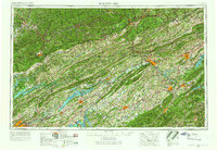 1957 Johnson City1966 Print · USGSUpper East Tennessee and Southwest Virginia are shown here during the mid-sixties transition of the Appalachians. Researchers can trace the industrial rail hubs of Kingsport, the sprawling waters of Cherokee Lake, and the historic Cumberland Gap.
 - 1957 Map of Jenkins, 1974 Print
 1957 Jenkins1974 Print · USGSThe Cumberland Plateau in the mid-twentieth century reveals a complex landscape of winding river valleys and deep-seated industry. Genealogists and historians can trace the development of Hazard, Jenkins, and Pikeville alongside extensive Numerous Oil and Gas Fields and the routes of the Chesapeake & Ohio Railway.
 - 1960 Map of Jenkins
 1960 Jenkins1960 Print · USGSEastern Kentucky and the West Virginia borderlands are captured at a mid-century peak of the coal and rail era. Trace the industrial corridors of the Chesapeake and Ohio RR through mountain hubs like Hazard and Jenkins.
 - 1960 Map of Johnson City
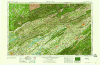 1960 Johnson City1960 Print · USGSUpper East Tennessee and the surrounding tri-state area are shown in the mid-fifties during the height of the TVA reservoir era. Trace the industrial rail lines of the Southern and Louisville and Nashville between Kingsport and Johnson City.
 - 1963 Map of Johnson City
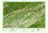 1963 Johnson City1963 Print · USGSThe Tri-Cities and the surrounding Appalachian ridges are shown in detail during the early sixties, highlighting the era's vital rail and river networks. Genealogists and historians can trace the routes of the Clinchfield RR and locate settlements from Rogersville to Elizabethton.
 - 1976 Map of Benham, 1981 Print
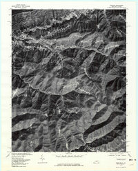 1976 Benham1981 Print · USGSHarlan County's coal towns and river valleys are shown in detail during the mid-seventies in this aerial-based survey. Genealogists and researchers can trace the dense footprints of Benham, Lynch, and Cumberland along the winding Looney Creek.
 - 1977 Map of Middlesboro, 1983 Print
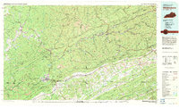 1977 Middlesboro1983 Print · USGSThe tri-state border region of Kentucky, Tennessee, and Virginia is shown here in the late seventies as the rail-and-river economy hummed through the gaps. Trace local family roots and transit routes through Middlesboro, Harlan, and Cumberland Gap National Historical Park.
 - 1977 Map of Pikeville, 1983 Print
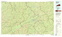 1977 Pikeville1983 Print · USGSThe Central Appalachian coalfields and the rugged borders of Kentucky and Virginia come into focus during the late seventies. Researchers can trace the rail networks of the C & O and L & N through towns like Jenkins, Whitesburg, and Pikeville.
Showing maps 1-25 of 41
Top cities near Cumberland
- Big Stone Gap historical maps
- Pennington Gap historical maps
- Whitesburg historical maps
- Appalachia historical maps
- Dryden historical maps
- Evarts historical maps
See more
Frequently asked questions
- What are the different types of historical maps available for Cumberland?
- What is the oldest map of Cumberland?
- Where can I purchase historical maps of Cumberland for my home or office?
- Where can I download high-res historical maps of Cumberland?
- Are there historical topographic maps available for Cumberland?
- Is there historical aerial imagery available for Cumberland?
- Where are historical maps of Cumberland sourced from?