1950s Maps of Henderson County, Kentucky
Explore 24 historic maps of Henderson County from the 1950s. These maps offer a rare glimpse into what life looked like during the 1950s — showing old roads, neighborhoods, homes, and landmarks that have changed or disappeared over time.
Whether you're researching your family's past, planning a metal detecting trip, or studying how Henderson County's landscape evolved across the 1950s, these high-resolution maps are a powerful tool for exploring the history of this region.
- Focus on a specific era: All maps on this page are from the 1950s, giving you a focused view of this time period.
- See what’s changed: Compare century-old streets, trails, and buildings to today's modern landscape using overlays and satellite layers.
- Research with precision: Use these maps for genealogy, historical research, land use analysis, or educational projects.
- View, download, or print: Maps are fully viewable online in high resolution, and can be downloaded or printed for your own records.
Start exploring Henderson County's history through authentic maps from the 1950s. This is your window into the past.
Henderson County, KY maps
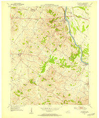
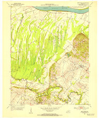
(24)- 1951 Map of Poole
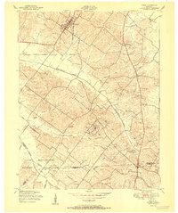 1951 Poole1951 Print · USGSNorthwest Kentucky is captured here during the early Cold War era as military and industrial interests expanded. Genealogists and local historians can trace family plots like Watson Cem and explore the rail corridor of the Illinois Central.
 - 1951 Map of Waverly
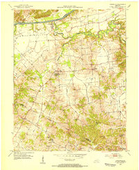
 1951 Waverly1951 Print · USGSUnion County is seen here in the early postwar years, when military expansion and oil exploration began to reshape the rural landscape. Genealogists and historians can trace the foundations of Camp Breckinridge, old family burial grounds like Odd Fellows Cem, and the rail-side community of Waverly.
 - 1951 Map of Robards
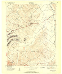
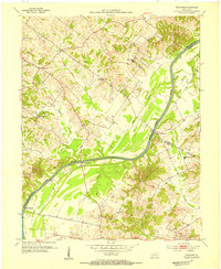
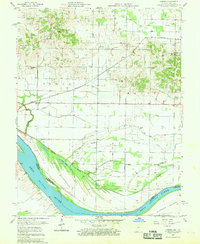
 1951 Robards1951 Print · USGSRobards sits at a critical rail and river junction south of the Ohio River during the early postwar years. Genealogists and local researchers can trace a dense network of family burial sites like Denton Cem and Smith Cem, or locate the mid-century Oil Fields.
 - 1951 Map of Yankeetown, 1952 Print
 1951 Yankeetown1952 Print · USGSThe banks of the Ohio River in the early fifties reveal a landscape of river-bottom settlements and upland farms. Researchers can trace the layout of Scuffletown and Carlinburg, find early Oil Wells, and locate rural landmarks like St Rupert Ch and Vanada Cem.2 unique versions available
 - 1951 Map of Spottsville, 1953 Print
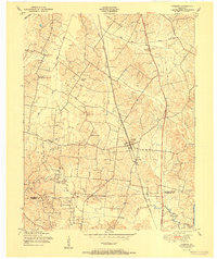
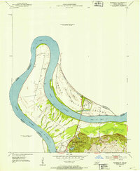
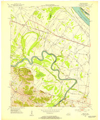
 1951 Spottsville1953 Print · USGSHenderson County's riverbank communities thrived in the early fifties amid a landscape of family farms and active oil exploration. Genealogists and historians can trace local landmarks like County Training Sch, the Ridgewood Ch, and the riverside depot at Baskett.
 - 1952 Map of Evansville, 1953 Print
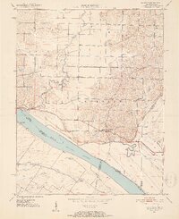
 1952 Evansville1953 Print · USGSThe Ohio River floodplain at the Indiana-Kentucky border comes alive in this early 1950s survey. Genealogists and local historians can trace family landholdings like Mc Clair and Bennett alongside landmarks such as Dade Park and White City.
 - 1952 Map of Mount Vernon, 1953 Print
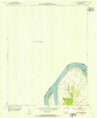 1952 Mount Vernon1953 Print · USGSThe Ohio River bend south of Mount Vernon comes into focus in the early fifties, marking the intersection of Posey, Henderson, and Union counties. Genealogists and river historians can trace the contours of Slim Island and the marshy edges of Grassy Pond.2 unique versions available
 - 1952 Map of Henderson, 1953 Print
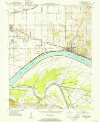
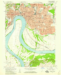
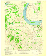
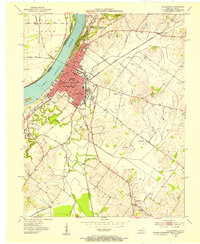 1952 Henderson1953 Print · USGSHenderson thrived as a vital river and rail crossroads in the early fifties, just as local oil exploration was dotting the landscape. Genealogists can trace family footprints across Fairmont Cemetery, visit Marshall Ch, or locate the old Audubon Sch.
 - 1952 Map of Newburgh, 1953 Print
 1952 Newburgh1953 Print · USGSThe Indiana-Kentucky borderlands along the Ohio River come to life in the early fifties, showing the transition from agricultural bottomlands to riverfront settlements. Researchers can trace family roots at Rose Hill Cem or locate the historic Angel Mounds State Memorial and Lock No 47.2 unique versions available
 - 1952 Map of Reed, 1953 Print
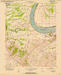
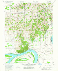
 1952 Reed1953 Print · USGSThe Henderson and Daviess County line follows the serpentine Green River in the early fifties, revealing a landscape of river-bottom farms and active oil extraction. Genealogists and local historians can trace family roots through sites like Birk City, Mt Zion Ch, and Hamilton Ferry.
 - 1952 Map of Wilson, 1954 Print
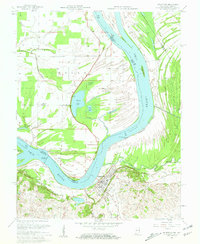
 1952 Wilson1954 Print · USGSThe Ohio River loops through this borderland in the early fifties, defining a landscape of deep sloughs and timbered ridges. Genealogists can trace family names and sites at Geneva, St Johns Ch, and the Clay Cem while exploring the river's Lock and Dam No 48.
 - 1952 Map of Uniontown, 1954 Print
 1952 Uniontown1954 Print · USGSUniontown and the surrounding river bottomlands are captured here in the early 1950s at a time of active petroleum extraction. Researchers can locate St Agnes Ch, trace the old Ferry crossing, and identify numerous Oil Wells across the landscape.2 unique versions available
 - 1952 Map of Smith Mills, 1954 Print
 1952 Smith Mills1954 Print · USGSThe Ohio River bottomlands of Henderson County come into focus during the early 1950s, showing a landscape of sloughs and rising petroleum production. Genealogists can locate family landmarks like Smith Mills Cem and St Francis Ch alongside the many Oil Wells near Alzey.2 unique versions available
 - 1953 Map of Delaware, 1954 Print
 1953 Delaware1954 Print · USGSThe Green River valley comes to life in the early fifties, showing a rural Kentucky landscape of active oil wells and riverfront landings. Genealogists can trace family names at Boston Cem and Mackey Cem or locate the old Delaware and Euterpe settlements.3 unique versions available
 - 1953 Map of Curdsville, 1954 Print
 1953 Curdsville1954 Print · USGSDaviess and McLean counties come into focus in the early 1950s, revealing a landscape defined by the winding Green River and rural industry. Researchers can trace family roots through sites like Mt St Joseph Academy, McCain Cem, and the active Oil Wells of the era.3 unique versions available
 - 1954 Map of Evansville
 1954 Evansville1954 Print · USGSThe Ohio River borderlands between Indiana and Kentucky appear here during a period of robust industrial and military growth. Genealogists and researchers can trace the rail corridors of the Illinois Central and find landmarks like US Lock and Dam No 48 or Camp Breckinridge.
 - 1957 Map of West Franklin, 1959 Print
 1957 West Franklin1959 Print · USGSSouthwestern Indiana and the Kentucky borderlands meet along the Ohio River in the late fifties. Genealogists can trace family names across Nashville Hollow and locate rural landmarks like St Peters Ch, West Franklin, and Diamond Island.2 unique versions available
 - 1957 Map of Caborn, 1959 Print
 1957 Caborn1959 Print · USGSSouthwestern Indiana river life is centered on the Ohio River and the small hamlets of Bufkin and Caborn during the late fifties. Genealogists can locate family landmarks like St Johns Cem, Hartman Sch, and Mt Pleasant Ch among the complex sloughs and ditches of the river valley.2 unique versions available
 - 1957 Map of Evansville, 1959 Print
 1957 Evansville1959 Print · USGSEvansville is seen in a period of significant postwar growth, where the industrial riverfront meets a rapidly expanding network of neighborhoods and schools. Researchers can trace family roots through numerous local landmarks like Evansville College, Bosse Field, and the St Marys Hospital.2 unique versions available
 - 1957 Map of Mount Vernon, 1960 Print
 1957 Mount Vernon1960 Print · USGSMount Vernon sits at a vital mid-century crossroads where the Ohio River meets major rail lines. Researchers can trace family history at Black Chapel, St Matthews Cem, and rural outposts like Dead Mans Crossing and Upton.2 unique versions available
 - 1957 Map of Evansville, 1969 Print
 1957 Evansville1969 Print · USGSIndiana and Kentucky meet along the Ohio River in this mid-century survey of a vital industrial and transport corridor. Genealogists and historians can trace the development of river towns like Owensboro and Newburgh or locate old rail lines like the Southern Ry.3 unique versions available
 - 1958 Map of Uniontown, 1959 Print
 1958 Uniontown1959 Print · USGSThe Ohio River bend at the Kentucky-Indiana border comes alive in this late-fifties survey, showing a landscape of river navigation and oil extraction. Researchers can locate the Uniontown Cem, the Illinois Central rail line, and historic river markers like Dam No 49 (Mile 845).2 unique versions available
 - 1959 Map of Wilson, 1960 Print
 1959 Wilson1960 Print · USGSThe Ohio River meanders between Henderson County and Indiana in the late fifties, revealing a landscape of fertile bottomlands and complex river sloughs. Genealogists and local historians can locate Geneva, Lock and Dam No 48, and rural markers like St Johns Ch and Clay Cem.2 unique versions available
 - 1959 Map of Henderson, 1960 Print
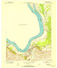
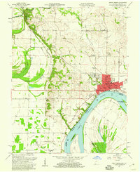
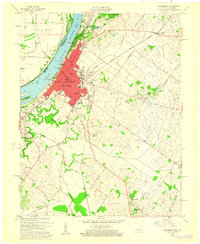 1959 Henderson1960 Print · USGSThe riverfront city of Henderson thrived in the late fifties as a hub of Kentucky industry and civic life. Genealogists can trace family names through local sites like Fairmont Cemetery, Walnut Hill Ch, and the rural community of Anthoston.
End of results
Showing maps 1-24 of 24
Top cities of Henderson County
Frequently asked questions
- What are the different types of historical maps available for Henderson County?
- What is the oldest map of Henderson County?
- Where can I purchase historical maps of Henderson County for my home or office?
- Where can I download high-res historical maps of Henderson County?
- Are there historical topographic maps available for Henderson County?
- Is there historical aerial imagery available for Henderson County?
- Where are historical maps of Henderson County sourced from?