2020s Maps of Jackson County, Kentucky
Explore 11 historic maps of Jackson County from the 2020s. These maps offer a rare glimpse into what life looked like during the 2020s — showing old roads, neighborhoods, homes, and landmarks that have changed or disappeared over time.
Whether you're researching your family's past, planning a metal detecting trip, or studying how Jackson County's landscape evolved across the 2020s, these high-resolution maps are a powerful tool for exploring the history of this region.
- Focus on a specific era: All maps on this page are from the 2020s, giving you a focused view of this time period.
- See what’s changed: Compare century-old streets, trails, and buildings to today's modern landscape using overlays and satellite layers.
- Research with precision: Use these maps for genealogy, historical research, land use analysis, or educational projects.
- View, download, or print: Maps are fully viewable online in high resolution, and can be downloaded or printed for your own records.
Start exploring Jackson County's history through authentic maps from the 2020s. This is your window into the past.
Jackson County, KY maps
(11)- 2022 Map of Parrot, 2022 Print
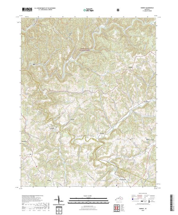 2022 Parrot2022 Print · USGSJackson and Laurel Counties appear here in the early 2020s, showing a landscape defined by the Daniel Boone National Forest. Researchers can trace old family names at Mount Zion Cem and locate rural communities such as Victory, Dabolt, and Greenmount.
 - 2022 Map of Livingston, 2022 Print
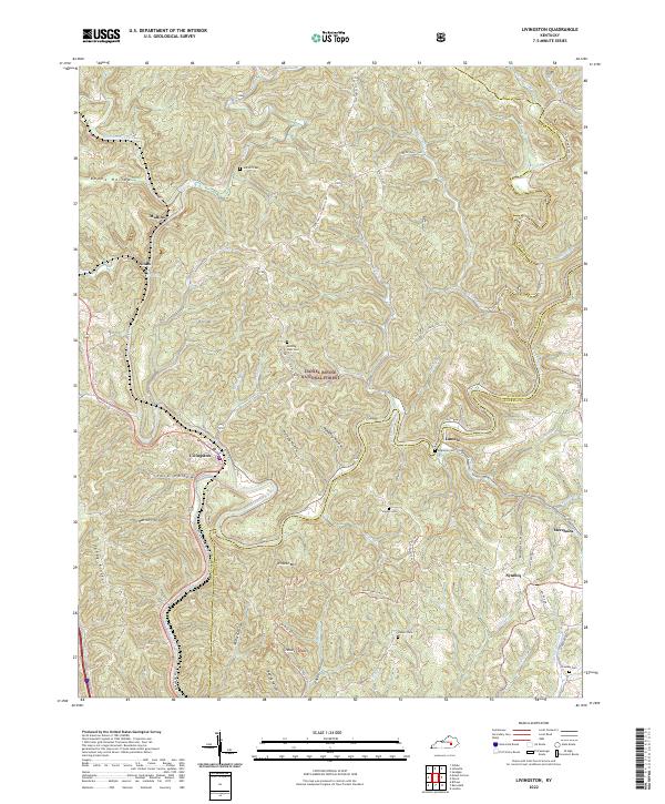 2022 Livingston2022 Print · USGSThe Rockcastle River valley in the early 2020s remains a landscape of deep hollows and timbered ridges. Researchers can trace rural cemetery locations like Jep Hill Cem and Robinson Cem or follow the Sheltoee Trace Trl through Livingston.
 - 2022 Map of McKee, 2022 Print
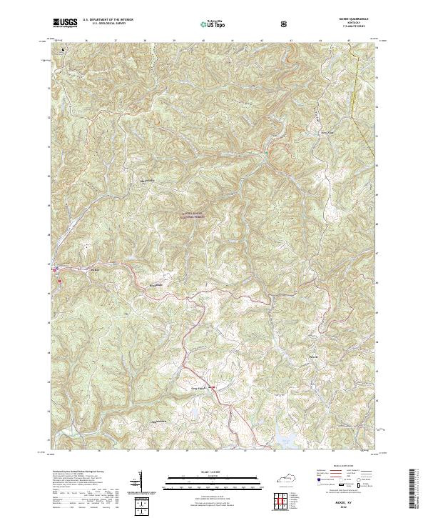 2022 McKee2022 Print · USGSJackson County is shown in detail during the early 2020s, centered on the community of McKee and the surrounding woodlands. Researchers can trace rural roads and family landmarks like Farmer Cemetery Rd, the Stelle Cemeteries, and Beulah Lake.
 - 2022 Map of Maulden, 2022 Print
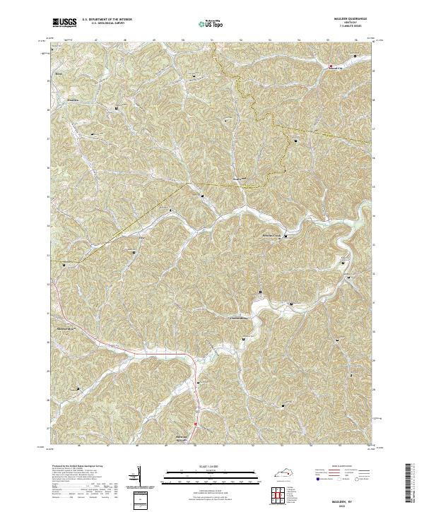 2022 Maulden2022 Print · USGSClay and Owsley counties appear here in the early twenty-first century, showing a landscape of upland hollows and small creek-side settlements. Genealogists can trace family names at Robinson Cem, Sacker Cem, and the old crossroads at Chestnutburg.
 - 2022 Map of Sturgeon, 2022 Print
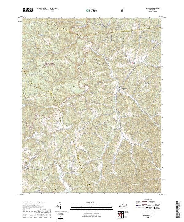 2022 Sturgeon2022 Print · USGSIn the hills of eastern Kentucky, this 2022 survey captures the isolated rural character and family history of Owsley County. Genealogists can locate several family burial sites including Logan Cemetery and Oliver Cem near the communities of Sturgeon and Travellers Rest.
 - 2022 Map of Sandgap, 2022 Print
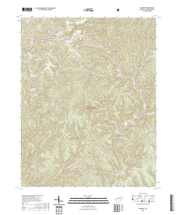 2022 Sandgap2022 Print · USGSJackson County, Kentucky, remains a land of deep ridges and historic trails in the early twenty-first century. Researchers can trace the path of the Sheltowee Trace Trl through the Daniel Boone National Forest and locate family landmarks like Carpenter Cem near Sandgap.
 - 2022 Map of Tyner, 2022 Print
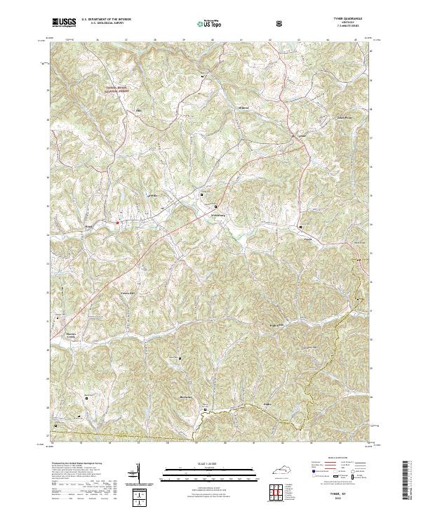 2022 Tyner2022 Print · USGSJackson County is documented here in the early 2020s, showing a landscape of ridge-top settlements and winding creek valleys. Researchers can trace family history through sites like Castee Cem or explore the area around Annville and Moores Creek.
 - 2022 Map of Bighill, 2022 Print
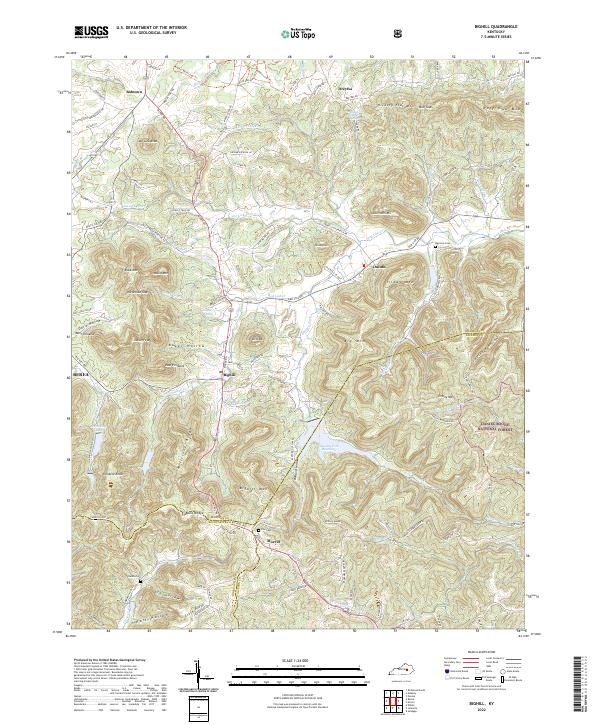 2022 Bighill2022 Print · USGSThe foothills of the Cumberland Plateau meet the Kentucky Bluegrass in the early 2020s, revealing a landscape of high pinnacles and deep-cut hollows. Researchers can trace rural lineages through sites like Red Lick Cem, Burnt Bridge, and the historic crossroads of Bighill and Dreyfus.
 - 2022 Map of Alcorn, 2022 Print
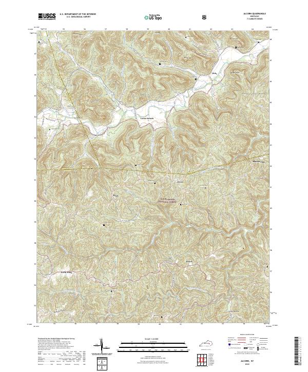 2022 Alcorn2022 Print · USGSThe Kentucky hills where Madison, Estill, and Jackson Counties converge appear in high detail during this contemporary era. Genealogists and local historians can trace family locations through numerous named burial sites like Skinner Cem, Gum Cem, and Isaacs Cem.
 - 2022 Map of Johnetta, 2022 Print
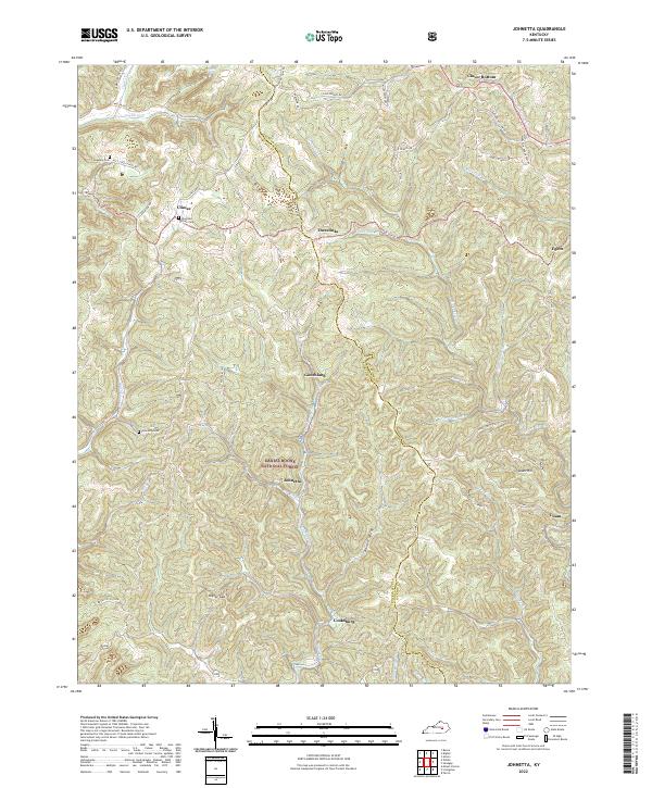 2022 Johnetta2022 Print · USGSThe Rockcastle and Jackson County line follows the ridge tops of this Kentucky landscape as it appeared in the early 2020s. Researchers can locate family landmarks like Johnetta Cemetery, the Johnson School, and the settlement of Threelinks.
 - 2022 Map of Leighton, 2022 Print
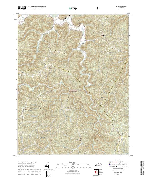 2022 Leighton2022 Print · USGSJackson and Estill counties are mapped here during the early 2020s, showing a landscape defined by forest ridges and family homesteads. Genealogists can trace decades of local history through namesake sites like Callahan Cem, Silver Mine Hollow, and the Sheltowee Trace Trl.
End of results
Showing maps 1-11 of 11
Top cities of Jackson County
Frequently asked questions
- What are the different types of historical maps available for Jackson County?
- What is the oldest map of Jackson County?
- Where can I purchase historical maps of Jackson County for my home or office?
- Where can I download high-res historical maps of Jackson County?
- Are there historical topographic maps available for Jackson County?
- Is there historical aerial imagery available for Jackson County?
- Where are historical maps of Jackson County sourced from?