2020s Maps of St. Matthews, Kentucky
Explore 4 historic maps of St. Matthews from the 2020s. These maps offer a rare glimpse into what life looked like during the 2020s — showing old roads, neighborhoods, homes, and landmarks that have changed or disappeared over time.
Whether you're researching your family's past, planning a metal detecting trip, or studying how St. Matthews's landscape evolved across the 2020s, these high-resolution maps are a powerful tool for exploring the history of this region.
- Focus on a specific era: All maps on this page are from the 2020s, giving you a focused view of this time period.
- See what’s changed: Compare century-old streets, trails, and buildings to today's modern landscape using overlays and satellite layers.
- Research with precision: Use these maps for genealogy, historical research, land use analysis, or educational projects.
- View, download, or print: Maps are fully viewable online in high resolution, and can be downloaded or printed for your own records.
Start exploring St. Matthews's history through authentic maps from the 2020s. This is your window into the past.
St. Matthews, KY maps
(4)- 2022 Map of Anchorage, 2022 Print
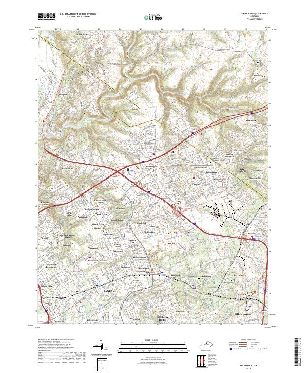 2022 Anchorage2022 Print · USGSThe eastern outskirts of Louisville are seen here in the early 2020s, showing a landscape of established neighborhoods and waterways. Trace family history at Berrytown Cem or explore the developments around Pewee Valley and Harrods Creek.
 - 2022 Map of Louisville East, 2022 Print
 2022 Louisville East2022 Print · USGSThe eastern suburbs of Louisville are shown in the early 2020s, highlighting a landscape defined by historic neighborhoods and institutional anchors. Local researchers can trace family plots at Cave Hill Cemetery or explore the transit corridors of the L & N RR and Bowman Field.
 - 2022 Map of Jeffersonville, 2022 Print
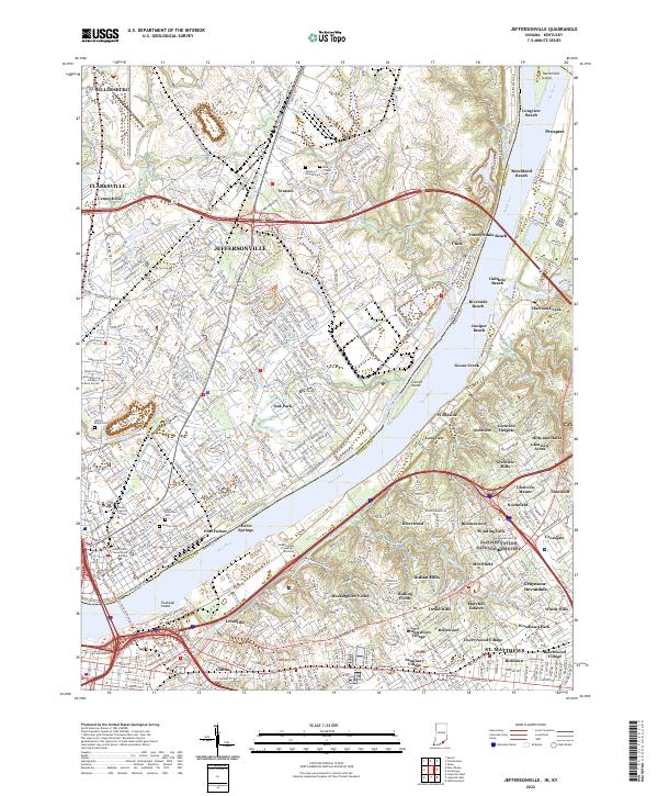 2022 Jeffersonville2022 Print · USGSThe riverfront communities of Indiana and Kentucky are shown here in the early twenty-first century as they flank the Ohio River. Researchers can trace local landmarks and neighborhood growth from the Clark County Government Building to family plots at Walnut Ridge Cem and Saint Anthonys Cem.
 - 2022 Map of Jeffersontown, 2022 Print
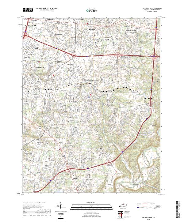 2022 Jeffersontown2022 Print · USGSEastern Jefferson County in the early 2020s shows a landscape of established suburban neighborhoods and historical corridors. Genealogists and local historians can trace burial sites like Middletown Historic Cem and the small-town roots of Jeffersontown and Ashville.
End of results
Showing maps 1-4 of 4
Top cities near St. Matthews
- Louisville historical maps
- Jeffersonville historical maps
- New Albany historical maps
- Jeffersontown historical maps
- Clarksville historical maps
- Shively historical maps
See more
Top neighborhoods of St. Matthews
- Broad Fields historical maps
- Fairmeade historical maps
- Parkside historical maps
- Springlee historical maps
- Cherrywood Village historical maps
- Plymouth Village historical maps
See more
Frequently asked questions
- What are the different types of historical maps available for St. Matthews?
- What is the oldest map of St. Matthews?
- Where can I purchase historical maps of St. Matthews for my home or office?
- Where can I download high-res historical maps of St. Matthews?
- Are there historical topographic maps available for St. Matthews?
- Is there historical aerial imagery available for St. Matthews?
- Where are historical maps of St. Matthews sourced from?