2020s Maps of Johnson County, Kentucky
Explore 13 historic maps of Johnson County from the 2020s. These maps offer a rare glimpse into what life looked like during the 2020s — showing old roads, neighborhoods, homes, and landmarks that have changed or disappeared over time.
Whether you're researching your family's past, planning a metal detecting trip, or studying how Johnson County's landscape evolved across the 2020s, these high-resolution maps are a powerful tool for exploring the history of this region.
- Focus on a specific era: All maps on this page are from the 2020s, giving you a focused view of this time period.
- See what’s changed: Compare century-old streets, trails, and buildings to today's modern landscape using overlays and satellite layers.
- Research with precision: Use these maps for genealogy, historical research, land use analysis, or educational projects.
- View, download, or print: Maps are fully viewable online in high resolution, and can be downloaded or printed for your own records.
Start exploring Johnson County's history through authentic maps from the 2020s. This is your window into the past.
Johnson County, KY maps
(13)- 2022 Map of Redbush, 2022 Print
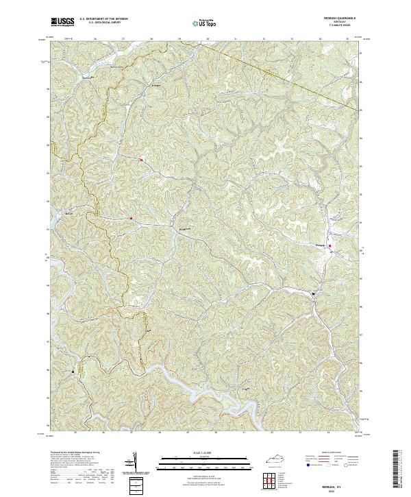 2022 Redbush2022 Print · USGSIn the early twenty-first century, these rural Kentucky highlands near the Johnson and Lawrence county line maintain their traditional ridge-and-hollow settlement patterns. Researchers can locate family landmarks such as Salyers Cem and Jenkins Cem or trace the early paths of Keaton and Flatgap.
 - 2022 Map of Prestonsburg, 2022 Print
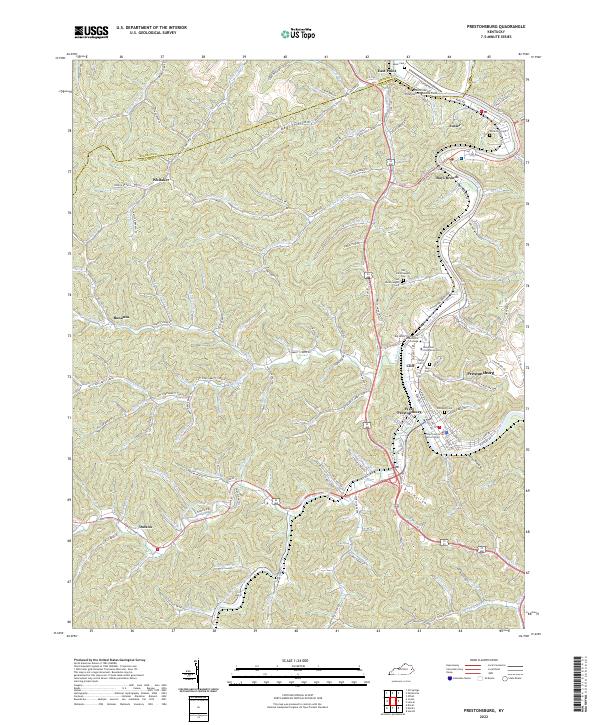 2022 Prestonsburg2022 Print · USGSThe Levisa Fork valley in 2022 serves as a vital hub for education and law in Floyd County. Researchers can trace family roots at Governors Cem or locate the campuses of Morehead State University and Big Sandy Community and Technical College.
 - 2022 Map of Mazie, 2022 Print
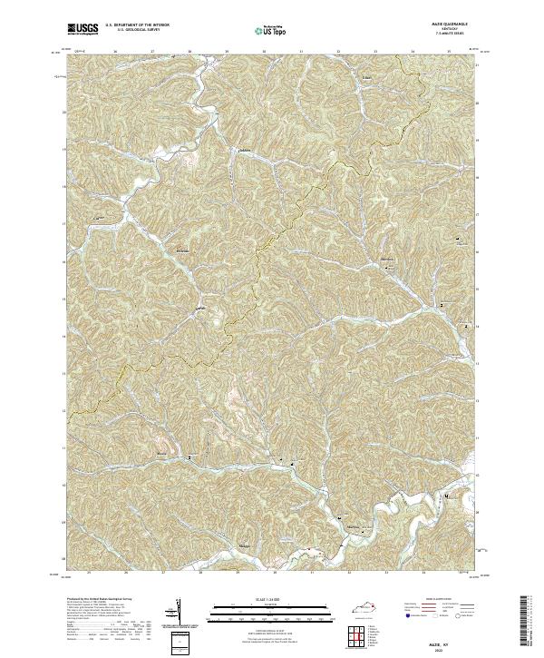 2022 Mazie2022 Print · USGSThe borderlands of Elliott and Lawrence Counties in eastern Kentucky remain a network of narrow valleys and family settlements. Local researchers can trace family lines through numerous burial sites like Hay Cem, Sparks Cem, and the cluster of Boggs family cemeteries.
 - 2022 Map of Richardson, 2022 Print
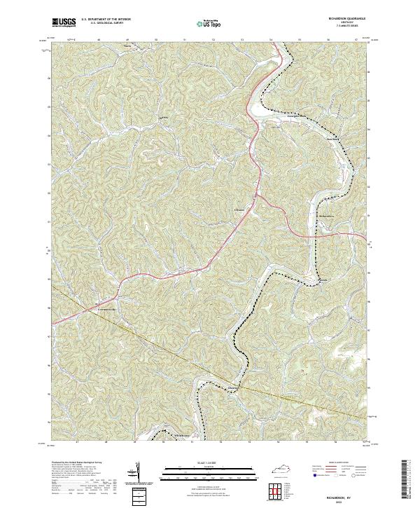 2022 Richardson2022 Print · USGSEastern Kentucky's narrow valleys and ridge-top borders come into focus in this recent survey. Genealogists and local historians can trace family-named landmarks from Butcher Cem to settlements like Lowmansville and Richardson.
 - 2022 Map of Sitka, 2022 Print
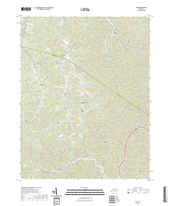 2022 Sitka2022 Print · USGSThe foothills of Johnson and Lawrence Counties are shown here during the early twenty-first century, featuring a landscape carved by winding hollows. Researchers can locate family landmarks like the Stambaugh Cem and old crossroads at Chandlerville and Wilbur.
 - 2022 Map of Ivyton, 2022 Print
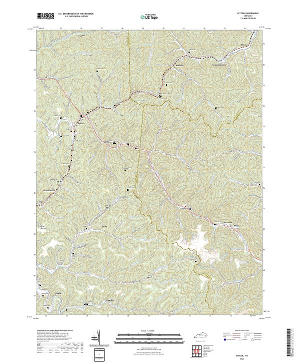 2022 Ivyton2022 Print · USGSThe headwaters of the Licking River and Middle Creek appear here in the early 2020s, showing a landscape defined by deep hollows and family homesteads. Researchers can locate dozens of remote burial sites like Hackworth Cem and trace the Dawkins Line Rail Trl.
 - 2022 Map of Oil Springs, 2022 Print
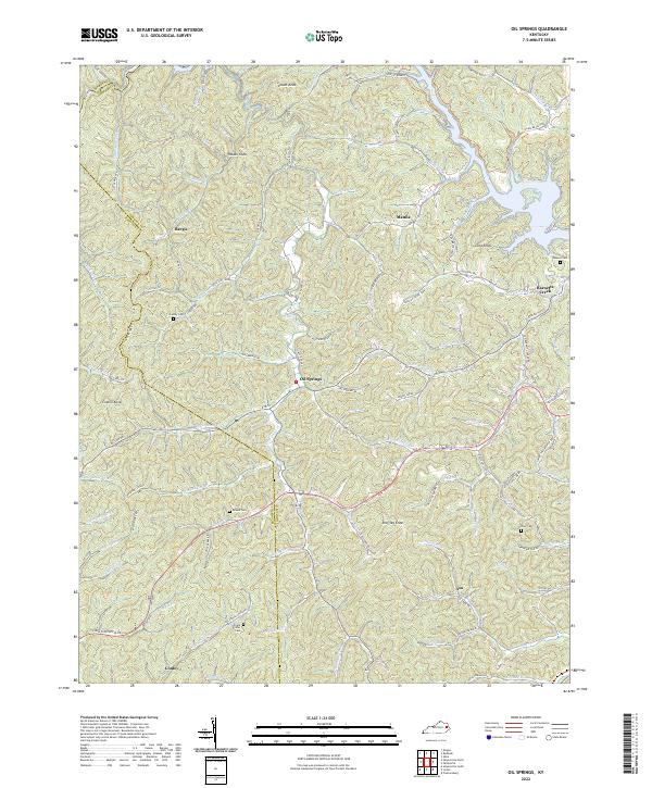 2022 Oil Springs2022 Print · USGSThe hill country of Johnson County in the early 2020s shows a landscape of small settlements and family history tucked along winding creek forks. Genealogists can trace ancestral land near the Frank D Prater Cem, Adams Cem, or the community of Oil Springs.
 - 2022 Map of Paintsville, 2022 Print
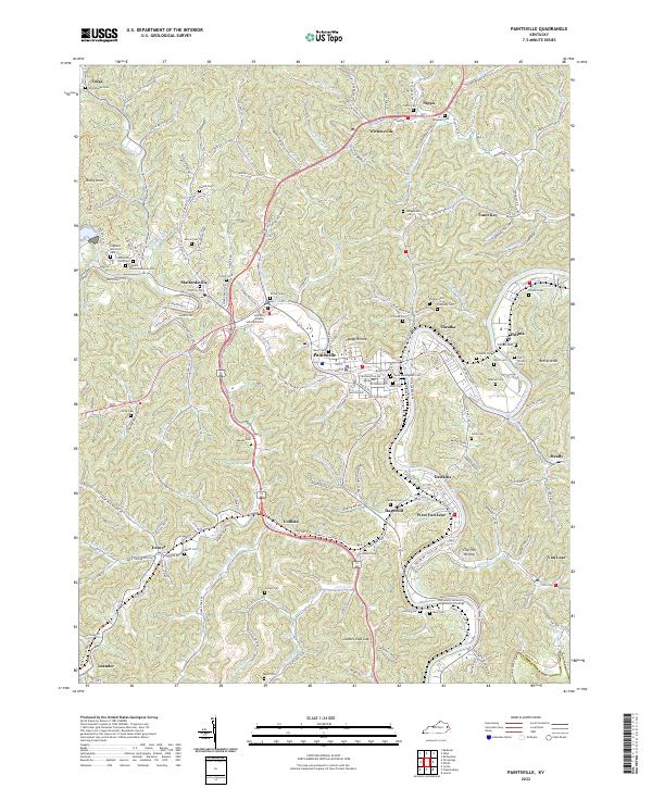 2022 Paintsville2022 Print · USGSJohnson County is shown here in the early twenty-first century, centered on the confluence of Paint Creek and the Levisa Fork. Researchers can trace dozens of family burial sites like Whipporwill Cem or follow the path of the historic Dawkins Line Rail-Trl.
 - 2022 Map of Offutt, 2022 Print
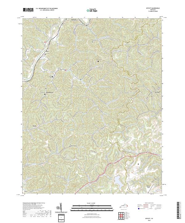 2022 Offutt2022 Print · USGSThe Levisa Fork region in eastern Kentucky shows a landscape defined by deep hollows and river-bend settlements in the early 2020s. Genealogists can locate family landmarks like Ballard Butcher Cem, Williamsport, and the curiously named Horse in Tree Hollow.
 - 2022 Map of Inez, 2022 Print
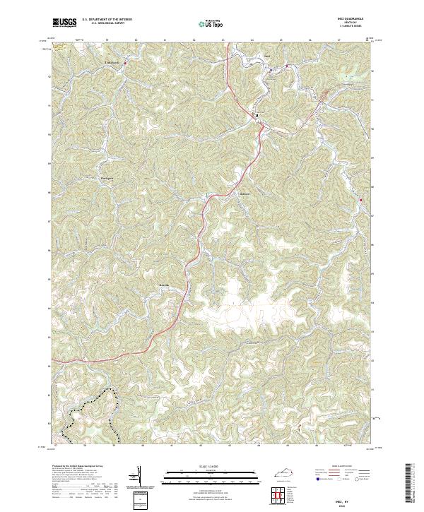 2022 Inez2022 Print · USGSInez and the surrounding hollows of Martin County are captured here in the early 2020s, showing the enduring settlement patterns of the Cumberland Plateau. Researchers can trace family history at Ward Cem or locate old community centers like Davella and Tomahawk.
 - 2022 Map of Milo, 2022 Print
 2022 Milo2022 Print · USGSMartin County, Kentucky, at the start of the 2020s, reveals a deeply dissected landscape where family and community history is etched into every hollow. Researchers can trace ancestral locations near the Castle School, Buffalo Horn Cem, and Stidham.
 - 2022 Map of Salyersville North, 2022 Print
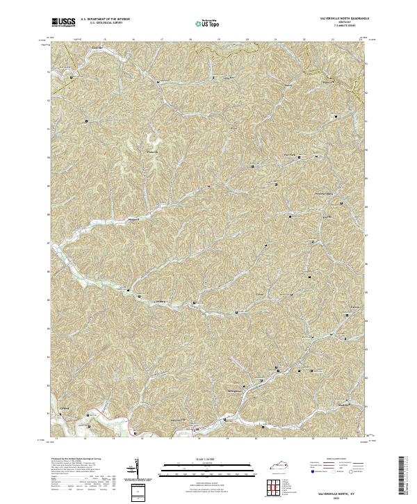 2022 Salyersville North2022 Print · USGSMagoffin County near the headwaters of the Licking River is documented here in its contemporary landscape. Researchers can trace dozens of family cemeteries like Christopher Gullet Cem and Tackett Memorial Cem or locate community centers in Salyersville and Lickburg.
 - 2023 Map of Lancer, 2023 Print
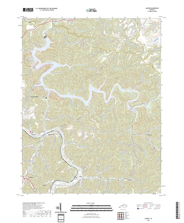 2023 Lancer2023 Print · USGSFloyd County at the start of the 2020s shows a landscape where recreation and community history meet along the winding waters of Dewey Lake. Researchers can trace local lineage through sites like Lockhart Cem or locate old valley settlements such as Endicott and Dwale.
End of results
Showing maps 1-13 of 13
Top cities of Johnson County
Frequently asked questions
- What are the different types of historical maps available for Johnson County?
- What is the oldest map of Johnson County?
- Where can I purchase historical maps of Johnson County for my home or office?
- Where can I download high-res historical maps of Johnson County?
- Are there historical topographic maps available for Johnson County?
- Is there historical aerial imagery available for Johnson County?
- Where are historical maps of Johnson County sourced from?