Old Maps of Knox County, Kentucky for Genealogy
Trace your family roots with 115 historic maps of Knox County. These high-res maps reveal old neighborhoods, homesites, landmarks, and streets — helping you uncover where your ancestors lived and how the area evolved over time.
- Explore historic neighborhoods: Identify where your relatives may have lived in the 1800s or 1900s.
- Compare maps over time: Trace the changes in streets, buildings, and landmarks for multi-generational research.
- Perfect for genealogy & ancestry research: Used by family historians and researchers to map out lineage and migration.
These maps are an incredible resource for exploring your personal connection to Knox County's past.
Knox County, KY maps
(115)- 1886 Map of Cumberland Gap
 1886 Cumberland Gap1886 Print · USGSThe tri-state border region around the Cumberland Gap appears here in the 1880s, before modern development transformed these mountain passes. Genealogists and historians can trace early river crossings and settlements like Flat Lick, Tye Ferry, and Campbell Ford.
 - 1888 Map of Cumberland Gap
 1888 Cumberland Gap1888 Print · USGSThe tri-state wilderness of the Appalachians is captured in the late 1880s, centered on the strategic crossing at the Cumberland Gap. Trace the early river-and-road economy through features like Tye's Ferry, McHenry Ford, and the old town sites of Barboursville and Pineville.
 - 1890 Map of Williamsburg
 1890 Williamsburg1890 Print · USGSThe Kentucky and Tennessee borderlands come alive in the late nineteenth century as the coal industry and railroads expand. Genealogists can trace family roots in Williamsburgh or locate early industrial sites like Beaver Mines and Steels Mill.2 unique versions available
 - 1891 Map of Manchester
 1891 Manchester1891 Print · USGSEastern Kentucky's mountain settlements and early salt industry come to life in the years following the Reconstruction era. Genealogists and historians can locate early family landmarks such as Moore Store, the Salt Works, and Boush Store.7 unique versions available
 - 1891 Map of Cumberland Gap
 1891 Cumberland Gap1891 Print · USGSThe tri-state mountain corridor appears here in the late nineteenth century, showing the critical gateways through the Cumberland Mountains. Researchers can trace early river crossings like Mshenry Ford and historic settlements such as Barboursville and Pineville.7 unique versions available
 - 1894 Map of Williamsburg
 1894 Williamsburg1894 Print · USGSThe Cumberland River valley and the Kentucky-Tennessee borderlands are captured here during the late nineteenth-century coal and rail expansion. Researchers can trace early industrial sites like Beaver Mines and Kensee Coal Mine or locate family roots in Whitley and Chitwood.5 unique versions available
 - 1903 Map of Pineville
 1903 Pineville1903 Print · USGSThe Cumberland Gap region in the early 1900s was a landscape defined by its formidable ridges and vital river passages. Trace the steep ascent of Cumberland Mountain and the winding course of the Cumberland River as they appeared over a century ago.
 - 1952 Map of Corbin, 1953 Print
 1952 Corbin1953 Print · USGSCorbin and its surrounding coal-country settlements are captured here in the early fifties, showing the vital Louisville and Nashville rail corridor. Researchers can trace family sites at Resthaven Cem or locate community centers like Bacon Creek Sch and Harts Chapel.
 - 1952 Map of Barbourville, 1953 Print
 1952 Barbourville1953 Print · USGSBarbourville and the Cumberland River valley are captured in the early fifties during a period of rural transition. Genealogists can trace family lines through dozen of hillslope cemeteries and schools like Ketchen Sch, Dishman Sch, and Union College.2 unique versions available
 - 1952 Map of Heidrick, 1953 Print
 1952 Heidrick1953 Print · USGSKnox County was a hub of coal mining and rail transport in the early fifties, with ridges carved by new industry. Researchers can trace family homesteads near Jarvis Store, find small community centers like Baileys Switch, or locate old burial sites such as Dozier Cem.2 unique versions available
 - 1952 Map of Hima, 1953 Print
 1952 Hima1953 Print · USGSClay County's narrow hollows and ridge-line communities are shown here in the early 1950s. Genealogists and local historians can locate several family cemeteries and rural schoolhouses including Antioch Sch, Cottongim Cem, and New Home.2 unique versions available
 - 1952 Map of Blackwater, 1953 Print
 1952 Blackwater1953 Print · USGSLaurel County at the start of the 1950s reveals a landscape deeply connected to its pioneers and local congregations. Genealogists can trace family names through the Wilderness Road corridor and numerous rural landmarks like Camp Ground Sch and Bush Ch.2 unique versions available
 - 1952 Map of Fount, 1953 Print
 1952 Fount1953 Print · USGSKnox County in the early fifties is captured here as a landscape of tight-knit hollows and ridge-top settlements. Researchers can trace family history through dozens of localized sites like Dripping Spring Ch, the Louisville and Nashville line, and family cemeteries like Pittman Cem.
 - 1952 Map of Rockholds, 1954 Print
 1952 Rockholds1954 Print · USGSWhitley County hill country in the early fifties is mapped here as coal extraction began to shape the landscape around Rockholds. Researchers can trace family history through numerous rural landmarks like Brummett Ch, Cedar Gap Sch, and the McFarland Cem.4 unique versions available
 - 1952 Map of Frakes, 1954 Print
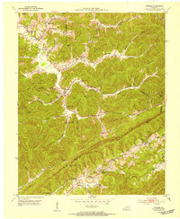 1952 Frakes1954 Print · USGSThe rugged borderlands of Whitley, Knox, and Bell counties are captured in the early fifties, showing a landscape of isolated ridges and tight hollows. Genealogists can locate family landmarks like the Croley Cemetery and the notable Henderson Settlement School.2 unique versions available
 - 1952 Map of Artemus, 1954 Print
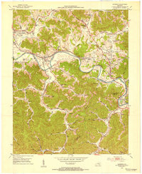 1952 Artemus1954 Print · USGSKnox County's river-and-rail corridor is captured here in the early fifties, showing the interplay between small-town life and the energy industry. Researchers can trace family roots at Binghamtown Cem or locate vanished landmarks like the Turkey Creek Mission and Boone Heights.2 unique versions available
 - 1952 Map of Davisburg, 1954 Print
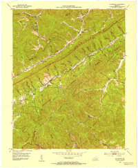 1952 Davisburg1954 Print · USGSBell County coal country in the early fifties shows a rugged landscape of rail-served hollows and mountain-top lookouts. Genealogists can locate several family cemeteries and country schools like Old Carroll Cem, Hignite Sch, and the Davisburg School.
 - 1954 Map of Ogle, 1955 Print
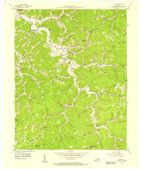 1954 Ogle1955 Print · USGSIn the mid-1950s, the hollows and creek branches of Clay County were home to a dense network of mountain communities and rural schools. Genealogists can trace family footprints through numerous local landmarks like White Cem, the Gooserock Sch, and the settlement of Brightshade.2 unique versions available
 - 1954 Map of Pineville, 1956 Print
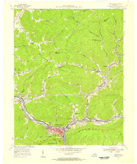 1954 Pineville1956 Print · USGSBell County in the mid-fifties shows a landscape shaped by coal and the Cumberland River. Genealogists and historians can trace rail-side settlements like Wallsend, Arjay, and Fourmile, alongside local landmarks like Chain Rock and the Lone Jack Sch.2 unique versions available
 - 1954 Map of Beverly, 1956 Print
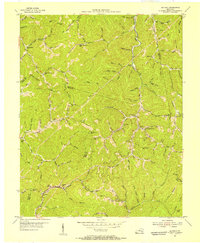 1954 Beverly1956 Print · USGSBell County and the surrounding ridges in the 1950s show a mountain landscape connected by the Red Bird River and the Louisville and Nashville. Trace local history at the Red Bird Mission Hospital or find family roots at Indian Grave Sch and Field.2 unique versions available
 - 1954 Map of Scalf, 1956 Print
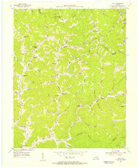 1954 Scalf1956 Print · USGSIn the mid-1950s, this area of Knox County was a network of remote hollows and mountain schools centered around Stinking Creek. You can trace rural life through landmarks like Salt Gum Ch, the Barnyard Sch, and Hammond.2 unique versions available
 - 1955 Map of Johnson City
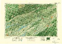 1955 Johnson City1955 Print · USGSEast Tennessee and the bordering highlands of Virginia and Kentucky appear here during the post-war industrial boom. You can trace the complex network of mountain ridges and new TVA lakes, from Johnson City to the coalfields near Middlesboro and Lynch.
 - 1956 Map of Corbin, 1966 Print
 1956 Corbin1966 Print · USGSThe Kentucky and Tennessee borderlands are captured here in the mid-fifties, showing the region's shift toward modern interstate travel and reservoir development. Genealogists and historians can trace old community lines near Albany and Monticello or locate early rail junctions along the Southern and Tennessee Central lines.3 unique versions available
 - 1957 Map of Johnson City, 1966 Print
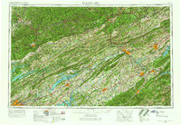 1957 Johnson City1966 Print · USGSUpper East Tennessee and Southwest Virginia are shown here during the mid-sixties transition of the Appalachians. Researchers can trace the industrial rail hubs of Kingsport, the sprawling waters of Cherokee Lake, and the historic Cumberland Gap.
 - 1957 Map of Jenkins, 1974 Print
 1957 Jenkins1974 Print · USGSThe Cumberland Plateau in the mid-twentieth century reveals a complex landscape of winding river valleys and deep-seated industry. Genealogists and historians can trace the development of Hazard, Jenkins, and Pikeville alongside extensive Numerous Oil and Gas Fields and the routes of the Chesapeake & Ohio Railway.
Showing maps 1-25 of 115
Top cities of Knox County
Frequently asked questions
- What are the different types of historical maps available for Knox County?
- What is the oldest map of Knox County?
- Where can I purchase historical maps of Knox County for my home or office?
- Where can I download high-res historical maps of Knox County?
- Are there historical topographic maps available for Knox County?
- Is there historical aerial imagery available for Knox County?
- Where are historical maps of Knox County sourced from?