1910s Maps of Charley, Kentucky
Explore 2 historic maps of Charley from the 1910s. These maps offer a rare glimpse into what life looked like during the 1910s — showing old roads, neighborhoods, homes, and landmarks that have changed or disappeared over time.
Whether you're researching your family's past, planning a metal detecting trip, or studying how Charley's landscape evolved across the 1910s, these high-resolution maps are a powerful tool for exploring the history of this region.
- Focus on a specific era: All maps on this page are from the 1910s, giving you a focused view of this time period.
- See what’s changed: Compare century-old streets, trails, and buildings to today's modern landscape using overlays and satellite layers.
- Research with precision: Use these maps for genealogy, historical research, land use analysis, or educational projects.
- View, download, or print: Maps are fully viewable online in high resolution, and can be downloaded or printed for your own records.
Start exploring Charley's history through authentic maps from the 1910s. This is your window into the past.
Charley, KY maps
(2)- 1914 Map of Inez
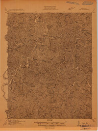 1914 Inez1914 Print · USGSThe Big Sandy River valley in the early twentieth century was a landscape of coal-country settlements and riverside rail stops. Researchers can trace the development of small communities like Whitehouse and Inez or locate vanished landmarks like Wells Chapel and Graves Shoals Sta.
 - 1916 Map of Inez
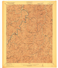 1916 Inez1916 Print · USGSMartin and Lawrence Counties are shown here during a period of rural growth and river-based transport. Genealogists can locate specific homesteads near Wells Chapel, track old post offices like Graves Shoals, or find local landmarks such as Sandlick School.3 unique versions available
End of results
Showing maps 1-2 of 2
Top cities near Charley
- Paintsville historical maps
- Louisa historical maps
- Van Lear historical maps
- Fort Gay historical maps
- West Van Lear historical maps
- Inez historical maps
See more
Frequently asked questions
- What are the different types of historical maps available for Charley?
- What is the oldest map of Charley?
- Where can I purchase historical maps of Charley for my home or office?
- Where can I download high-res historical maps of Charley?
- Are there historical topographic maps available for Charley?
- Is there historical aerial imagery available for Charley?
- Where are historical maps of Charley sourced from?