Old Maps of Louisa, Kentucky for Genealogy
Trace your family roots with 33 historic maps of Louisa. These high-res maps reveal old neighborhoods, homesites, landmarks, and streets — helping you uncover where your ancestors lived and how the area evolved over time.
- Explore historic neighborhoods: Identify where your relatives may have lived in the 1800s or 1900s.
- Compare maps over time: Trace the changes in streets, buildings, and landmarks for multi-generational research.
- Perfect for genealogy & ancestry research: Used by family historians and researchers to map out lineage and migration.
These maps are an incredible resource for exploring your personal connection to Louisa's past.
Louisa, KY maps
(33)- 1903 Map of Kenova
 1903 Kenova1903 Print · USGSThe tri-state river junction at Ashland and Kenova was a bustling industrial hub after the turn of the century. Trace early rail lines and mining settlements like Coalton and Boghead, or locate family landmarks along the Little Sandy River and Means Tunnel.5 unique versions available
 - 1904 Map of Kenova
 1904 Kenova1904 Print · USGSThe tri-state confluence of the Ohio River and Big Sandy River hums with early industrial activity at the start of the century. Genealogists can trace rail-side settlements and remote homesteads along Blaine Creek and near Mt Savage or Webbville.
 - 1911 Map of Louisa
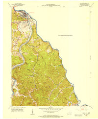
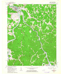
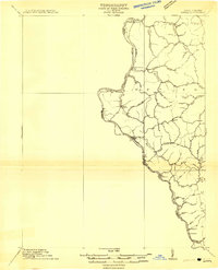 1911 Louisa1911 Print · USGSThe West Virginia borderlands along the Big Sandy River come to life in this early twentieth-century study of Wayne County. Trace family roots and vanished rail stops like Fort Gay, Glenhayes, and Saltpeter along the Norfolk and Western Railway line.
 - 1913 Map of Louisa
 1913 Louisa1913 Print · USGSThe river borders of West Virginia and Kentucky come alive in this pre-World War I survey of the Big Sandy valley. Genealogists can trace family footprints in Fort Gay, Saltpeter, and Glenhayes or locate the rural Buck Church.3 unique versions available
 - 1939 Map of Louisa
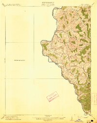
 1939 Louisa1939 Print · USGSThe borderlands of West Virginia and Kentucky are captured here in the late thirties, centered on the river junctions. Researchers can trace family ties at small rural sites like Double Cabin Sch, Elijah Ch, and the settlement of Fort Gay.3 unique versions available
 - 1953 Map of Prichard, 1954 Print
 1953 Prichard1954 Print · USGSThe Big Sandy River corridor comes into focus in the early 1950s as a vital transportation link between Kentucky and West Virginia. Genealogists and rail historians can trace the paths of the Norfolk and Western railroad and locate local landmarks like Buchanan Chapel and Catalpa.2 unique versions available
 - 1953 Map of Louisa, 1955 Print
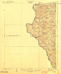
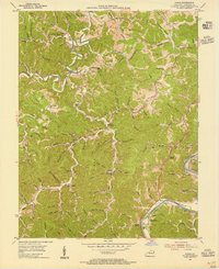
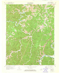
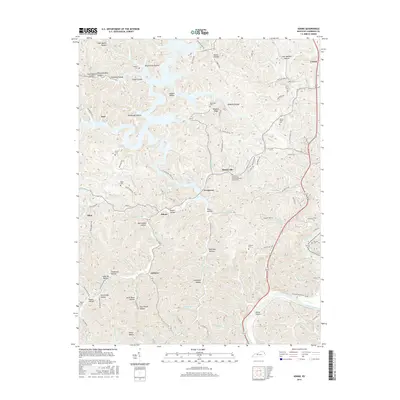
 1953 Louisa1955 Print · USGSLawrence County at the mid-century shows a landscape shaped by the confluence of the Big Sandy River and the Tug Fork. Genealogists can trace family names through numerous burial sites and rural churches like Elizabeth Jarrell Ch, Chapman Ch, and the Preece Cem.
 - 1953 Map of Adams, 1955 Print
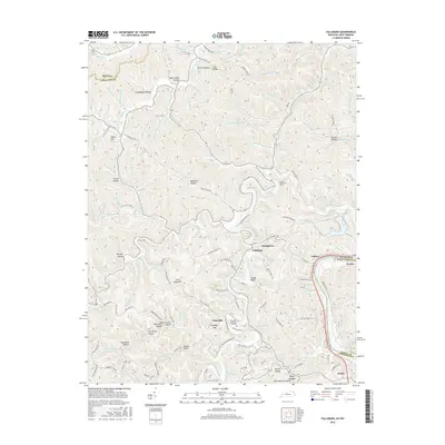
 1953 Adams1955 Print · USGSLawrence County's coal and oil country comes into focus in the early fifties, showing a landscape shaped by narrow hollows and ridge-top settlements. Researchers can trace family locations near Evergreen, find rural landmarks like Blackburn Sch, and locate the Strip Mines along the Chesapeake and Ohio rail line.2 unique versions available
 - 1953 Map of Fallsburg, 1955 Print
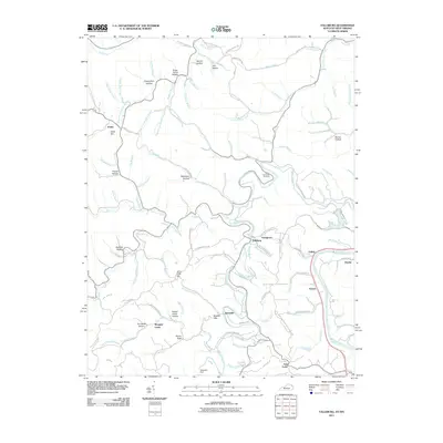
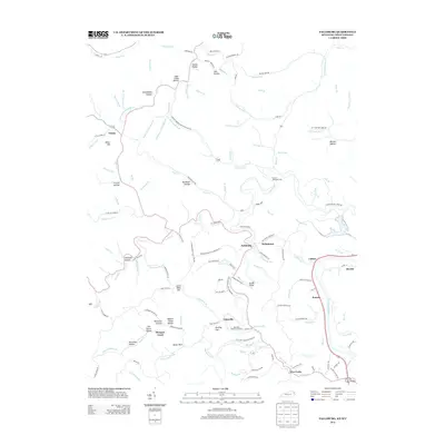
 1953 Fallsburg1955 Print · USGSLawrence County, Kentucky, is shown in the early fifties as a landscape defined by its deep hollows and creek-side settlements. Genealogists can locate family landmarks like Garret Chapel, Dennis Sch, and the scattered communities of Yatesville and Five Forks.2 unique versions available
 - 1957 Map of Huntington, 1966 Print
 1957 Huntington1966 Print · USGSThe industrial heart of the Ohio River valley is captured here in the mid-sixties, showing the growth of Huntington and Ashland. Researchers can trace the extensive rail networks of the Chesapeake and Ohio RR and locate sites like the Chief Cornstalk Hunting Ground.3 unique versions available
 - 1960 Map of Huntington
 1960 Huntington1960 Print · USGSThe tri-state river valley thrived in the late fifties as a hub of heavy industry and Appalachian rail transit. Genealogists and historians can trace the connection between river towns like Ashland and Portsmouth or locate family homesteads near Coleman Ridge.
 - 1962 Map of Prichard, 1963 Print
 1962 Prichard1963 Print · USGSThe Big Sandy River valley and its busy rail lines define this borderland in the early 1960s. Genealogists can trace family names through Shannon Cem or find local landmarks like Brick Church and Catalpa.5 unique versions available
 - 1962 Map of Louisa, 1963 Print
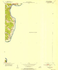
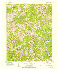
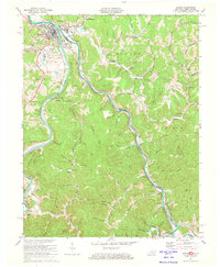
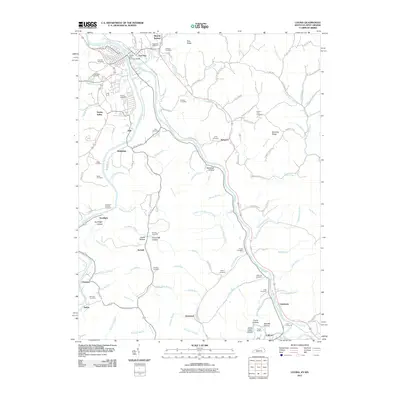
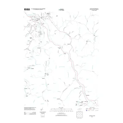
 1962 Louisa1963 Print · USGSThe confluence of the Tug and Levisa Forks at the West Virginia border defined the rail and river life of the early sixties. Genealogists can locate dozens of family burial grounds and rural landmarks such as Smith Chapel, Greenlawn Cem, and Torchlight Sch.
 - 1971 Map of Adams, 1973 Print
 1971 Adams1973 Print · USGSLawrence County, Kentucky, is shown here in the early 1970s as a landscape of deep hollows and active coal mining. Local researchers can trace family landmarks and rural hubs such as Beech Farm, Carters Chapel, and the Lower Twin Branch School.3 unique versions available
 - 1971 Map of Louisa, 1973 Print
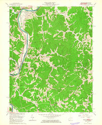
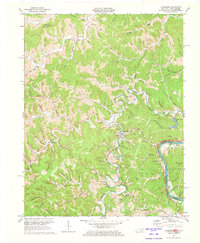
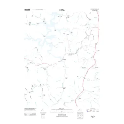
 1971 Louisa1973 Print · USGSThe tri-state border region of Kentucky and West Virginia is captured here in the early seventies as the river-and-rail economy shaped the valley. Genealogists can trace family names at Greenlawn Cem or McClure Cem, and locate rural landmarks like Old Pleasant Ch and the hamlet of Saltpetre.4 unique versions available
 - 1971 Map of Fallsburg, 1973 Print
 1971 Fallsburg1973 Print · USGSIn the early 1970s, the rugged borderlands of Lawrence County were a complex network of rail lines and creek-side settlements. Researchers can trace the legacy of family homesteads and industry through labels for the Covered Bridge, Garrett Chapel, and the coal-and-oil works of the Big Sandy River valley.4 unique versions available
 - 1982 Map of Huntington, 1983 Print
 1982 Huntington1983 Print · USGSThe tri-state region around Huntington and Ashland is shown in the early 1980s, documenting a landscape shaped by river commerce and coal-country railroads. Trace family roots and old routes through Barboursville, the Gas Field, and the Tug Fork valley.
 - 2010 Map of Adams, 2010 Print
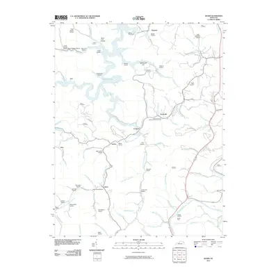 2010 Adams2010 Print · USGSCovers Louisa, including Adams, Ledocio, and other nearby areas
 - 2011 Map of Fallsburg, 2011 Print
 2011 Fallsburg2011 Print · USGSCovers Louisa, including Morgans Creek, Five Forks, and other nearby areas
 - 2011 Map of Louisa, 2011 Print
 2011 Louisa2011 Print · USGSCovers Louisa, including Fort Gay, Chapman, and other nearby areas
 - 2013 Map of Adams, 2013 Print
 2013 Adams2013 Print · USGSCovers Louisa, including Adams, Ledocio, and other nearby areas
 - 2013 Map of Louisa, 2013 Print
 2013 Louisa2013 Print · USGSCovers Louisa, including Fort Gay, Chapman, and other nearby areas
 - 2013 Map of Fallsburg, 2013 Print
 2013 Fallsburg2013 Print · USGSCovers Louisa, including Morgans Creek, Five Forks, and other nearby areas
 - 2016 Map of Adams, 2016 Print
 2016 Adams2016 Print · USGSCovers Louisa, including Adams, Ledocio, and other nearby areas
 - 2016 Map of Fallsburg, 2016 Print
 2016 Fallsburg2016 Print · USGSCovers Louisa, including Morgans Creek, Five Forks, and other nearby areas
Showing maps 1-25 of 33
Top cities near Louisa
Frequently asked questions
- What are the different types of historical maps available for Louisa?
- What is the oldest map of Louisa?
- Where can I purchase historical maps of Louisa for my home or office?
- Where can I download high-res historical maps of Louisa?
- Are there historical topographic maps available for Louisa?
- Is there historical aerial imagery available for Louisa?
- Where are historical maps of Louisa sourced from?