Old Maps of Zoe, Kentucky for Academic Research
Study the evolution of Zoe with 11 high-resolution historic maps. Whether you're teaching, researching, or modeling changes in land use, these maps provide essential visual documentation of urban, environmental, and geographic change.
- Analyze long-term change: Track patterns in development, transportation, and natural features.
- Ideal for environmental or urban studies: Support academic projects with primary historical map data.
- Use in the classroom or lab: Educators and researchers rely on these maps to bring historical context to life.
These maps are a powerful tool for teaching, research, and visualizing how Zoe has changed over the decades.
Zoe, KY maps
(11)- 1892 Map of Beattyville
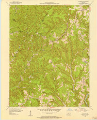
 1892 Beattyville1892 Print · USGSThe Kentucky River and its headwaters define this late nineteenth-century survey of the rugged Cumberland Plateau. Researchers can trace the early industrial sites of Estill Furnace and Fitchburg Furnace alongside the path of the Kentucky Union Railroad.6 unique versions available
 - 1953 Map of Zachariah, 1956 Print
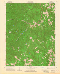
 1953 Zachariah1956 Print · USGSThe hills of Eastern Kentucky appear in the early fifties as a landscape of remote ridges and tight-knit hollows. Genealogists can trace family roots through Townsend Cem and Thacker Cem or locate old schoolhouses like Mt Paran Sch.2 unique versions available
 - 1957 Map of Jenkins, 1974 Print
 1957 Jenkins1974 Print · USGSThe Cumberland Plateau in the mid-twentieth century reveals a complex landscape of winding river valleys and deep-seated industry. Genealogists and historians can trace the development of Hazard, Jenkins, and Pikeville alongside extensive Numerous Oil and Gas Fields and the routes of the Chesapeake & Ohio Railway.
 - 1960 Map of Jenkins
 1960 Jenkins1960 Print · USGSEastern Kentucky and the West Virginia borderlands are captured at a mid-century peak of the coal and rail era. Trace the industrial corridors of the Chesapeake and Ohio RR through mountain hubs like Hazard and Jenkins.
 - 1966 Map of Zachariah, 1968 Print
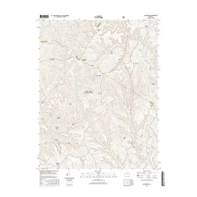
 1966 Zachariah1968 Print · USGSKentucky's mountain frontier comes into focus during the mid-sixties, where the borders of Lee, Wolfe, Estill, and Powell counties converge. Researchers can trace rural genealogy and land use through landmarks like Townsend Cem, Fixer, and the local Oil Field.2 unique versions available
 - 1982 Map of Irvine, 1983 Print
 1982 Irvine1983 Print · USGSEastern Kentucky's hill country is mapped here in the early eighties, showcasing the complex river valleys and ridge-top settlements of the Cumberland Plateau. Researchers can trace historic rail lines like the Louisville & Nashville RR or locate rural communities such as Beattyville and Slade.
 - 2011 Map of Zachariah, 2011 Print
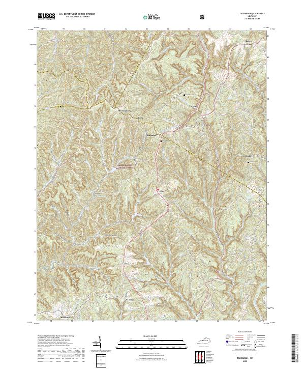
 2011 Zachariah2011 Print · USGSCovers Zoe, including Standing Rock, Torrent, and other nearby areas
 - 2013 Map of Zachariah, 2013 Print
 2013 Zachariah2013 Print · USGSCovers Zoe, including Standing Rock, Torrent, and other nearby areas
 - 2016 Map of Zachariah, 2016 Print
 2016 Zachariah2016 Print · USGSCovers Zoe, including Standing Rock, Torrent, and other nearby areas
 - 2019 Map of Zachariah, 2019 Print
 2019 Zachariah2019 Print · USGSCovers Zoe, including Standing Rock, Torrent, and other nearby areas
 - 2022 Map of Zachariah, 2022 Print
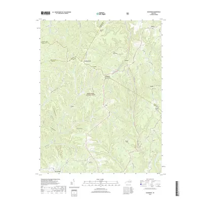
 2022 Zachariah2022 Print · USGSThe eastern Kentucky highlands come into focus here, showing the ridge-top settlements and forest land of Lee County. Genealogists can locate family sites like Townsend Cem and Whisman Cem or trace the paths around Zachariah and Fixer.
End of results
Showing maps 1-11 of 11
Top cities near Zoe
- Stanton historical maps
- Beattyville historical maps
- Campton historical maps
- Booneville historical maps
- Willow Shoals historical maps
Frequently asked questions
- What are the different types of historical maps available for Zoe?
- What is the oldest map of Zoe?
- Where can I purchase historical maps of Zoe for my home or office?
- Where can I download high-res historical maps of Zoe?
- Are there historical topographic maps available for Zoe?
- Is there historical aerial imagery available for Zoe?
- Where are historical maps of Zoe sourced from?