Old Maps of Lincoln County, Kentucky for Hiking & Exploration
Hike through history with 102 historic maps of Lincoln County. Explore old trails, ghost towns, and forgotten backroads — perfect for outdoor adventurers and local explorers.
- Rediscover forgotten places: Map out old mining camps, roads, and footpaths that no longer exist on modern maps.
- Layer with modern tools: Combine with LiDAR or satellite views to plan hikes through historical terrain.
- Made for exploration: Popular among hikers, overlanders, and local history lovers.
Use these maps to find adventure and explore the hidden past of Lincoln County.
Lincoln County, KY maps
(102)- 1892 Map of Richmond
 1892 Richmond1892 Print · USGSMadison and Clark counties are mapped here in the late nineteenth century, centered on the growing railroad hub of Richmond. Genealogists can trace family land and travel routes through historic crossings like Boonesboro, river towns like Ford, and high points such as Combs Mtn.
 - 1893 Map of London
 1893 London1893 Print · USGSSoutheast Kentucky's plateau country was undergoing a railway-driven transformation in the early 1890s. Genealogists and local historians can trace family roots through numerous small communities like Broadhead, Gum Sulphur, and Altamont along the Louisville and Nashville Railroad.
 - 1897 Map of Richmond
 1897 Richmond1897 Print · USGSMadison and Clark counties are mapped here during a decade of rapid railroad expansion and river-based commerce. Genealogists can trace family names and extinct locales from Boonesboro to the industrial Stone Quarry and the hub at Winchester.5 unique versions available
 - 1897 Map of London
 1897 London1897 Print · USGSThe Kentucky interior near the close of the nineteenth century centers on the vital Louisville and Nashville Railroad corridor. Genealogists can trace early homesteads and rail stops from Mt. Vernon to Bee Lick and Hazlepatch.5 unique versions available
 - 1905 Map of Harrodsburg
 1905 Harrodsburg1905 Print · USGSCentral Kentucky's Bluegrass region is captured here in the early twentieth century, showing a landscape defined by the deep gorges of the Kentucky River. Researchers can trace the era's vital rail networks and river commerce through features like Lock No 7 and the Louisville and Nashville RR.3 unique versions available
 - 1935 Map of Somerset
 1935 Somerset1935 Print · USGSIn the mid-1930s, the rural landscapes around Somerset were a dense network of one-room schools and river crossings. Genealogists can trace family connections through numerous landmarks like Mt Zion Sch, Waitsboro Ferry, and the Mills Springs National Cem.
 - 1950 Map of Bryantsville, 1953 Print
 1950 Bryantsville1953 Print · USGSGarrard County and the winding Dix River are shown in the early fifties at the meeting of three counties. Local researchers can trace the Wilderness Trail and locate family landmarks like Robinson Reed Cem or the community of Bryantsville.
 - 1952 Map of Halls Gap, 1953 Print
 1952 Halls Gap1953 Print · USGSLincoln County in the early fifties is mapped here as a network of ridge-top settlements and creek-side farms. Genealogists and local historians can trace family locations through Campbell Cem, the South Fork Arabia Post Office, and Kings Mountain.
 - 1952 Map of Eubank, 1953 Print
 1952 Eubank1953 Print · USGSThe Eubank area and the southern Lincoln County borderlands appear here in the early fifties, following the path of the Southern railroad. Researchers can trace rural lineages through numerous landmarks like Phillips Chapel, Double Spring Cem, and Walnut Grove Sch.
 - 1952 Map of Crab Orchard, 1953 Print
 1952 Crab Orchard1953 Print · USGSLincoln County comes into focus in the early fifties, showing the historic crossing of the rail lines and old pioneer routes. Researchers can trace family roots through numerous rural landmarks like Ottenheim, the William Whitley House State Shrine, and the Boone Cem.2 unique versions available
 - 1952 Map of Hustonville, 1953 Print
 1952 Hustonville1953 Print · USGSCentral Kentucky's rural landscape at the dawn of the 1950s shows a region of small farm hubs and railroad towns. Genealogists can trace local roots at Kidds Store, the SOUTHERN railroad stop in Mc Kinney, and schools like Stapp Sch.3 unique versions available
 - 1952 Map of Paint Lick, 1953 Print
 1952 Paint Lick1953 Print · USGSGarrard County's rolling hills and winding creeks are documented here in the early fifties, showing a landscape of small farmsteads and rural crossroads. Local historians can trace family roots through numerous sites like Old Paint Lick Ch, Carpenter Cem, and Oakdale Sch.2 unique versions available
 - 1952 Map of Lancaster, 1953 Print
 1952 Lancaster1953 Print · USGSGarrard and Lincoln counties are captured here in the early fifties, where the winding Dix River cuts through traditional Kentucky farm country. Researchers can trace the path of the Wilderness Trail and locate family landmarks like Ashlock Cem or Lawsons Chapel.
 - 1952 Map of Bryantsville, 1953 Print
 1952 Bryantsville1953 Print · USGSGarrard County in the early fifties shows a landscape shaped by the winding Herrington Lake and the historic Wilderness Trail. Researchers can trace the layout of Bryantsville, the grounds of Camp Dick Robinson, and the State Hospital.3 unique versions available
 - 1952 Map of Yosemite, 1953 Print
 1952 Yosemite1953 Print · USGSIn the early fifties, the hilly terrain of Casey County was dotted with family-named ridges and small country schools. Genealogists can trace rural life through landmarks like Old Willow Springs Cem, Freedom Sch, and Middleburg.3 unique versions available
 - 1952 Map of Stanford, 1953 Print
 1952 Stanford1953 Print · USGSLincoln County at the start of the 1950s shows a landscape still defined by its historic transit routes and small crossroads. Researchers can trace the Wilderness Trail, locate family plots at Buffalo Spring Cemetery, and find the Hubble Sch.
 - 1952 Map of Junction City, 1954 Print
 1952 Junction City1954 Print · USGSCentral Kentucky's rail-and-river landscape is captured here in the early fifties, where the Southern and L&N lines intersect. Genealogists can trace family landmarks like Goodall Airfield, Gray Cem, and the rural community of Milledgeville before modern development shifted the region.2 unique versions available
 - 1952 Map of Woodstock, 1954 Print
 1952 Woodstock1954 Print · USGSThe rural uplands of Pulaski and Lincoln counties are captured here in the early fifties, showing a landscape of high knobs and deep hollows. Researchers can trace ancestral locations through numerous country schools and churches like Penobscot Sch and Sweetgum Ch.2 unique versions available
 - 1953 Map of Maretburg, 1954 Print
 1953 Maretburg1954 Print · USGSRockcastle County in the early 1950s is a landscape of high knobs and creek-bottom settlements centered on the historic Wilderness Road. Genealogists can locate family landmarks like Sayers Cem, Double Springs, and many rural schoolhouses including Ottawa Sch.3 unique versions available
 - 1953 Map of Brodhead, 1954 Print
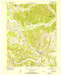 1953 Brodhead1954 Print · USGSBrodhead and the surrounding Kentucky hills are captured here in the early fifties, showing a landscape shaped by the Louisville and Nashville railroad. You can trace the historic Wilderness Road and locate family landmarks like Watts Chapel, Turkeytown, and the Gum Grove Sch.
 - 1954 Map of Science Hill, 1955 Print
 1954 Science Hill1955 Print · USGSMid-century Pulaski County is defined here by the Southern railroad line and a dense network of ridge-top farms and schools. Researchers can trace family history through dozens of localized landmarks like Center Post Sch, Freedom Ch, and the Van Hook Cem.
 - 1957 Map of Winchester, 1968 Print
 1957 Winchester1968 Print · USGSCentral Kentucky's landscape in the mid-twentieth century features the sprawling Fort Knox and the early parkway system. Genealogists and historians can trace rail lines like the Southern Railway and find landmarks from Bernheim Forest to Pilot Knob.3 unique versions available
 - 1960 Map of Winchester
 1960 Winchester1960 Print · USGSCentral Kentucky's diverse landscape is shown here at mid-century, from the bluegrass plains to the rugged Pottsville Escarpment. Genealogists and historians can trace the rail-and-river network connecting towns like Bardstown and Stanford alongside landmarks like Lake Cumberland.
 - 1961 Map of Halls Gap
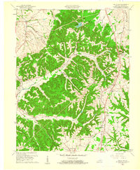 1961 Halls Gap1961 Print · USGSLincoln County in the early sixties was defined by its railroad hamlets and the winding headwaters of the Green River. Researchers can locate ancestral sites like Turnersville, Jumbo, and the Memorial High Sch among the ridgelines.2 unique versions available
 - 1961 Map of Stanford, 1962 Print
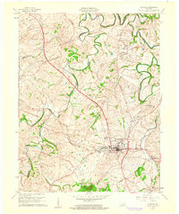 1961 Stanford1962 Print · USGSStanford and the surrounding Lincoln County countryside are captured here in the early sixties, showing the convergence of history and industry. Researchers can trace the Wilderness Road, locate several family burial sites like Blackerby Cem, and find the vanished Hubble Sch.3 unique versions available
Showing maps 1-25 of 102
Top cities of Lincoln County
Frequently asked questions
- What are the different types of historical maps available for Lincoln County?
- What is the oldest map of Lincoln County?
- Where can I purchase historical maps of Lincoln County for my home or office?
- Where can I download high-res historical maps of Lincoln County?
- Are there historical topographic maps available for Lincoln County?
- Is there historical aerial imagery available for Lincoln County?
- Where are historical maps of Lincoln County sourced from?