1960s Maps of Livingston County, Kentucky
Explore 8 historic maps of Livingston County from the 1960s. These maps offer a rare glimpse into what life looked like during the 1960s — showing old roads, neighborhoods, homes, and landmarks that have changed or disappeared over time.
Whether you're researching your family's past, planning a metal detecting trip, or studying how Livingston County's landscape evolved across the 1960s, these high-resolution maps are a powerful tool for exploring the history of this region.
- Focus on a specific era: All maps on this page are from the 1960s, giving you a focused view of this time period.
- See what’s changed: Compare century-old streets, trails, and buildings to today's modern landscape using overlays and satellite layers.
- Research with precision: Use these maps for genealogy, historical research, land use analysis, or educational projects.
- View, download, or print: Maps are fully viewable online in high resolution, and can be downloaded or printed for your own records.
Start exploring Livingston County's history through authentic maps from the 1960s. This is your window into the past.
Livingston County, KY maps
(8)- 1961 Map of Paducah
 1961 Paducah1961 Print · USGSThe Lower Ohio Valley at mid-century is a landscape defined by its great rivers and newly formed reservoirs. Researchers can trace the riverfronts of Paducah and Metropolis, or locate smaller settlements like Old Shawneetown and Cave in Rock along the banks.2 unique versions available
 - 1962 Map of Brownfield, 1963 Print
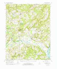
 1962 Brownfield1963 Print · USGSSouthern Illinois and the Kentucky border meet along the Ohio River in this early 1960s survey of Pope County. Researchers can trace rural life through numerous family burial grounds like Foreman Cem, the Illinois Central rail line, and river landmarks like Ropers Landing.3 unique versions available
 - 1962 Map of Brownfield, 1965 Print
 1962 Brownfield1965 Print · USGSSouthern Illinois at the peak of the mid-century era shows a landscape where the deep woods of the Shawnee National Forest meet the Ohio River. Genealogists and historians can trace rail-side towns like Reevesville and discover dozens of family burial grounds, including Barger Cem and Nelson Cem.
 - 1964 Map of Paducah
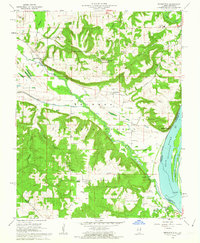
 1964 Paducah1964 Print · USGSThe river-and-rail corridor of Southern Illinois and Western Kentucky is captured here during the height of the mid-century industrial era. Genealogists and researchers can trace local landmarks across several counties, from the rail yards of Paducah to the waters of Crab Orchard Lake and Kentucky Reservoir.2 unique versions available
 - 1967 Map of Smithland, 1968 Print
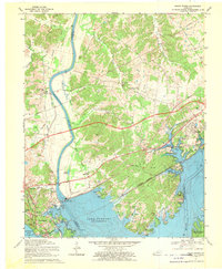
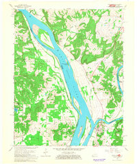 1967 Smithland1968 Print · USGSThe confluence of the Ohio and Cumberland Rivers defines this midcentury landscape of river towns and timbered hills. Genealogists can trace family names at Kickapoo Cem and Sloan Cem or locate the old Dyer Hill Mine and Hamletsburg ferry crossing.2 unique versions available
 - 1967 Map of Birmingham Point, 1968 Print
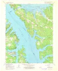 1967 Birmingham Point1968 Print · USGSIn the late sixties, this area between the newly formed Kentucky Lake and Lake Barkley reveals a landscape transformed by water. Researchers can trace the original location of Birmingham, find family burial grounds like Demumbers Cem, and follow the route of The Trace.3 unique versions available
 - 1967 Map of Grand Rivers, 1970 Print
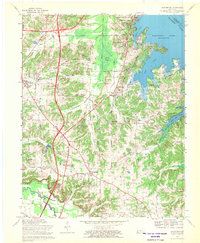
 1967 Grand Rivers1970 Print · USGSIn the late 1960s, the landscape around the newly formed Lake Barkley was a hub of infrastructure and recreation. Trace the development of Grand Rivers and Kuttawa alongside landmarks like the Barkley Dam and Kentucky State Penitentiary Farm.
 - 1969 Map of Briensburg, 1970 Print
 1969 Briensburg1970 Print · USGSThe Tennessee River shoreline of Marshall County is captured here during the late sixties as modern highways reshaped the local economy. Researchers can trace ancestral sites at Birmingham Cem and McNatt Cem or locate landmarks like the Drive-in Theater.
End of results
Showing maps 1-8 of 8
Top cities of Livingston County
- Salem historical maps
- Smithland historical maps
- Grand Rivers historical maps
- Carrsville historical maps
Frequently asked questions
- What are the different types of historical maps available for Livingston County?
- What is the oldest map of Livingston County?
- Where can I purchase historical maps of Livingston County for my home or office?
- Where can I download high-res historical maps of Livingston County?
- Are there historical topographic maps available for Livingston County?
- Is there historical aerial imagery available for Livingston County?
- Where are historical maps of Livingston County sourced from?