Old Maps of Livingston County, Kentucky for Metal Detecting
Plan your next treasure hunt with 150 historic maps of Livingston County. Find old homesites, ghost towns, trails, and gathering spots that may be lost to time — perfect for identifying promising metal detecting locations.
- Locate forgotten sites: Uncover places like long-lost settlements, abandoned rail lines, or gathering spots.
- Plan better hunts: Use map overlays combined with LiDAR or satellite views to narrow in on historically rich areas.
- Made for detectorists: Thousands of hobbyists use these maps to discover relics, coins, and hidden history.
Use these historic maps to boost your research and find new opportunities beneath the surface of Livingston County.
Livingston County, KY maps
(150)- 1916 Map of Fords Ferry
 1916 Fords Ferry1916 Print · USGSThe Illinois-Kentucky borderlands along the Ohio River come alive in this survey from the mid-1910s. Genealogists can trace the rural school system through Double Box School and Love School or locate early commerce at Fraileys Store.2 unique versions available
 - 1916 Map of Golconda
 1916 Golconda1916 Print · USGSSouthern Illinois river life is frozen in time during this mid-1910s survey of the Ohio River frontier. Researchers can trace the early development of Golconda and Elizabethtown, or locate rural landmarks like Miller Cem and Cavins Store.
 - 1917 Map of Brownfield
 1917 Brownfield1917 Print · USGSSouthern Illinois in the years before the Great War is captured here through its dense network of rural schoolhouses and rail sidings. Researchers can locate family landmarks like Lackey Bridge, Allard College School, and Dixon Springs Sta (Renshaw P.O.).4 unique versions available
 - 1920 Map of Goloonda
 1920 Goloonda1920 Print · USGSThe Ohio River bottomlands of Livingston County are captured here just after the Great War, when river ferries and rural schoolhouses still anchored local life. Genealogists and researchers can trace family lands near Berry Ferry, Mt Pisgah Church, or the many district schools like Trimble School.
 - 1921 Map of Fords Ferry
 1921 Fords Ferry1921 Print · USGSCrittenden County in the early twenties shows a landscape of river-dependent commerce and small rural hamlets connected by the Illinois Central. Genealogists can trace family footprints through dozens of local landmarks like Shelby Store, Hurricane Church, and the Seminary School.
 - 1921 Map of Golconda
 1921 Golconda1921 Print · USGSThe Ohio River valley at the start of the 1920s reveals a bustling corridor of small river towns and rural school districts spanning Illinois and Kentucky. Genealogists and historians can trace family roots through dozens of local landmarks like Berrys Ferry, Cammens Store, and the Bethel Church.3 unique versions available
 - 1925 Map of Cave In Rock
 1925 Cave In Rock1925 Print · USGSCrittenden County's river-and-rail landscape is captured here in the mid-1920s, during a time of thriving rural school districts and mining operations. Researchers can trace ancestral locations near Fords Ferry, the Franklin Mines, or Hurricane Church.3 unique versions available
 - 1926 Map of Paducah, 1967 Print
 1926 Paducah1967 Print · USGSThe riverfront cities of Paducah and Metropolis are shown at the height of the steam-and-rail era before the major mid-century dam projects. Genealogists can trace family names through dozens of rural landmarks like Weyer Cemetery, Hamilton Chapel, and the Little Union Sch.
 - 1928 Map of Eddyville
 1928 Eddyville1928 Print · USGSWestern Kentucky's river valleys and mining districts are captured here in the late twenties before modern dams reshaped the Cumberland. Trace the old ferry crossings, family-run stops like Shelby's Store, and vanished school sites like Cherry Sch and Wilson Sch.
 - 1929 Map of Smithland
 1929 Smithland1929 Print · USGSThe convergence of the Ohio, Tennessee, and Cumberland Rivers defines this late 1920s survey of the Kentucky-Illinois border. Genealogists and researchers can trace riverside life through Haddox Ferry, Smithland, and vanished schoolhouses like Yellowbird Sch.3 unique versions available
 - 1929 Map of Paducah
 1929 Paducah1929 Print · USGSThe confluence of the Ohio and Tennessee Rivers comes alive in the late twenties as a bustling hub of river and rail transport. Genealogists and historians can trace family roots through numerous local landmarks like West Paducah PO, Veyer Cemetery, and the County Sanitarium.4 unique versions available
 - 1931 Map of Eddyville
 1931 Eddyville1931 Print · USGSWestern Kentucky life along the winding Cumberland River is captured here in the late twenties, before the landscape was altered by massive dam projects. Genealogists and historians can trace family roots through dozens of rural landmarks like Shelby's Store, the Nancy Hanks Mine, and Williams Chapel Sch.
 - 1936 Map of Paducah
 1936 Paducah1936 Print · USGSPaducah thrived as a vital river and rail hub during the mid-thirties, situated at the confluence of the Ohio and Tennessee. Genealogists and historians can trace neighborhood growth through local schools like Hamilton Sch and family-named landmarks such as Nortons Bluff and Stiles Crossing.
 - 1936 Map of Eddyville
 1936 Eddyville1936 Print · USGSWestern Kentucky's river valleys appear here in the mid-1930s, showing the narrow land between the Tennessee and Cumberland rivers before the creation of major reservoirs. Genealogists can locate family landmarks like Sevenee Furnace Ch, Poplar Creek Sch, and the riverside Eureka Ferry.
 - 1936 Map of Grand Rivers
 1936 Grand Rivers1936 Print · USGSGrand Rivers sits at a strategic Kentucky crossroads in the mid-1930s, documenting the narrow land between two great river systems. Genealogists and local historians can trace the early layout of Grand Rivers and the Lyon and Livingston County line near the Cumberland River.
 - 1936 Map of Smithland
 1936 Smithland1936 Print · USGSThe confluence of the Ohio and Tennessee Rivers is captured here in the mid-1930s, documenting a landscape of river-dependent towns and rural school districts. Genealogists can locate family sites like Sleeper Cemetery or Thompson Chapel and trace the original path of the Illinois Central Railroad.
 - 1936 Map of Benton
 1936 Benton1936 Print · USGSWestern Kentucky's rural Marshall County is captured here in the mid-1930s, showing a landscape defined by river fords and small family settlements. Genealogists can trace hundreds of specific locations, from C C C Camp No 519 to Oak Level and Tatumsville.
 - 1936 Map of Birmingham
 1936 Birmingham1936 Print · USGSThe Tennessee and Cumberland rivers converge in the mid-1930s, showing the riverfront town of Birmingham before the creation of Kentucky Lake. Genealogists and historians can trace numerous family burial sites like Birmingham Cem and rural centers such as Yale Sch and the Birmingham Ferry.
 - 1936 Map of Golden Pond
 1936 Golden Pond1936 Print · USGSWestern Kentucky’s river-locked interior is captured here in the mid-1930s, just before the creation of the great lakes. Local researchers can trace family roots at Birmingham or Fenton, and locate industrial landmarks like the Center Furnace and Star Lime Works.
 - 1936 Map of Calvert City
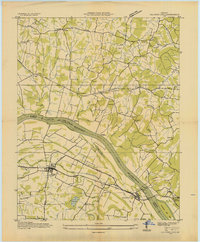 1936 Calvert City1936 Print · USGSMarshall and Livingston counties are captured in the mid-1930s before dam construction permanently altered the Tennessee River valley. Genealogists can locate family landmarks like Cothran Cem, Driskill Sch, and river crossings at Haddox Ferry.
 - 1936 Map of Little Cypress
 1936 Little Cypress1936 Print · USGSThe Ohio and Tennessee Rivers meet amidst a network of rural settlements in the mid-1930s. Researchers can trace family sites like Little Cypress or locate Kincaid Mounds and early churches like Chestnut Hill Ch.
 - 1936 Map of Briensburg
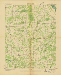 1936 Briensburg1936 Print · USGSWestern Kentucky’s rural landscape comes alive in this mid-1930s survey of Marshall County. Genealogists can trace family roots through numerous country schools and cemeteries like Lone Valley Sch, Stice Sch, and the Dees Cem.
 - 1938 Map of Birmingham
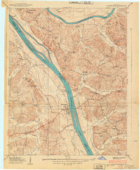 1938 Birmingham1938 Print · USGSThe Tennessee and Cumberland Rivers converge in Lyon County just before the regional landscape was transformed by dam projects. Genealogists can trace family footprints at Birmingham, find rural landmarks like Star Lime Works PO, or locate Harvard Ch and Birmingham Cem.
 - 1938 Map of Briensburg
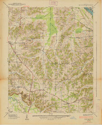 1938 Briensburg1938 Print · USGSBefore the major dams changed the river valley, this 1930s survey captures Marshall County at the height of its rural settlement. Genealogists can trace family names at Wilson Cem or Dees Cem and find local landmarks like Stahl Sch and Provine Chapel.
 - 1940 Map of Paducah, 1958 Print
 1940 Paducah1958 Print · USGSAcross the river from Illinois at the start of the 1940s, this area captures Paducah and Metropolis at a peak of rail and river activity. Researchers can trace the Illinois Central RR lines, locate family markers at Veyer Cemetery, and find rural landmarks like Klondike Sch and Palestine Ch.
Showing maps 1-25 of 150
Top cities of Livingston County
- Salem historical maps
- Smithland historical maps
- Grand Rivers historical maps
- Carrsville historical maps
Frequently asked questions
- What are the different types of historical maps available for Livingston County?
- What is the oldest map of Livingston County?
- Where can I purchase historical maps of Livingston County for my home or office?
- Where can I download high-res historical maps of Livingston County?
- Are there historical topographic maps available for Livingston County?
- Is there historical aerial imagery available for Livingston County?
- Where are historical maps of Livingston County sourced from?