Old Maps of Salem, Kentucky for Hiking & Exploration
Hike through history with 28 historic maps of Salem. Explore old trails, ghost towns, and forgotten backroads — perfect for outdoor adventurers and local explorers.
- Rediscover forgotten places: Map out old mining camps, roads, and footpaths that no longer exist on modern maps.
- Layer with modern tools: Combine with LiDAR or satellite views to plan hikes through historical terrain.
- Made for exploration: Popular among hikers, overlanders, and local history lovers.
Use these maps to find adventure and explore the hidden past of Salem.
Salem, KY maps
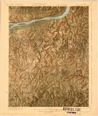
(28)- 1916 Map of Fords Ferry
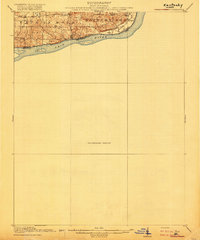 1916 Fords Ferry1916 Print · USGSThe Illinois-Kentucky borderlands along the Ohio River come alive in this survey from the mid-1910s. Genealogists can trace the rural school system through Double Box School and Love School or locate early commerce at Fraileys Store.2 unique versions available
 - 1916 Map of Golconda
 1916 Golconda1916 Print · USGSSouthern Illinois river life is frozen in time during this mid-1910s survey of the Ohio River frontier. Researchers can trace the early development of Golconda and Elizabethtown, or locate rural landmarks like Miller Cem and Cavins Store.
 - 1920 Map of Goloonda
 1920 Goloonda1920 Print · USGSThe Ohio River bottomlands of Livingston County are captured here just after the Great War, when river ferries and rural schoolhouses still anchored local life. Genealogists and researchers can trace family lands near Berry Ferry, Mt Pisgah Church, or the many district schools like Trimble School.
 - 1921 Map of Fords Ferry
 1921 Fords Ferry1921 Print · USGSCrittenden County in the early twenties shows a landscape of river-dependent commerce and small rural hamlets connected by the Illinois Central. Genealogists can trace family footprints through dozens of local landmarks like Shelby Store, Hurricane Church, and the Seminary School.
 - 1921 Map of Golconda
 1921 Golconda1921 Print · USGSThe Ohio River valley at the start of the 1920s reveals a bustling corridor of small river towns and rural school districts spanning Illinois and Kentucky. Genealogists and historians can trace family roots through dozens of local landmarks like Berrys Ferry, Cammens Store, and the Bethel Church.3 unique versions available
 - 1925 Map of Cave In Rock
 1925 Cave In Rock1925 Print · USGSCrittenden County's river-and-rail landscape is captured here in the mid-1920s, during a time of thriving rural school districts and mining operations. Researchers can trace ancestral locations near Fords Ferry, the Franklin Mines, or Hurricane Church.3 unique versions available
 - 1949 Map of Paducah
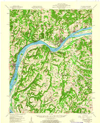
 1949 Paducah1949 Print · USGSThe confluence of the Ohio, Mississippi, Tennessee, and Cumberland rivers at the close of the 1940s reveals a region bound by water and rail. Researchers can trace historic river landings, timberlands in the Shawnee National Forest, and the coal-mining infrastructure around West Frankfort and Herrin.2 unique versions available
 - 1950 Map of Paducah
 1950 Paducah1950 Print · USGSThe confluence of the great midwestern rivers defines this mid-century landscape at the intersection of Illinois, Kentucky, and Missouri. Genealogists and historians can trace the rail-and-river economy through the hubs of Paducah, Cairo, and Metropolis or locate family roots near the Wildcat Hills.
 - 1954 Map of Paducah
 1954 Paducah1954 Print · USGSSouthern Illinois and Western Kentucky intersect at the great river confluences during this mid-century era of rail and river industry. Genealogists and historians can trace family roots and commerce through river towns like Cairo, Metropolis, and Golconda, or along the tracks of the Illinois Central Railroad.2 unique versions available
 - 1954 Map of Lola, 1955 Print
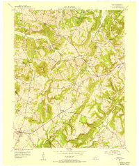
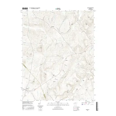
 1954 Lola1955 Print · USGSSettlement and industry across the Livingston and Crittenden county line appear here in the mid-1950s. Genealogists can trace family landmarks and rural life at Bethel Ch, Turkey Cem, and the decommissioned May Mines.2 unique versions available
 - 1954 Map of Salem, 1955 Print
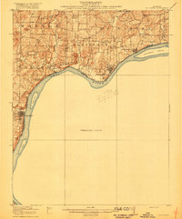
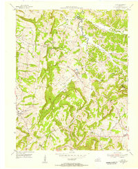
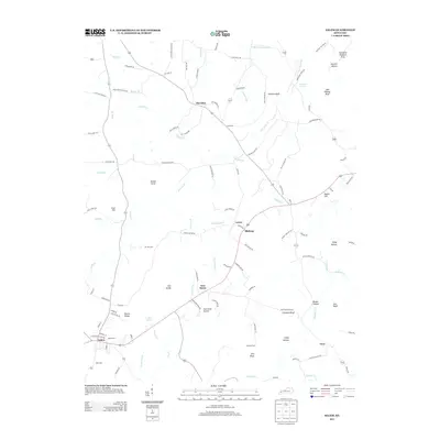
 1954 Salem1955 Print · USGSCrittenden and Livingston Counties show a landscape defined by fluorite and mineral extraction during the 1950s. Genealogists and historians can trace local family landmarks like Liberty Grove Ch, Mount Zion Ch, and the Keystone Mine and Fluorite Flotation Mill.2 unique versions available
 - 1958 Map of Cave In Rock, 1960 Print
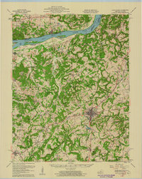 1958 Cave In Rock1960 Print · USGSThe Ohio River valley and Crittenden County high ground are captured here in the late fifties, showcasing a landscape of river ferries and rail-line towns. Local historians can trace family sites at Freedom Ch, follow the Illinois Central tracks through Crayne, or locate the old Fords Ferry crossing.
 - 1959 Map of Golconda, 1960 Print
 1959 Golconda1960 Print · USGSThe Ohio River valley at the edge of the Shawnee National Forest comes alive in the late fifties, showing a landscape defined by river traffic and upland mining. Trace local history through family-named landmarks like McMurray Chapel, Mantle Rock, and the Empire Gem Mine.2 unique versions available
 - 1961 Map of Paducah
 1961 Paducah1961 Print · USGSThe Lower Ohio Valley at mid-century is a landscape defined by its great rivers and newly formed reservoirs. Researchers can trace the riverfronts of Paducah and Metropolis, or locate smaller settlements like Old Shawneetown and Cave in Rock along the banks.2 unique versions available
 - 1964 Map of Paducah
 1964 Paducah1964 Print · USGSThe river-and-rail corridor of Southern Illinois and Western Kentucky is captured here during the height of the mid-century industrial era. Genealogists and researchers can trace local landmarks across several counties, from the rail yards of Paducah to the waters of Crab Orchard Lake and Kentucky Reservoir.2 unique versions available
 - 1984 Map of Paducah, 1986 Print
 1984 Paducah1986 Print · USGSThe river-driven economy of western Kentucky and southern Illinois is captured here in the mid-eighties, showing the massive impact of the Kentucky Lake and Lake Barkley reservoirs. Genealogists and historians can trace rail lines like the Illinois Central Gulf RR and explore sites from Fort Massac State Park to the Kentucky State Penitentiary.
 - 1986 Map of Paducah, 1987 Print
 1986 Paducah1987 Print · USGSThe tri-river confluence of the Ohio, Tennessee, and Cumberland rivers is captured here in the mid-1980s during a period of established river power and industry. Researchers can trace local heritage through landmarks like Friendship Church, the Smithland Locks and Dam, and the Illinois Central Gulf RR.
 - 1987 Map of Paducah, 1988 Print
 1987 Paducah1988 Print · USGSThe Lower Ohio Valley and the Illinois Ozarks come alive in this late twentieth-century regional survey. Genealogists and local historians can trace river-town roots and state park landmarks from Metropolis to Cape Girardeau and Trail of Tears State Park.
 - 2010 Map of Lola, 2010 Print
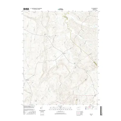
 2010 Lola2010 Print · USGSCovers Salem, including Lola, Hampton, and other nearby areas
 - 2010 Map of Salem, 2010 Print
 2010 Salem2010 Print · USGSCovers Salem, including Levias, New Salem, and other nearby areas
 - 2013 Map of Lola, 2013 Print
 2013 Lola2013 Print · USGSCovers Salem, including Lola, Hampton, and other nearby areas
 - 2013 Map of Salem, 2013 Print
 2013 Salem2013 Print · USGSCovers Salem, including Levias, New Salem, and other nearby areas
 - 2016 Map of Salem, 2016 Print
 2016 Salem2016 Print · USGSCovers Salem, including Levias, New Salem, and other nearby areas
 - 2016 Map of Lola, 2016 Print
 2016 Lola2016 Print · USGSCovers Salem, including Lola, Hampton, and other nearby areas
 - 2019 Map of Salem, 2019 Print
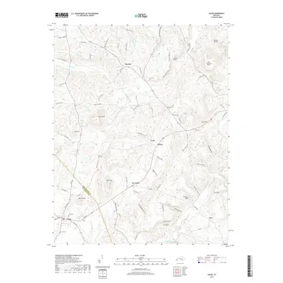 2019 Salem2019 Print · USGSCovers Salem, including Levias, New Salem, and other nearby areas
Showing maps 1-25 of 28
Top cities near Salem
- Marion historical maps
- Calvert City historical maps
- Eddyville historical maps
- Rosiclare historical maps
- Kuttawa historical maps
- Smithland historical maps
See more
Frequently asked questions
- What are the different types of historical maps available for Salem?
- What is the oldest map of Salem?
- Where can I purchase historical maps of Salem for my home or office?
- Where can I download high-res historical maps of Salem?
- Are there historical topographic maps available for Salem?
- Is there historical aerial imagery available for Salem?
- Where are historical maps of Salem sourced from?