1950s Maps of Lyon County, Kentucky
Explore 18 historic maps of Lyon County from the 1950s. These maps offer a rare glimpse into what life looked like during the 1950s — showing old roads, neighborhoods, homes, and landmarks that have changed or disappeared over time.
Whether you're researching your family's past, planning a metal detecting trip, or studying how Lyon County's landscape evolved across the 1950s, these high-resolution maps are a powerful tool for exploring the history of this region.
- Focus on a specific era: All maps on this page are from the 1950s, giving you a focused view of this time period.
- See what’s changed: Compare century-old streets, trails, and buildings to today's modern landscape using overlays and satellite layers.
- Research with precision: Use these maps for genealogy, historical research, land use analysis, or educational projects.
- View, download, or print: Maps are fully viewable online in high resolution, and can be downloaded or printed for your own records.
Start exploring Lyon County's history through authentic maps from the 1950s. This is your window into the past.
Lyon County, KY maps
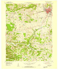
(18)- 1950 Map of Paducah
 1950 Paducah1950 Print · USGSThe confluence of the great midwestern rivers defines this mid-century landscape at the intersection of Illinois, Kentucky, and Missouri. Genealogists and historians can trace the rail-and-river economy through the hubs of Paducah, Cairo, and Metropolis or locate family roots near the Wildcat Hills.
 - 1950 Map of Mont, 1953 Print
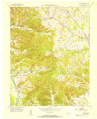
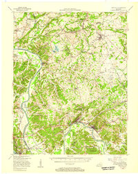
 1950 Mont1953 Print · USGSThe Between the Rivers country of Western Kentucky is documented here in the mid-twentieth century, just before its major federal transformation. Genealogists and historians can trace family sites like Woodson Chapel, Henderson Chapel Cem, and industrial remnants including the Center Furnace (Ruins).2 unique versions available
 - 1953 Map of Lamasco, 1954 Print
 1953 Lamasco1954 Print · USGSWestern Kentucky's rural landscape is captured here in the early fifties, just as the traditional river-and-road network remained largely intact. Researchers can trace family history through dozens of landmarks like Trigg Furnace Sch, Siloam Ch, and Parker Cem.2 unique versions available
 - 1954 Map of Evansville
 1954 Evansville1954 Print · USGSThe Ohio River borderlands between Indiana and Kentucky appear here during a period of robust industrial and military growth. Genealogists and researchers can trace the rail corridors of the Illinois Central and find landmarks like US Lock and Dam No 48 or Camp Breckinridge.
 - 1954 Map of Paducah
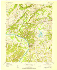
 1954 Paducah1954 Print · USGSSouthern Illinois and Western Kentucky intersect at the great river confluences during this mid-century era of rail and river industry. Genealogists and historians can trace family roots and commerce through river towns like Cairo, Metropolis, and Golconda, or along the tracks of the Illinois Central Railroad.2 unique versions available
 - 1954 Map of Eddyville, 1955 Print
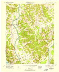
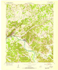 1954 Eddyville1955 Print · USGSWestern Kentucky river life is captured here in the mid-fifties, just before massive reservoir projects reshaped the valley. Researchers can trace the original riverfronts of Eddyville and Kuttawa, identifying landmarks like the State Penitentiary and the Illinois Central rail line.
 - 1954 Map of Fredonia, 1955 Print
 1954 Fredonia1955 Print · USGSMid-century Caldwell County centers on the fluorite mining hub of Fredonia as it appeared in the fifties. Genealogists and historians can locate family landmarks such as Campbell Cem, the community at Mexico, and local institutions like New Bethel Ch.2 unique versions available
 - 1954 Map of Princeton West, 1955 Print
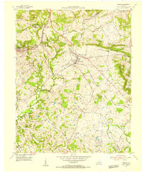
 1954 Princeton West1955 Print · USGSCaldwell County at the mid-century mark centers on the growing hub of Princeton and the busy ILLINOIS CENTRAL rail line. Researchers can trace rural lineages through numerous local landmarks like Friendship Ch, Dotson Sch, and Caldwell Cem.
 - 1954 Map of Dycusburg, 1955 Print
 1954 Dycusburg1955 Print · USGSThe Cumberland River loops through the western Kentucky fluorspar district during the mid-fifties, when small-scale mining shaped the local economy. Researchers can locate active operations like the Nancy Hanks Mine and rural landmarks such as Shelbys Store and Groves Chapel.2 unique versions available
 - 1955 Map of Fairdealing, 1956 Print
 1955 Fairdealing1956 Print · USGSMarshall County and the Tennessee River shoreline are captured here in the mid-fifties as the region adapted to the new reservoir. Genealogists and local historians can locate many family landmarks, such as Pleasant Hope Church, the Eggner Ferry Bridge, and Fairdealing.3 unique versions available
 - 1955 Map of Grand Rivers, 1956 Print
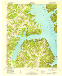
 1955 Grand Rivers1956 Print · USGSThe Land Between the Lakes region appears here in the mid-fifties, showing the intersection of river trade and modern reservoir development. Genealogists and historians can trace family landings such as Doom Landing, old churches like Suwanee Furnace Church, and the McPhail School.
 - 1955 Map of Birmingham Point, 1956 Print
 1955 Birmingham Point1956 Print · USGSBetween the Rivers in the mid-fifties, this area shows the dramatic transformation of the landscape following the creation of Kentucky Lake. Genealogists and local historians can locate family landmarks like the Birmingham Cem, Nickell Cem, and the Oakland Sch.2 unique versions available
 - 1955 Map of Eddyville, 1957 Print
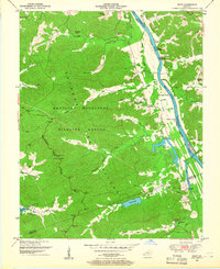
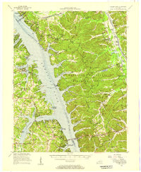
 1955 Eddyville1957 Print · USGSMid-century Lyon County and the surrounding river country still center on the Cumberland River and the Illinois Central rail line. Genealogists and historians can trace the foundations of local life at the Eddyville Ferry, Suwanee Furnace, and the State Penal Farm.
 - 1955 Map of Golden Pond, 1957 Print
 1955 Golden Pond1957 Print · USGSIn the mid-1950s, the peninsula between the Tennessee and Cumberland rivers was a landscape of deep hollows and new reservoirs. Trace family roots and local history through landmarks like Birmingham Cem, the ruins of Center Furnace, and Paradise Ch.
 - 1956 Map of Dyersburg, 1960 Print
 1956 Dyersburg1960 Print · USGSThe Four Rivers region comes alive in the mid-fifties, capturing the intricate borderlands of Tennessee, Kentucky, and Missouri. Genealogists and historians can trace the rail-and-river networks connecting Dyersburg, Caruthersville, and the shoreline of Reelfoot Lake.4 unique versions available
 - 1956 Map of Nashville, 1971 Print
 1956 Nashville1971 Print · USGSThe Tennessee-Kentucky borderlands come into focus in the mid-1960s as major reservoir projects transformed the Cumberland and Tennessee river valleys. Researchers can trace the rail networks of the Louisville and Nashville and visit sites like Fort Campbell and Fort Donelson National Military Park.2 unique versions available
 - 1957 Map of Evansville, 1969 Print
 1957 Evansville1969 Print · USGSIndiana and Kentucky meet along the Ohio River in this mid-century survey of a vital industrial and transport corridor. Genealogists and historians can trace the development of river towns like Owensboro and Newburgh or locate old rail lines like the Southern Ry.3 unique versions available
 - 1959 Map of Nashville
 1959 Nashville1959 Print · USGSMiddle Tennessee and Southern Kentucky come into focus during the late fifties, showing the region's transition into a modern transportation and military hub. Researchers can trace the sprawling Fort Campbell Military Reservation or locate historic rail stops along the Tennessee Central Ry and Illinois Central RR.
End of results
Showing maps 1-18 of 18
Top cities of Lyon County
Frequently asked questions
- What are the different types of historical maps available for Lyon County?
- What is the oldest map of Lyon County?
- Where can I purchase historical maps of Lyon County for my home or office?
- Where can I download high-res historical maps of Lyon County?
- Are there historical topographic maps available for Lyon County?
- Is there historical aerial imagery available for Lyon County?
- Where are historical maps of Lyon County sourced from?