Old Maps of Marion County, Kentucky
Explore 85 old maps of Marion County, spanning from 1952 to today. These high-resolution historic maps reveal how streets, neighborhoods, landmarks, and natural features evolved over time — perfect for genealogy, metal detecting, research, and local history exploration.
What you can do with these maps:
- See how Marion County changed over time: Compare historical maps to modern-day views to trace roads, homesites, rail lines & more.
- View detailed metadata: Each map includes creators, publishers, year, scale, and archive source.
- Overlay maps with satellite & LiDAR: Visualize the past alongside modern tools to explore terrain & human change.
- Trusted historical sources: Maps sourced from the USGS, Library of Congress, and other archives.
- Access maps your way: View online, download high-res files, or order prints for personal or research use.
Start exploring old maps of Marion County to uncover forgotten places, hidden landmarks, and the deep history beneath your feet.
Marion County, KY maps
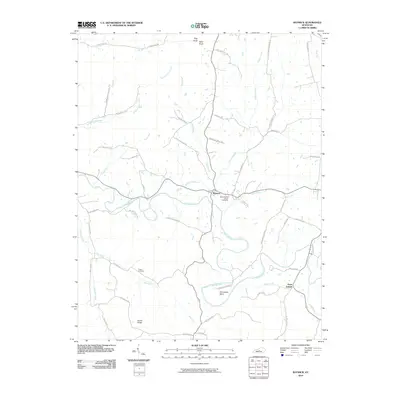
(85)- 1952 Map of Bradfordsville, 1954 Print
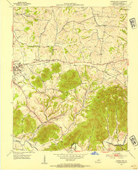
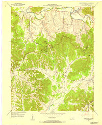 1952 Bradfordsville1954 Print · USGSThe forks of the Rolling Fork river in the early fifties define this central Kentucky landscape. Genealogists and local historians can trace rural school districts and family cemeteries near Bradfordsville, Merrimac, and the ridges of Muldraugh Hill.2 unique versions available
 - 1953 Map of Mackville, 1954 Print
 1953 Mackville1954 Print · USGSCentral Kentucky's rural landscape is captured here in the early fifties, showing the farming communities at the junction of four counties. Genealogists can trace family names through landmarks like Cocanougher Cem, Pottsville, and Beech Grove Ch.2 unique versions available
 - 1953 Map of Howardstown, 1954 Print
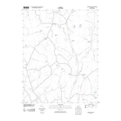
 1953 Howardstown1954 Print · USGSSettlement along the Rolling Fork is captured here in the early fifties at the intersection of Nelson and Larue counties. Genealogists and local historians can locate rural landmarks like St Vincent de Paul Cem, Gleanings, and the Levelwood Sch.4 unique versions available
 - 1953 Map of Bradfordsville NE, 1954 Print
 1953 Bradfordsville NE1954 Print · USGSMarion and Casey counties in the early fifties are shown here as a landscape of ridge-top boundaries and valley settlements. Genealogists can trace family roots through landmarks like Weatherford Cem, McFarland Sch, and the community at Jacktown.2 unique versions available
 - 1953 Map of Loretto, 1954 Print
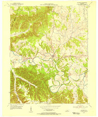
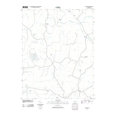
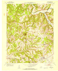 1953 Loretto1954 Print · USGSMarion County life in the early fifties was centered on parish communities and the railroad corridor. Genealogists can trace family roots through landmarks like Holy Cross, Sisters of Loretto Convent, and the Dant (Dants Sta) rail stop.3 unique versions available
 - 1953 Map of Gravel Switch, 1954 Print
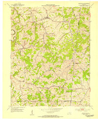
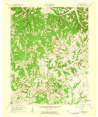
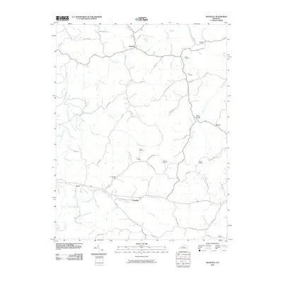
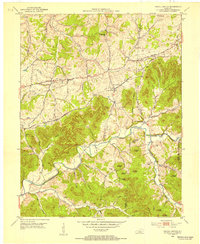 1953 Gravel Switch1954 Print · USGSMarion County and the surrounding knobs are shown here in the mid-1950s as rural life centered on the Louisville and Nashville rail line. Researchers can trace family roots through numerous landmarks like Aliceton Cem, Doctors Fork Ch, and the Jane Todd Crawford Trail.
 - 1953 Map of Saloma, 1954 Print
 1953 Saloma1954 Print · USGSTaylor and Marion counties are shown in the early fifties during a peak era for rural Kentucky schoolhouses and country churches. Genealogists can trace family footprints near Saloma, White Rose, and landmarks like Arvins Grove Sch or St Matthews Cem.
 - 1953 Map of Saint Catharine, 1954 Print
 1953 Saint Catharine1954 Print · USGSWashington County's rural landscapes and Catholic heritage are preserved in this mid-century survey. Genealogists and historians can trace family-named landmarks like Burkes Spring and Bearwallow or study the grounds of Saint Catharine Academy.2 unique versions available
 - 1953 Map of Lebanon East, 1954 Print
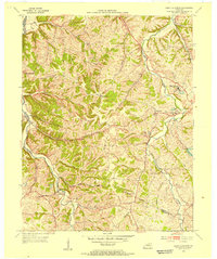
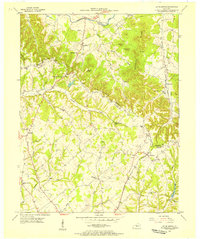
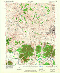
 1953 Lebanon East1954 Print · USGSMarion County in the early fifties shows a rural landscape of ridges and creek bottoms as it appeared before modern expansion. Genealogists can trace family landmarks like St Ives Cem, Ryder Cem, and the small settlement of Cartwright along the rail line.2 unique versions available
 - 1953 Map of Springfield, 1954 Print
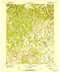
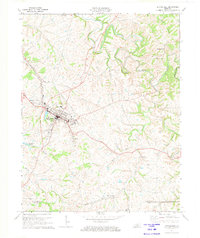
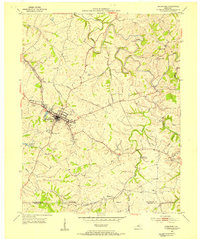 1953 Springfield1954 Print · USGSSpringfield and the surrounding Washington County countryside are captured here in the early fifties, centered on the historic junction of major roads. Genealogists can trace family roots through sites like St Dominics Cem, Jimtown, and Bethlehem Sch.2 unique versions available
 - 1953 Map of Raywick, 1955 Print
 1953 Raywick1955 Print · USGSMarion County in the early fifties is captured here as a landscape of river-bottom farms and rural church communities. Genealogists can trace family roots through the St Francis Xavier Cem, the settlement of Raywick, and Highview Sch.3 unique versions available
 - 1953 Map of Spurlington, 1955 Print
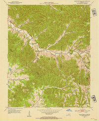
 1953 Spurlington1955 Print · USGSThe Muldraugh Hill country of Taylor and Marion counties is captured in the early fifties, showing a landscape defined by the Louisville and Nashville rail line. Trace family roots at Spurlington or explore old school sites like Palestine Sch and Union Ridge Sch.3 unique versions available
 - 1953 Map of Lebanon West, 1968 Print
 1953 Lebanon West1968 Print · USGSMarion County in the early fifties is captured here as a landscape of rural schoolhouses and rail-dependent towns. Genealogists can trace family footprints near Frogtown, the National Cemetery at Lebanon, or the parish at Calvary.
 - 1953 Map of Bradfordsville, 1976 Print
 1953 Bradfordsville1976 Print · USGSThe rural borders of Marion, Casey, and Taylor counties are captured here in the early fifties during a time of small-town schoolhouses and country churches. Researchers can trace family roots at Pine Grove Sch, Shreve Cem, and the settlement of Jacktown.
 - 1957 Map of Winchester, 1968 Print
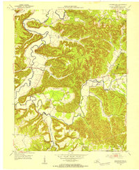
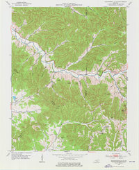
 1957 Winchester1968 Print · USGSCentral Kentucky's landscape in the mid-twentieth century features the sprawling Fort Knox and the early parkway system. Genealogists and historians can trace rail lines like the Southern Railway and find landmarks from Bernheim Forest to Pilot Knob.3 unique versions available
 - 1960 Map of Winchester
 1960 Winchester1960 Print · USGSCentral Kentucky's diverse landscape is shown here at mid-century, from the bluegrass plains to the rugged Pottsville Escarpment. Genealogists and historians can trace the rail-and-river network connecting towns like Bardstown and Stanford alongside landmarks like Lake Cumberland.
 - 1961 Map of Saloma, 1963 Print
 1961 Saloma1963 Print · USGSThe Taylor County countryside is captured here in the early sixties, showing a landscape defined by the ridgelines of Muldraugh Hill. Researchers can trace old family roots at St Matthews Cem or locate industrial sites like the White Rose Oil Field.2 unique versions available
 - 1972 Map of Springfield, 1973 Print
 1972 Springfield1973 Print · USGSSpringfield and the Washington County countryside are captured in the early seventies as the local rail and road networks matured. Researchers can trace family-named settlements like Briartown and Jimtown, or locate local landmarks such as St Rose Ch and Lincoln Homestead State Park.2 unique versions available
 - 1981 Map of Elizabethtown, 1983 Print
 1981 Elizabethtown1983 Print · USGSCentral Kentucky in the early eighties shows a landscape of military installations, state parks, and historic sites. Genealogists and historians can trace rail lines like the Louisville and Nashville or locate sites like Lebanon National Cemetery and the Lincoln Memorial National Historic Site.
 - 1986 Map of Campbellsville
 1986 Campbellsville1986 Print · USGSCentral Kentucky in the mid-eighties was a landscape of deep river valleys and high ridges. Genealogists can trace family holdings near rural settlements like Phillipsburg or locate landmarks such as Mt Gilead Ch and the Magnolia Gas Storage Field.2 unique versions available
 - 2010 Map of Raywick, 2010 Print
 2010 Raywick2010 Print · USGSCovers Marion County, including Loretto, Raywick, and other nearby areas
 - 2010 Map of Mackville, 2010 Print
 2010 Mackville2010 Print · USGSCovers Marion County, including Mackville, Deep Creek, and other nearby areas
 - 2010 Map of Loretto, 2010 Print
 2010 Loretto2010 Print · USGSCovers Marion County, including Loretto, Nerinx, and other nearby areas
 - 2010 Map of Spurlington, 2010 Print
 2010 Spurlington2010 Print · USGSCovers Marion County, including Campbellsville, Finley, and other nearby areas
 - 2010 Map of Bradfordsville, 2010 Print
 2010 Bradfordsville2010 Print · USGSCovers Marion County, including Bradfordsville, Merrimac, and other nearby areas
Showing maps 1-25 of 85
Top cities of Marion County
Frequently asked questions
- What are the different types of historical maps available for Marion County?
- What is the oldest map of Marion County?
- Where can I purchase historical maps of Marion County for my home or office?
- Where can I download high-res historical maps of Marion County?
- Are there historical topographic maps available for Marion County?
- Is there historical aerial imagery available for Marion County?
- Where are historical maps of Marion County sourced from?