
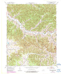
1953 Map of Bradfordsville NE
USGS Topo · Published 1954About this map
The Dividing Ridge forms a prominent natural boundary across this landscape at the intersection of Marion, Casey, and Taylor counties. In the early 1950s, this area of Kentucky was characterized by a dense network of small rural institutions and family-named landmarks. Settlements like Jacktown and Sapp served as local hubs, while a significant number of one-room schools, such as Pine Grove Sch and Atwood Sch, were still active landmarks in the community.
Find a feature on this map
58 named features on this map. Tap any name to fly to it.
Don’t see what you’re looking for? This feature index may not catch every label — zoom into the map to look around manually.
Map Details
Editions of this 1953 Bradfordsville NE Map
2 editions found
Other maps of this area

1905 · Harrodsburg
USGS Topo · 1:125,000

1952 · Ellisburg
USGS Topo · 1:24,000

1952 · Clementsville
USGS Topo · 1:24,000

1952 · Liberty
USGS Topo · 1:24,000

1952 · Mannsville
USGS Topo · 1:24,000

1952 · Bradfordsville
USGS Topo · 1:24,000

1952 · Parksville
USGS Topo · 1:24,000

1953 · Gravel Switch
USGS Topo · 1:24,000

1953 · Lebanon East
USGS Topo · 1:24,000

1953 · Bradfordsville
USGS Topo · 1:24,000