Old Maps of Hickory Grove, Kentucky for Metal Detecting
Plan your next treasure hunt with 13 historic maps of Hickory Grove. Find old homesites, ghost towns, trails, and gathering spots that may be lost to time — perfect for identifying promising metal detecting locations.
- Locate forgotten sites: Uncover places like long-lost settlements, abandoned rail lines, or gathering spots.
- Plan better hunts: Use map overlays combined with LiDAR or satellite views to narrow in on historically rich areas.
- Made for detectorists: Thousands of hobbyists use these maps to discover relics, coins, and hidden history.
Use these historic maps to boost your research and find new opportunities beneath the surface of Hickory Grove.
Hickory Grove, KY maps
(13)- 1890 Map of Williamsburg
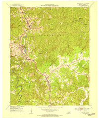
 1890 Williamsburg1890 Print · USGSThe Kentucky and Tennessee borderlands come alive in the late nineteenth century as the coal industry and railroads expand. Genealogists can trace family roots in Williamsburgh or locate early industrial sites like Beaver Mines and Steels Mill.2 unique versions available
 - 1894 Map of Williamsburg
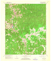
 1894 Williamsburg1894 Print · USGSThe Cumberland River valley and the Kentucky-Tennessee borderlands are captured here during the late nineteenth-century coal and rail expansion. Researchers can trace early industrial sites like Beaver Mines and Kensee Coal Mine or locate family roots in Whitley and Chitwood.5 unique versions available
 - 1952 Map of Whitley City, 1954 Print
 1952 Whitley City1954 Print · USGSMcCreary County during the early fifties reveals a landscape defined by the Kentucky coal industry and the timber of the national forest. Researchers can trace railroad history through the Kentucky and Tennessee line or locate family sites like Pine Knot Cem and Round Top Sch.
 - 1956 Map of Corbin, 1966 Print
 1956 Corbin1966 Print · USGSThe Kentucky and Tennessee borderlands are captured here in the mid-fifties, showing the region's shift toward modern interstate travel and reservoir development. Genealogists and historians can trace old community lines near Albany and Monticello or locate early rail junctions along the Southern and Tennessee Central lines.3 unique versions available
 - 1958 Map of Corbin
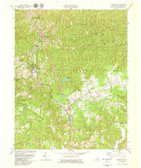
 1958 Corbin1958 Print · USGSThe Upper Cumberland borderlands appear in the late 1950s as massive reservoirs and early atomic-era growth reshape the region. Trace family roots and vanished landmarks near Lake Cumberland, Oak Ridge, and the Cumberland National Forest.
 - 1963 Map of Whitley City, 1966 Print
 1963 Whitley City1966 Print · USGSMcCreary County's upland communities and the Southern railroad corridor are captured here during the mid-1960s. Genealogists and local historians can trace rural family-named landmarks such as Silerville, Hickory Grove Ch, and the Piney Knot Cem.
 - 1979 Map of Whitley City
 1979 Whitley City1979 Print · USGSThe Southern railway corridor defines this 1970s landscape through the heart of McCreary County and the National Forest. Genealogists and local historians can trace family-named sites like Gilreath Cem and rural centers such as Revelo, Marshes Siding, and Cal Hill Ch.2 unique versions available
 - 1981 Map of Corbin, 1984 Print
 1981 Corbin1984 Print · USGSThe Kentucky and Tennessee borderlands in the early eighties were characterized by coal towns and deep mountain ridges. Trace family history or rail routes through Stearns, Williamsburg, and the mining settlements near Jellico Mountain along the L & N RR.
 - 2010 Map of Whitley City, 2010 Print
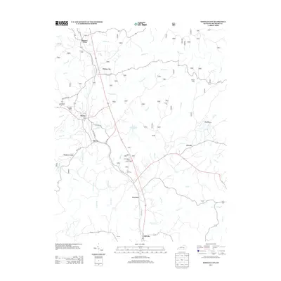
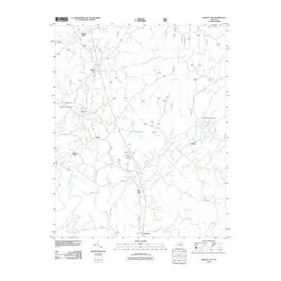 2010 Whitley City2010 Print · USGSCovers Hickory Grove, including Marshes Siding, Revelo, and other nearby areas
 - 2013 Map of Whitley City, 2013 Print
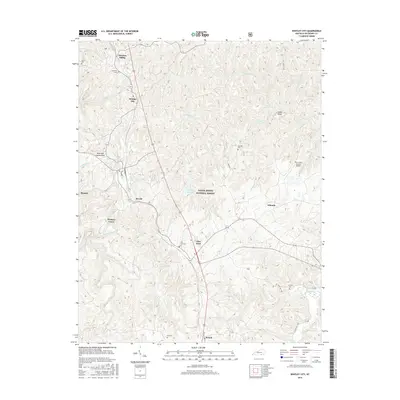
 2013 Whitley City2013 Print · USGSCovers Hickory Grove, including Marshes Siding, Revelo, and other nearby areas
 - 2016 Map of Whitley City, 2016 Print
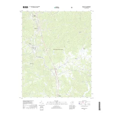
 2016 Whitley City2016 Print · USGSCovers Hickory Grove, including Marshes Siding, Revelo, and other nearby areas
 - 2019 Map of Whitley City, 2019 Print
 2019 Whitley City2019 Print · USGSCovers Hickory Grove, including Marshes Siding, Revelo, and other nearby areas
 - 2022 Map of Whitley City, 2022 Print
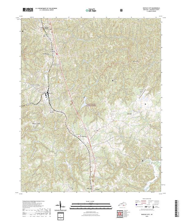 2022 Whitley City2022 Print · USGSMcCreary County's central corridor is detailed here just after the turn of the twenty-first century, following the highway and rail path between Whitley City and Pine Knot. Researchers can trace local lineage through several cemeteries including Carter Cem and Gilreath Cem.
End of results
Showing maps 1-13 of 13
Top cities near Hickory Grove
Frequently asked questions
- What are the different types of historical maps available for Hickory Grove?
- What is the oldest map of Hickory Grove?
- Where can I purchase historical maps of Hickory Grove for my home or office?
- Where can I download high-res historical maps of Hickory Grove?
- Are there historical topographic maps available for Hickory Grove?
- Is there historical aerial imagery available for Hickory Grove?
- Where are historical maps of Hickory Grove sourced from?