Old Maps of Nicholas County, Kentucky for Academic Research
Study the evolution of Nicholas County with 60 high-resolution historic maps. Whether you're teaching, researching, or modeling changes in land use, these maps provide essential visual documentation of urban, environmental, and geographic change.
- Analyze long-term change: Track patterns in development, transportation, and natural features.
- Ideal for environmental or urban studies: Support academic projects with primary historical map data.
- Use in the classroom or lab: Educators and researchers rely on these maps to bring historical context to life.
These maps are a powerful tool for teaching, research, and visualizing how Nicholas County has changed over the decades.
Nicholas County, KY maps
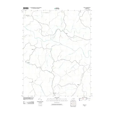
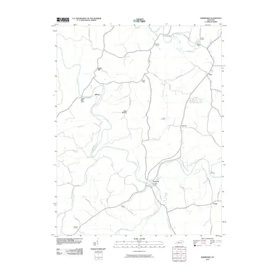
(60)- 1952 Map of Cowan, 1953 Print
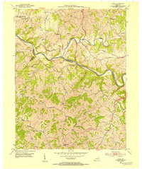
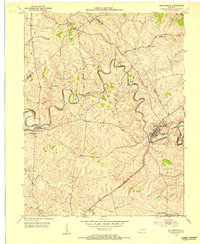
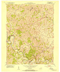 1952 Cowan1953 Print · USGSThe rural landscapes of Fleming and Nicholas counties are captured here in the early fifties, centered on the winding Licking River. Genealogists and historians can locate family landmarks such as Cowan, Blue Licks Spr, and Furman Chapel Ch.3 unique versions available
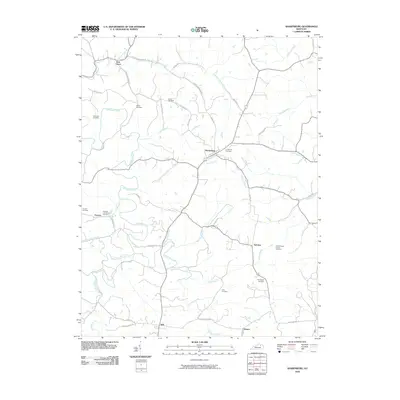
 - 1952 Map of Sharpsburg, 1953 Print
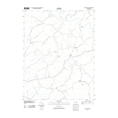
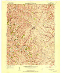 1952 Sharpsburg1953 Print · USGSCentral Kentucky's deeply incised creek valleys and rural crossroads are captured here in the early fifties. Genealogists and local historians can trace family land near Sharpsburg, Springfield Cem, and the meandering banks of Hinkston Creek.
 - 1952 Map of Sherburne, 1953 Print
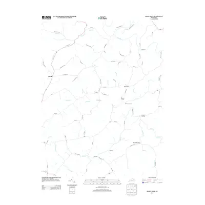
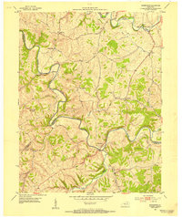 1952 Sherburne1953 Print · USGSThe Licking River valley at the border of Fleming, Bath, and Nicholas counties is captured here in the early 1950s. Family historians can trace rural roots through numerous burial sites like Gilead Cem and Porter Cem, or locate old river settlements like Sherburne and Marthas Mills.
 - 1952 Map of North Middletown, 1953 Print
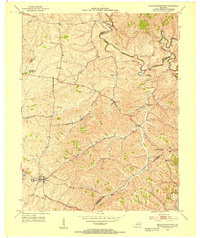 1952 North Middletown1953 Print · USGSIn the early fifties, the rolling Bluegrass country around North Middletown remained a landscape of quiet farms and family history. Genealogists can trace family names through landmarks like the Edward Boone Grave, Thomason Cem, and the historic Cane Ridge Meetinghouse.
 - 1952 Map of Piqua, 1954 Print
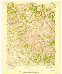
 1952 Piqua1954 Print · USGSNicholas and Robertson counties are shown in the early fifties as the Licking River cuts through the northern Kentucky hills. Genealogists can find numerous rural landmarks such as Wagoners Chapel, Needmore Ch, and the small community of Kentontown.
 - 1952 Map of Shady Nook, 1954 Print
 1952 Shady Nook1954 Print · USGSHarrison County in the early fifties is shown here as a series of tight-knit rural communities connected by the winding Licking River. You can trace old family roots through landmarks like Harding Cem, the Republican Ch, and the crossroads at Shady Nook.2 unique versions available
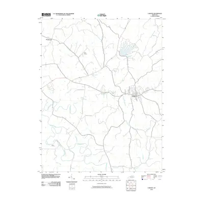
 - 1953 Map of Carlisle, 1954 Print
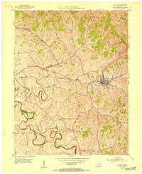 1953 Carlisle1954 Print · USGSNicholas County and the town of Carlisle are shown in detail during the early 1950s as the rail-and-road network defined local life. Genealogists can locate family landmarks such as Stokes Cem, Oakland Mills Ch, and the Parks Sch.2 unique versions available
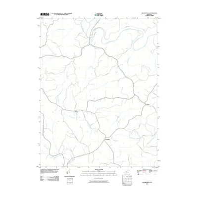
 - 1953 Map of Moorefield, 1954 Print
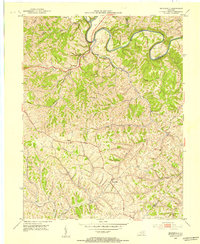 1953 Moorefield1954 Print · USGSNicholas County and its borderlands in the early fifties show a rural landscape defined by the deep bends of the Licking River. Researchers can trace old family sites and rural landmarks like Parrish Chapel Cemetery and the settlement of Moorefield.2 unique versions available
 - 1953 Map of Millersburg, 1954 Print
 1953 Millersburg1954 Print · USGSMid-century Bourbon County comes to life as a network of rail-side towns and winding creek valleys. Genealogists can trace family roots at Old Historic Cem, Ruddels Mills, or the campus of the Millersburg Military Institute.2 unique versions available
 - 1956 Map of Louisville, 1971 Print
 1956 Louisville1971 Print · USGSThe Ohio River valley and the Kentucky Bluegrass are captured here during a period of rapid mid-century growth and industrial activity. Genealogists and historians can trace rail-centered towns and military land use at Fort Knox and the Jefferson Proving Ground.2 unique versions available
 - 1957 Map of Huntington, 1966 Print
 1957 Huntington1966 Print · USGSThe industrial heart of the Ohio River valley is captured here in the mid-sixties, showing the growth of Huntington and Ashland. Researchers can trace the extensive rail networks of the Chesapeake and Ohio RR and locate sites like the Chief Cornstalk Hunting Ground.3 unique versions available
 - 1960 Map of Huntington
 1960 Huntington1960 Print · USGSThe tri-state river valley thrived in the late fifties as a hub of heavy industry and Appalachian rail transit. Genealogists and historians can trace the connection between river towns like Ashland and Portsmouth or locate family homesteads near Coleman Ridge.
 - 1964 Map of Louisville
 1964 Louisville1964 Print · USGSThe Ohio River valley and Kentucky Bluegrass are captured in the mid-1960s, showing a region balanced between industrial growth and its agrarian roots. Genealogists and historians can trace the development of county seats like Shelbyville and Paris, or locate established institutions such as Georgetown College and Bernheim Forest.
 - 1982 Map of Morehead, 1983 Print
 1982 Morehead1983 Print · USGSThe foothills of northeastern Kentucky come alive in the early eighties, showcasing a landscape defined by timber, limestone caves, and major reservoirs. Local researchers can trace the development of Morehead State University or locate old crossings at Plummers Mill and Salt Lick.
 - 1986 Map of Lexington
 1986 Lexington1986 Print · USGSCentral Kentucky’s Bluegrass region is captured in the mid-eighties as urban centers like Lexington and Frankfort expand alongside deep-rooted rural hubs. Researchers can trace historic rail lines like the Southern Railway and find landmarks such as the Lexington Blue Grass Army Depot and Tacketts Mill.
 - 2010 Map of Cowan, 2010 Print
 2010 Cowan2010 Print · USGSCovers Nicholas County, including Blue Licks, Fairview, and other nearby areas
 - 2010 Map of North Middletown, 2010 Print
 2010 North Middletown2010 Print · USGSCovers Nicholas County, including North Middletown, Jackstown, and other nearby areas
 - 2010 Map of Millersburg, 2010 Print
 2010 Millersburg2010 Print · USGSCovers Nicholas County, including Millersburg, Blacks Crossroads, and other nearby areas
 - 2010 Map of Piqua, 2010 Print
 2010 Piqua2010 Print · USGSCovers Nicholas County, including Barterville, Kentontown, and other nearby areas
 - 2010 Map of Moorefield, 2010 Print
 2010 Moorefield2010 Print · USGSCovers Nicholas County, including Sprout, Weston, and other nearby areas
 - 2010 Map of Carlisle, 2010 Print
 2010 Carlisle2010 Print · USGSCovers Nicholas County, including Carlisle, Headquarters, and other nearby areas
 - 2010 Map of Sharpsburg, 2010 Print
 2010 Sharpsburg2010 Print · USGSCovers Nicholas County, including Sharpsburg, Stoops, and other nearby areas
 - 2010 Map of Sherburne, 2010 Print
 2010 Sherburne2010 Print · USGSCovers Nicholas County, including Upper Blue Licks, Battle Run, and other nearby areas
 - 2010 Map of Shady Nook, 2010 Print
 2010 Shady Nook2010 Print · USGSCovers Nicholas County, including Oddville, Morning Glory, and other nearby areas
 - 2013 Map of Shady Nook, 2013 Print
 2013 Shady Nook2013 Print · USGSCovers Nicholas County, including Oddville, Morning Glory, and other nearby areas
Showing maps 1-25 of 60
Top cities of Nicholas County
Frequently asked questions
- What are the different types of historical maps available for Nicholas County?
- What is the oldest map of Nicholas County?
- Where can I purchase historical maps of Nicholas County for my home or office?
- Where can I download high-res historical maps of Nicholas County?
- Are there historical topographic maps available for Nicholas County?
- Is there historical aerial imagery available for Nicholas County?
- Where are historical maps of Nicholas County sourced from?