1900s (20th Century) Maps of Fedscreek, Kentucky
Explore 8 historic maps of Fedscreek from the 1900s (20th Century). These maps offer a rare glimpse into what life looked like during the 1900s — showing old roads, neighborhoods, homes, and landmarks that have changed or disappeared over time.
Whether you're researching your family's past, planning a metal detecting trip, or studying how Fedscreek's landscape evolved across the 1900s, these high-resolution maps are a powerful tool for exploring the history of this region.
- Focus on a specific era: All maps on this page are from the 1900s, giving you a focused view of this time period.
- See what’s changed: Compare century-old streets, trails, and buildings to today's modern landscape using overlays and satellite layers.
- Research with precision: Use these maps for genealogy, historical research, land use analysis, or educational projects.
- View, download, or print: Maps are fully viewable online in high resolution, and can be downloaded or printed for your own records.
Start exploring Fedscreek's history through authentic maps from the 1900s. This is your window into the past.
Fedscreek, KY maps
(8)- 1914 Map of Hurley
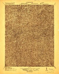
 1914 Hurley1914 Print · USGSThe Buchanan County borderlands come to life in this early twentieth-century survey, showcasing a landscape of high ridges and deep hollows. Genealogists can trace family roots through a dense network of mountain schools like Bull Creek School and remote outposts such as Kelsa PO or Artia.
 - 1915 Map of Hurley
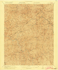
 1915 Hurley1915 Print · USGSBuchanan County's deep hollows and early settlements are documented in this 1910s survey along the Kentucky-Virginia border. Genealogists and local historians can locate early centers of community life including Pawpaw P O, Looneyville School, and Hurley.2 unique versions available
 - 1917 Map of Hurley
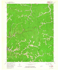
 1917 Hurley1917 Print · USGSBuchanan County's mountain hollows and coal-country settlements are meticulously mapped in the years before the Great War. Genealogists can trace a dense network of early rural education sites like Rowe Mountain School and Home Creek School, alongside river points like Grundy and Levisa Fork.5 unique versions available
 - 1954 Map of Jamboree, 1956 Print
 1954 Jamboree1956 Print · USGSThe Kentucky-Virginia borderlands in the mid-fifties were defined by narrow hollows and essential rail lines. Genealogists and historians can trace the foundations of mountain life through Jamboree P O, Rowland Row Camp, and schools like Smith Fork Sch.
 - 1957 Map of Jenkins, 1974 Print
 1957 Jenkins1974 Print · USGSThe Cumberland Plateau in the mid-twentieth century reveals a complex landscape of winding river valleys and deep-seated industry. Genealogists and historians can trace the development of Hazard, Jenkins, and Pikeville alongside extensive Numerous Oil and Gas Fields and the routes of the Chesapeake & Ohio Railway.
 - 1960 Map of Jenkins
 1960 Jenkins1960 Print · USGSEastern Kentucky and the West Virginia borderlands are captured at a mid-century peak of the coal and rail era. Trace the industrial corridors of the Chesapeake and Ohio RR through mountain hubs like Hazard and Jenkins.
 - 1963 Map of Jamboree, 1964 Print
 1963 Jamboree1964 Print · USGSEastern Kentucky's coal and gas country is captured here in the early 1960s as industrial development reshaped the hollows. Genealogists and researchers can trace local landmarks like Steele PO, the Phillips Cem, and the tracks of the Norfolk and Western.2 unique versions available
 - 1977 Map of Pikeville, 1983 Print
 1977 Pikeville1983 Print · USGSThe Central Appalachian coalfields and the rugged borders of Kentucky and Virginia come into focus during the late seventies. Researchers can trace the rail networks of the C & O and L & N through towns like Jenkins, Whitesburg, and Pikeville.
End of results
Showing maps 1-8 of 8
Top cities near Fedscreek
- Pikeville historical maps
- Elkhorn City historical maps
- Grundy historical maps
- Haysi historical maps
- Matewan historical maps
- Vansant historical maps
See more
Frequently asked questions
- What are the different types of historical maps available for Fedscreek?
- What is the oldest map of Fedscreek?
- Where can I purchase historical maps of Fedscreek for my home or office?
- Where can I download high-res historical maps of Fedscreek?
- Are there historical topographic maps available for Fedscreek?
- Is there historical aerial imagery available for Fedscreek?
- Where are historical maps of Fedscreek sourced from?