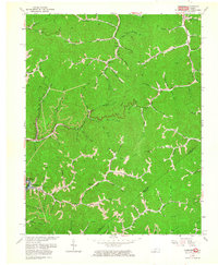
1963 Map of Jamboree
USGS Topo · Published 1964About this map
Deep in the Appalachian coalfields of Pike County, this 1963 survey reveals a landscape defined by hollows and extractive industry. Small communities like Jamboree and Dunlap follow the narrow valley floors, while Norfolk and Western rail lines and a network of gas wells and air shafts signal the economic drivers of the era. The mapping of Fishtrap Reservoir and its associated inundation zone indicates a region undergoing significant hydrologic and infrastructure changes.
Find a feature on this map
79 named features on this map. Tap any name to fly to it.
Don’t see what you’re looking for? This feature index may not catch every label — zoom into the map to look around manually.
Map Details
Editions of this 1963 Jamboree Map
2 editions found
Other maps of this area

1886 · Grundy
USGS Topo · 1:125,000

1887 · Warfield
USGS Topo · 1:125,000

1890 · Grundy
USGS Topo · 1:125,000

1891 · Warfield
USGS Topo · 1:125,000

1892 · Grundy
USGS Topo · 1:125,000

1909 · Matewan
USGS Topo · 1:48,000

1914 · Hurley
USGS Topo · 1:48,000

1915 · Regina
USGS Topo · 1:48,000

1915 · Hurley
USGS Topo · 1:48,000

1915 · Williamson
USGS Topo · 1:48,000