
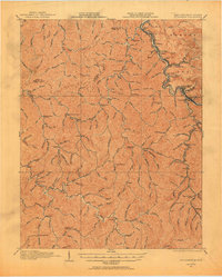
1915 Map of Williamson
USGS Topo · Published 1915About this map
Williamson stands as the primary hub along the Tug Fork river, which serves as the winding border in this 1915 survey. The landscape is defined by the sharp, dendritic drainage patterns characteristic of the Central Appalachian coalfields, where the Norfolk and Western Ry follows the riverbank to connect small valley settlements. The map documents the early 20th-century development of mining towns and railroad stops including Chattaroy, Nolan, and Goodman. This advance sheet represents a critical cooperation between the state surveys of Kentucky and West Virginia, capturing the precise topography and county line between Pike Co and Mingo Co. Beyond the populated valleys, the dense network of ridges is broken only by smaller waterways like Pigeon Creek, illustrating the geographic isolation of these communities before modern road systems.
Find a feature on this map
14 named features on this map. Tap any name to fly to it.
Don’t see what you’re looking for? This feature index may not catch every label — zoom into the map to look around manually.
Map Details
Editions of this 1915 Williamson Map
2 editions found
Other maps of this area

1886 · Prestonsburg
USGS Topo · 1:125,000

1886 · Grundy
USGS Topo · 1:125,000

1887 · Warfield
USGS Topo · 1:125,000

1890 · Whitesburg
USGS Topo · 1:125,000

1890 · Grundy
USGS Topo · 1:125,000

1891 · Warfield
USGS Topo · 1:125,000

1892 · Grundy
USGS Topo · 1:125,000

1892 · Whitesburg
USGS Topo · 1:125,000

1892 · Prestonsburg
USGS Topo · 1:125,000

1909 · Matewan
USGS Topo · 1:48,000