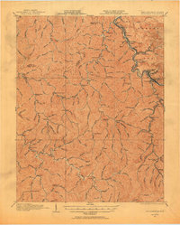
1915 Map of Williamson
USGS Topo · Published 1955About this map
The Norfolk and Western Ry snakes through the deep valleys of the Cumberland Plateau, following the winding course of the Tug Fork which separates Kentucky and West Virginia. This 1915 survey captures the region at a height of industrial development, with coal camp architecture and rail infrastructure defining settlements like Williamson, Chattaroy, and Sharondale. The landscape is densely populated with small mountain communities and rural educational centers, including the Tom Price School, Elkins Fork School, and Hurricane School. Beyond the river towns, the map reveals a network of hollows named after local families and landmarks, such as Johns Creek and Johnson Fork. Genealogical details are prominent throughout, from the Pinson Fork PO to isolated stations like Peg Sta, offering a clear view of the social and economic connectivity in the Appalachian coalfields during the early 20th century.
Find a feature on this map
148 named features on this map. Tap any name to fly to it.
Don’t see what you’re looking for? This feature index may not catch every label — zoom into the map to look around manually.
Map Details
Editions of this 1915 Williamson Map
2 editions found

Other maps of this area

1886 · Prestonsburg
USGS Topo · 1:125,000

1886 · Grundy
USGS Topo · 1:125,000

1887 · Warfield
USGS Topo · 1:125,000

1890 · Whitesburg
USGS Topo · 1:125,000

1890 · Grundy
USGS Topo · 1:125,000

1891 · Warfield
USGS Topo · 1:125,000

1892 · Grundy
USGS Topo · 1:125,000

1892 · Whitesburg
USGS Topo · 1:125,000

1892 · Prestonsburg
USGS Topo · 1:125,000

1909 · Matewan
USGS Topo · 1:48,000