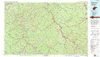
1982 Map of Williamson
USGS Topo · Published 1983About this map
The Tug Fork and Levisa Fork rivers define the complex geography of this Central Appalachian borderland, where West Virginia meets Kentucky and Virginia in the early 1980s. The region is marked by an intensive coal-mining landscape, indicated by numerous Strip Mine operations scattered across the ridges between major hubs like Williamson and Logan. Transport networks follow the narrow river valleys, with the Norfolk and Western RR and Chesapeake and Ohio RR moving coal through settlements such as Matewan and Paintsville. This era reflects a balance between industrial extraction and public recreation, with the presence of Jenny Wiley State Resort Park near Dewey Lake and the Cabwaylingo State Forest providing managed natural spaces amidst the busy mining districts and small valley communities like Blackberry City.
Find a feature on this map
200 named features on this map. Tap any name to fly to it.
Don’t see what you’re looking for? This feature index may not catch every label — zoom into the map to look around manually.
Map Details
Editions of this 1982 Williamson Map
This is the sole edition of this map. No revisions or reprints were ever made.
Other maps of this area

1886 · Prestonsburg
USGS Topo · 1:125,000

1886 · Grundy
USGS Topo · 1:125,000

1887 · Warfield
USGS Topo · 1:125,000

1889 · Salyersville
USGS Topo · 1:125,000

1890 · Whitesburg
USGS Topo · 1:125,000

1890 · Grundy
USGS Topo · 1:125,000

1891 · Tazewell
USGS Topo · 1:125,000

1891 · Hazard
USGS Topo · 1:125,000

1891 · Oceana
USGS Topo · 1:125,000

1891 · Salyersville
USGS Topo · 1:125,000